
I don’t quite know what to make of Marfa, Texas. It isn’t on the edge, but it is very edgy. For some reason the Chianti Foundation, founded by artist Donald Judd, decided to make Marfa-middle-of-nowhere Texas a hub of the arts — specifically the minimalist arts. The place used to be a water stop and has a permanent population of 1,981 people. But it has a lot of visitors now. Artsy, minimalist visitors.
To be fair, the foundation has done a great job rebuilding some historic buildings and the hotel where the actors from Giant stayed during filming is here and very cool. But the overwhelming vibe is the vibe from all the artists, patrons and fancy people who visit.
New Yorkers have redone an old Thunderbird motor court motel. I stayed there. It has cowhide rugs on polished concrete floors and platform beds and wire baskets with nice towels and locally sourced organic soap. Minimalist. They filled the old motor court area with a spectacular desert garden and it is beautifully tended, so there was that. Additionally, with artists and patrons you need food and drinks. Crafted cocktails to be precise.
Everyone I met was interesting and nice and there really isn’t a reason to mock the place. I had a good time. I met a musician from Nashville, a food truck guy from California and I went to the bar where they have a long crafted cocktail list. The tightly shirted and tied barkeep was disappointed with my bourbon and water.
So my conclusion is that if you are in the area, you should see Marfa. You should do the whole museum and art thing — which I didn’t — because it is world renown. The Thunderbird is a good place to stay, and the Capri is a good place to people watch and eat a fantastic salad. I just can’t shake the incongruity of it all, and maybe that is the point.
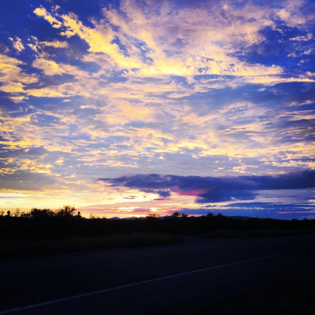
With no access to the border from Ruidosa to basically Fort Hancock, I had to come to Marfa and then head west on HYW 90 and pick up I-10 in Vanhorn. The interstate hits the border again just east of Fort Hancock and the edge re-greets me with the damndest storm I’ve ever seen. Howling winds and blinding rain pound the rocky desert and the arroyos spit it right back out. There is water everywhere. By the time I clear El Paso my knuckles hurt from gripping the wheel and I’m exhausted. I hug the border on NM HWY 9 across the boot heel of New Mexico. This is like the Border Patrol’s private highway. I drive it from beginning to end, which I guess is an achievement of some sort, but of what I don’t know. From just west of the Cedar Mountain range, the road plies a broad valley all the way to the Arizona Border. In addition to lush grassland, much of the valley is given over to pepper farms. Some sort of chiles, appropriately, and farmed on an industrial scale. The fields are oddly pretty with all the bright red peppers shining in the broken sunlight.
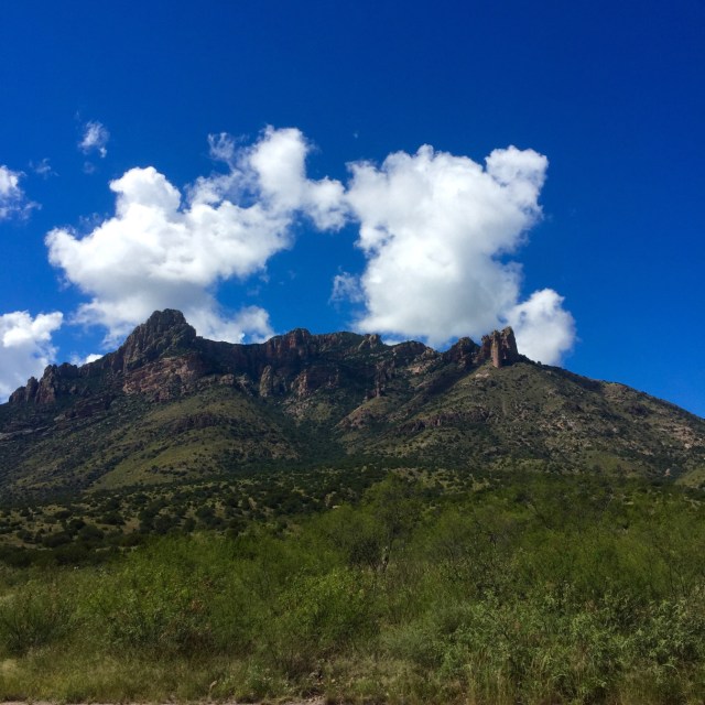
Crossing the border into Arizona at Rodeo, I immediately turn into the Coronado National Forest via Portal, Arizona. The Chiricahua Mountains are here, jagged and angrily biting at the sky. Sharp and sudden they remind of mini Sierras. I check in at the office and am told the dispersed camping area at Rusterler’s Park is open, but that rains and fire damage have made the road a little tricky. With four wheel drive they say, I will be fine. I get a map of sorts, and head out with that minimal input.
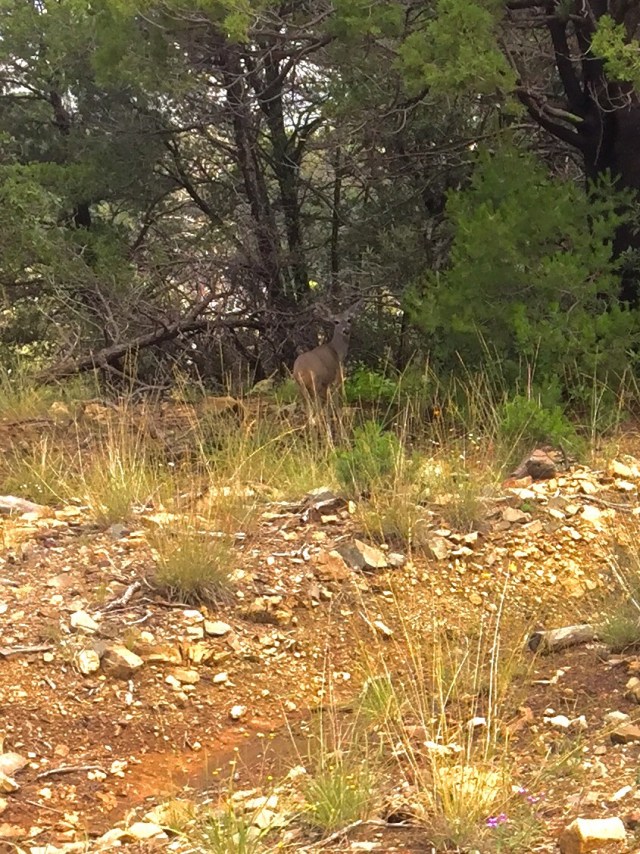
The road was as advertised. Generally pretty good, but a little greasy in spots and periodically showing the evidence of huge ponderosa pines that had fallen across it, dead from a fire and toppled by all the recent rains. This is what’s known as an omen. But I have a great ride — it’s 28 miles or so, so it takes a while, but it is excellent. I get visitors along the way.
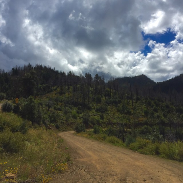
The sky, however, began to change. By the time I reached Rustler’s Park, which is over the front range and sits in a saddle between the front and back range, I realize the fire or fires, burned all the way up to and over the top of the front range. So Rustler’s Park was a collection of blackened, dead ponderosa pine surrounding the high meadow. The fire was sometime in the last 12 months and, in the end, is very good for the forest. Already the meadow grasses and wildflowers are covering the floor and soon a better forest will emerge. But the thought of camping amidst the carnage was sort of deflating. And, bad weather was coming fast. I remembered the down trees along the way and thought about camping under dead pines in a wet windstorm some more. In the end, I’d sworn too many blood oaths to loved ones about taking chances to make it doable. I couldn’t see spoiling a beautiful ride with a worrisome night. So I pushed on over the top and followed the two track all the way out the other side to the Chiricahua National Monument and its stone hoodoos, and then found a highway into Willcox, Arizona for the night. The ride through to the highway was what I do this for — to see these amazing places up close and in the landscape. By the time I get to Willcox, the storm is raging over the mountains, and I feel good about my choice.
As much as I will miss waking up on top of the Chiricahua Mountains, I will certainly wake up at least. And that is good, because tomorrow begins the run through the notorious southern Arizona borderlands. It will be the edgiest of the edge. I should make it down through Patagonia to the border and then west across the Tohono O’Odham Indian reservation before skirting north away from the edge and around the Barry Goldwater Airforce Range.
