The Edge Trek is Completed

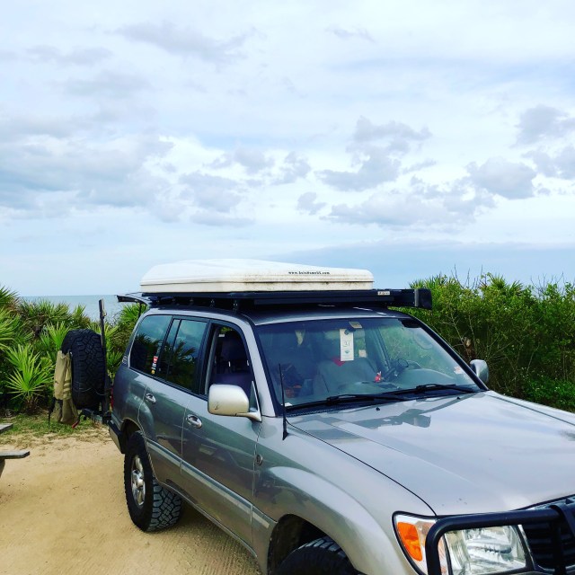
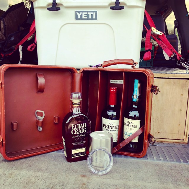
Downstairs, sulking a bit in the garage, is magnificent old 2002 gray Landcruiser. Scratched and dirty and, I’m sure, dripping a bit of something from somewhere, it is a monument to reliability, to confidence-inspiring capability, and it made my trek around the edge not only possible, but relatively comfortable. Thousands of miles — some easy, some frighteningly treacherous — and it never, not once, let me down.

A well-deserved rest

Across the country and around the edge I ran into people and saw businesses that depended on machinery. I saw machinery being used, repaired, sold and scrapped. I ate food planted and harvested by it, I used roads built by it, stayed in places graded by it, and choked on air polluted by it. And now, oddly, after a trek all the way around the edge of the country, I am consumed by just how much I have taken the industrial partnership between man and machine for granted. Sitting in one, using one, begging one to get me through one more time, changed that. And it, turns out, that industrial partnership changed the country I just circled as well.

It moved the practical “edge” to the actual political boundary. What I mean is, before I you could efficiently get from one place to another, the edge for you was basically the edge of town, or the edge of the farm, or whatever. The fact that, as a nation, we had agreed to or fought for a line on a map (that was probably only a rough estimate) denoting the edge of America, was wholly irrelevant to you. Once we began to develop efficient transportation, drilling, harvesting, mining, pumping, and all manner of other horizon expanding tools, we had a choice: stay in the lines, or keep pushing and conquer more. Now, I realize, we expanded the borders a great deal from the first landing and organization of the country up to the advent of modern machinery. My point is, once we had real power, backed by what we then knew were exceptional natural resources, we began to understand just what we were capable of. And we stayed inside our edge — by choice. We gave aid to others when the world desperately needed it, we gave treasure and we gave blood. But we didn’t take anything.

I said earlier in this trip that the edge defines America as an entity, and everything inside the edge demonstrates it as an idea. I agree with that still. And as an idea, it has, over time bulged and stretched and occasionally seemed as if it were about to break. But every time, not without pain, the power of the central themes of that idea — liberty and equality — have risen and held. It is as if our edge is just right; big enough to satisfy our need for individual pursuit, small enough to keep us together and aware of our mutual dependence. Our own development and use of industry and technology mean you can no longer hide within our broad boundaries (though there are some places you can go unnoticed for a while), and they also mean that you can accomplish whatever you can dream within our broad boundaries.

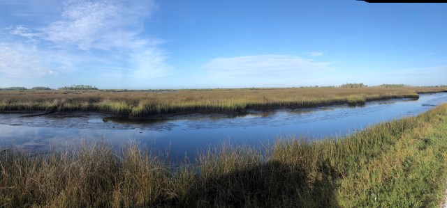
It is this loose, but no less binding, form of union that displays itself across the nation and around its edge. As varied as the ecology and geology and geography of the land itself, are the people and places that lie upon it. And yet all of it is America. Somehow, despite differences of all sorts, we maintain a commonality. We share a place. We find ourselves just close enough to be aware of each other, yet free enough to be ourselves.

I certainly became aware of people and things about which I had known little or nothing before this journey. And in the learning, became aware of things about myself. I’d like to think that I experienced some of the same things as those folks who plodded west to new lands and found new things before a thing such as my old Landcruiser existed. I’d like to think they had the same sense of wonder at the countryside, and intrigue at the different people and cultures. I’d like to think they wondered about the edge, where it was and whether it was different or somehow better than where they were. What I suspect is that they focused on finding food and shelter and safety — those things being much more at risk for them than me. What I know, is that as a part of the collective union, they never lost sight of the idea of America. Because it survives and thrives today. From edge to edge. Ugly in places, stunningly beautiful in places, confusing in places, overbuilt in places, thriving in places, struggling in places. Pushed and pulled, beaten and battered, polished and gleaming, but always, always, America.

I am going to try and pull all these musings and pictures from the edge together into a single book. As I said, the doctors are going to need to know which ward to put me in someday and there may be diagnostic evidence here. But also because somewhere along the way this adventure became much bigger than a drive around the edge of the country. It became a love story.

Speaking of which, I owe the opportunity to take off and ride around the country to a number of things, the single most important of which is my wife. She is the foundation of my life, a partner in every sense of the word, and a willing enabler of this journey. I love her. I need her. And this will be true always, no matter where I am, what I see, or how I get there.

So, the trek is complete, but the journey is not over. As I cobble it all together, I may revisit some places. I will certainly do more research and add to the thoughts I first penned in real time — and I hope some of you will offer thoughts about it all along the way. It will be an earnest effort, incomplete but honest, and it will allow me the privilege of giving back a tiny token of life on the edge.

The End

Ending where it all began (top) and my steadfast companions for the entire lap (bottom)

I slipped out of Long Beach, Mississippi under the early slate colored sky, the Gulf on my left at dead low tide, peaceful and flat, unable to generate a reflection from the sunless sky. Long Beach and neighboring Pass Christian are stately sort of towns (at least along the edge of the Gulf — I didn’t go into the main streets). The oaks are huge and sprawling, the homes are large, old and set back from the road. From their balconies and widow’s walks the view across the Gulf is broad and long.

Crossing Saint Louis Bay into Bay Saint Louis (I know, I though the flip flop of the names was odd too) the fog was thick and clinging to the surface of the bay like a lost child. It really never went away today — it lifted a few feet, thinned and then returned. I made my way across the marshy end of Mississippi and across the Pearl Rivers — first East Pearl, then West Pearl, and into Louisiana. THe edge here is so ragged, it gets hard to tell which side is which — there is water everywhere. Across on the old HWY90 through the Bayou Sauvage National Wildlife Refuge, around New Orleans and south toward Bell Chasse and, eventually, Venice. The end of the lap.

I’m reprinting this portion of the drive from my first day on the edge. I found the place as I left it, and I like the symmetry of ending with my words from the beginning. I will have another, final post, to try and sum it all up, but for the next couple of days, I am going to enjoy New Orleans with my wife. The greatest woman alive.

Portion of the entry from the day I first reached the edge:

New Orleans is always great.  Made more so these days by the presence of my son. It doesn’t need any shine on it and its blemishes are its charm.  Without pretense, it sits in the curve of the Mississippi and offers up its history, beauty, awfulness and soul willingly, in an example for us all. It is easy indeed.West and south of the city, across the river and along its final miles is a different story.

Unlike the easy spread of the Tennsaw and Mobile rivers, here our Country’s greatest River is terrifying, tense and hard at work.  Just past Belle Chase, with the heavy ships working a few hundred yards to my left, alarmingly floating above the level of my head, I realized this final stretch to expose the edge was going to be different.  I couldn’t relax.  Great industry, steel and smoke and holding tank and refinery rose as testament to the economic power of the mighty river, and dirt – soft, wet, porous earth piled into a levee of some engineer’s design – separated me from hundreds of millions of gallons of hydrolic force.  There are houses, trailers mostly, tucked against the levee and no matter the design, the normal-ness or the front yard mailbox flowers of any one of them, I was frightened at the notion of trying to sleep and eat and love and exist below the level of this much power. I’m sure they get used to it.  I’m sure it has some charms once you do get used to it. I can’t see them. All I can do is periodically remind myself to loosen my grip on the wheel, relax my shoulders and trust in the calculations that are keeping me from being underwater.

As if the river on the left isn’t enough, along about Buras, LA on the road south, you get the Gulf of Mexico pressing in on the right – again, at a level higher than your head. It is immediately apparent that while I may be driving to the edge, but for man, I would have arrived a long time ago.  In the interest of commerce, we have extended the edge through science and engineering.  And in doing so we created more country.  Without our determination, South Plaquemines Parish would be woody bayou and swampy delta at best, the straight up Gulf of Mexico more likely.  It’s a tense situation.

Plaquemines High School is as nice a facility as I’ve ever seen.  New, beautiful, and architecturally fascinating (it’s about 30 feet off the ground) it’s a testament what oil and gas money do for the home district.  The sign says “Home of the Hurricanes” which I suppose serves as both a mascot and a warning for the student body.  As I said, it’s a tense situation.

Before I left on this trip a fellow listened to me describe it and said “why in the Hell are you going to Venice, LA? It’s the end of the world and it isn’t a good ending.” Apparently his experience with an engineering crew down there 20 some years ago was not a good one.  The city itself is like some movie set of a post apocalyptic industrial world without any zoning laws  so I could kind of see his point.  If you were airlifted in here your first impression would likely include tears.  But here’s the thing: just south of the city, the levee ends and it’s like someone turned the oxygen back on. Peace.  Sure there is one last hulking refinery out there, but the river gets its rest.  It finally finds the edge and it is magnificent.  After ferrying and carrying and cashing and crashing and straining and draining every goddamn thing East of the Rockies and West of the Appalachians, the river is free.  So this is the edge.

Through the handle and into the delta

The “little towns” of 30 A make an interesting and compelling skyline.

The far western edge of the Florida panhandle takes a distinctly different approach to development than I have seen up to this point. In an attempt to recreate what I think is an “Old Florida” feel, the developers basically create complete small towns, including town squares, service alleys, common architecture on narrow streets with broad sidewalks — basically little Mayberries on the coastline. It actually works rather well. The building heights are modest –may be 4 or 5 stories is what they consider high rise — and the use of HWY 30A as sort of the driveway to all of them slows everything down and makes for a mellow vibe. A good friend generously provided me access to his place around Alys Beach, which meant awesome views, a place to do laundry, and the ballgame on high definition. This is an edge I could get used to.

Further west, once you get to the Destin/Fort Walton/Pensacola area, the landscape gets a bit more vertical and commercial. Mayberry kind of gives way to Vegas with a not quite as good a paint job. Once I crossed into Alabama, I went through Foley over to the eastern shore of Mobile Bay, up and around and under the tunnel to Spring Hill.

Here’s an exercise: call up the parents of friend. People you haven’t seen in 30 years. Tell them you are wandering around and wondered if you could stop by. See what happens. What happened to me was among the warmest experiences of old school hospitality I could ever imagine. After a wonderful time of catching up and covering all the intervening joys and tragedies, I was treated to fresh oysters and fish at the bar in the kitchen, and a level of convivial conversation that, sadly, I’m afraid todays’ screen grabbing, updating instagrammers don’t understand. I’m not knocking social media, I’m merely pointing out the importance of the “social” part of the moniker. We had a blast — we tasted bourbon, we told stories, and we came together around the common notion that friendship persists across time and space and absence. The meal was expertly prepared by The Captain. Capital T, capital C. And he was to be my guide into the Mobile Tensaw River Delta (MTRD) today.

America’s Amazon, the Mobile Tensaw River Delta

I want to tell you all about the MTRD, but I’m not qualified to get it all correct. I want you to do this — post this into your browser and watch the entire thing https://www.youtube.com/watch?v=hEynUn8VW3Y&feature. If that doesn’t work, go to YouTube and search “America’s Amazon” and watch it that way. There is advocacy in this documentary for making MTRD a National Park, and I am neither endorsing nor rejecting that notion. What’s important is that I believe the documentary gives you a good idea of just how special this place is. And what you see in the documentary, I got to see first hand today.

The Captain has been coming into the MTRD since he could walk, basically. And his father and grandfather before him did the same. That sort of knowledge, experience and stewardship brings with it a sense of a place that defies everything from science to politics to fundraising. Three generations of living in a place, and taking care of a place, creates a legacy of judgment that has to be heard. That has to be honored. A lot of scientists and a lot of politicians and a lot of do-gooders will tell you what we should do about a particular place, but three generations of stewards will show you how to do it.

If you want to see and understand the MTRD, you need The Captain

The MTRD is changing, a lot. And it has changed a lot in the past. What is changing it and why it is changing, quickly grows so complex that arguments naturally form. What is too often not heard, are the voices of those who have been here all along. Caring and trying, warning and soothing, asking and doing, in these special places throughout the country. I talked about it on the Chesapeake and in other areas I have visited along the edge. The people who are in the place — who have been in the place — have the best and fullest sense of what is what and why is why. They don’t panic. They don’t react to short term issues. They dwell on generations of experience and guide with a steady hand. We should listen to them.

Chuckfee Bay, MTRD

The edge has many special places. It has challenges and failures and glories. But on the south edge of all the water that enters Alabama, it has the MTRD. The most diverse ecology in North America. America’s Amazon. And we need to know that. And we need to value that. And we need to treasure the stewards who have, for generations, called it home.

The view from Camp Russell, MTRD

This is my last night on the edge trek. I eased away from the MTRD and made it to the south coast of Mississippi before dark. US Hwy 90 hewed tight to the shores of the gulf from Pascagoula west, peacefully shimmering into an iron gray storm on the horizon. Tomorrow morning, my edge trek journey will end. I will arrive at the end of the road, south of Venice, Louisiana where it all began. I will make the lap. Tonight, I’m toasting my last night on the edge trek with a 12 year old bourbon, thanking my lucky stars and the creator of the edge itself, for the chance to see this. To go and search and listen and find. To be on the edge.

See you tomorrow.

The edge of peace, the edge of power

Morning light over the flats of Pine Island

Sometimes out here on this journey, luck smiles on me. Such was the case yesterday. I had a sense as I gained a little elevation on the west coast of Florida, that here in the middle of the western edge, there was something interesting happening — a change from the previous experience on the eastern side and so far, up the western side. So I stopped before I planned to. I wanted the time this morning to see what was what. And the edge rewarded me.

North of Port Richey, the western edge of Florida gets thick with trees and rises to a whopping 20-25 feet above sea level. The trees are mixed hardwood and pine with the iconic live oaks playing a role as well. US 19 is a good road and seemingly out of nowhere, the people stop. Mile after mile, the landscape flows by, the Gulf of Mexico stays to the west and thick forests rise to block it out. Gone is the bright sunshine and sparkling vista, in its place is a cool, slow, green shaded ecosystem that really could be anywhere. The periodic towns are small and simple and to the point. Each one has a single road to the west, through the trees, to a coast — where there is another small village, that is simple and to the point. This, it seems to me, is old Florida.

Salt marshes guard the western edge of central Florida

I don’t really understand the sudden lack of people clamoring for a spot on the edge here, though getting out on Pine Island for a look around helped me figure some things out. To begin with, there isn’t much edge to hang on to at the coast. The forest ends at the salt line and marshes of sawgrass and mangrove fill the space pretty much to the Gulf’s edge. What space there is, rather then being sugar white sand, is more rock and silt. Some towns and homeowners have created beaches with low walls to hold in the sand. So you get the effect of the beach — until you go to frolic in the surf — of which there is none. There is a massive salt flat here that runs waaaaaay out into the Gulf. The bottom is silty and shallow and thick with vegetation. And marine life. Dolphins puff as their slick backs break the calm surface and they grab another breath. Blue Crabs, big ones, scuttle from one clump of grass to the other. Fish of all sorts do their thing as well. The water is crystal clear, but this is an edge for fishing.

Several rivers find the Gulf here, most famously the Crystal River and the Suwannee River. They run slow through the cypress and look black, though they too are gin clear. The manatees lumber into the warm water and eat the marine vegetation and in some places tolerate a lot of people who come to swim with them. But the coast is apparently not beachy enough to attract the hordes. This, today, was to my everlasting benefit.

Morning meeting of the bait club on the West Fort Island Pier

I loved this part of Florida’s western edge. It was the tonic I needed after so much development. I expect it is going to stay this way because, in addition to the lack of beachiness, there is also, apparently, a sinkhole issue. Oh, and a nuclear power plant. At the tip of West Fort Island where the Crystal River empties into the Gulf, there is a tiny state park with a well maintained pier jutting out onto the flats. Extensive research here amongst the grizzled crabbers and bobber fishermen gave me some important information. It’s easy to fill a cooler with crab, even in November, and the fish bite stays pretty steady except at very low tide. The water quality is excellent and the power plant looming on the horizon to the east is no issue at all. But the sinkholes are a problem. Apparently the underground aquifers have a tendency to sneak around eroding the limestone and causing the ground to rather suddenly shift. I was told to never consider a house if the trees were turning brown around it. And to check all the grout lines in the tile. Because first, the vegetation dies and then the tile cracks and then house disappears. Now, these professors of the salt flats are not, by any means, data driven authorities — they said the red tide was caused by too many people in Miami eating beef and pork — but there were a half dozen of them, sort of a morning bait club, and they have collectively been here for 70 years or so. And that gives them standing. And on this bright, quiet morning, in this peaceful place on the edge, facts were less important than the historical reality of a last, best, unspoiled edge on the western coast of Florida. So I didn’t tell them about the Sahara sands and the algae. I just stood around and listened to the dolphins and the old men and stared at the Gulf.

Further north, the edge bends to the west, but remains relatively empty. The old US 19 highway strays a bit further from the coastline and the single roads leading west space out. And you enter the panhandle. The edge is to my south now and the beachiness returns and with it the people. But it is a slower, less frenzied sort of development. And today, it is the beginning of a horror show.

I crossed the Ochlockonee Bay on highway 98, just east of Carabelle, Florida, and began to notice the piles of debris on the sides of the highway. Not big ones, but neat bundles of sticks and muck and the odd pine tress bucked in to chunks. This was the beginning and from then until Panama City, the edge became a progressively worse hellscape of one of the most daunting aspects of living on the edge.

The first evidence of what was to come

Hurricane Michael came ashore as the third most powerful hurricane on record — a category 4 storm with winds of 155 mph and a bottomless low pressure. The center hit Mexico beach, well to my west. What the storm did to the edge is unimaginable. I would not photograph the personal property damage — it felt too invasive to me — but I will tell you it is so overwhelming I don’t know how they even start to recover from it. Trees, ancient trees three feet across at the base, are rent and tossed in a pick up stick puzzle that covers roads and houses, litters the shoreline and buckles the ground. In places east of Apalachicola, the road was lifted up and folded over, upside down, onto the northern side. And in other places, there is no damage at all. The randomness of it makes it all the more horrifying. The extent, miles and miles and miles of it, makes it seem unconquerable.

And that’s really it. The edge and all its beauty is exposed to the whims of a power that we do not know. Until we do. In many places on my long journey, the edge has always felt capable of powerful change — there were mudslides in California, I even watched one — but no where was that sense of impending risk made this real. Here it is. And it is more than my brain can handle — I don’t have a place to put this sort of catastrophe in it. Is it the price you pay for living on the edge? Is it a stroke of horrible luck? Is it a reckoning for hubris? In the end, exhausted, I settled for it just being the edge. And I took heart in the reaction.

Everywhere people are steadily doing what needs to be done. There is a system — people gather debris and pile it at the roadside, lines of trucks are loaded with it by excavators that creep along from one pile to the next and lift it into the trucks. Tarps are tied, and businesses announce open status with spray painted bedsheets. FEMA is everywhere with camps of workers and centers for relief aid. Samaritan’s Purse 18 wheelers are parked at churches caring for the stricken. Hot dog stands provide free food and ice. And in Port Saint Joe, every new telephone pole along the highway sports a crisp, new, American Flag. This edge is going to clean up, and people are going to remain here, and businesses are going to keep doing business. It will, of course, never be the same. But it will be again. I believe it will take several years to get to that point, but it will happen.

Mercifully, Highway 98 is closed to all but authorized traffic just west of Port Saint Joe. Mexico beach, ground zero, still has too much work to do for passers by to clog it up. I had to head inland before turning south to enter Panama City and regain the edge. It took an hour and half to get through Panama City — over a distance of about 20 miles. The trees here were bigger, the population and building more dense, and the streets narrower. With the piles of debris, it was basically one lane for much of the residential sections. Then I crossed the bridge at St. Andrews Bay and everything returned to normal. I’m 16 miles away in a friend’s place between Rosemary Beach and Alys Beach, and life is completely, totally, normal.

Tomorrow I take a short run to Mobile to visit old friends and, more importantly, to receive the gift of a lifetime. Russell Ladd has forgotten more than most will ever know about the Mobile Tennsaw River Delta — an ecosystem so diverse and special it is often called America’s Amazon — and he is going to show me around it. I will spend part of Thursday with him in the delta. I can hardly wait.

A redder shade of blue on the edge

Ted Smallwood’s morning view of The 10,000 Islands

In 1906 Ted Smallwood figured he could help folks settling in the 10,000 islands area south of the Everglades, maybe make a little money, and damn sure have a nice view every morning. So he built a post office and trading post. It’s still there and, reportedly, contains everything that was inside when the doors shut for good in 1986. It reopened as a museum in 1990 operated by Ted’s granddaughter. I say “reportedly” above because it didn’t open until 11 am and I was there at 7 am.

What really matters is that the 10,000 islands area is spectacular, and living in this spot, on the southernmost part of Chokoloskee Island, in Ted’s excellent raised red barn of a building, is about the best way I can think of to enjoy them. While the area was fairly thick with native people 2,000 years ago, today, Chokoloskee is the only one of the islands with permanent residents — all 300 of them. The rest of the islands are limestone outcrops, shrouded in mangroves that spot and speckle the horizon in no discernible pattern at all. I do not believe there are 10,000 islands. There may be fewer, there may be more. I think someone making maps and naming places said what do we call this island? And they named it. Then again. Then again. Then again. Then, oh heck how many of these are there? Hang on. Joe says there must be 10,000 of ’em.

Regardless, the effect is that the river of grass meets the sea and sort of doesn’t quite give up willingly. The result is a wandering, braided series of creeks, channels, bays and passes that feel as wild as anyplace I’ve seen. And from Everglades City to Chokoloskee little shacks on the little creeks hold little surprises — like the stone crabs I found at a cafe for dinner. If I go missing, check Ted’s old place.

If you get to Everglades City in the right season, you can eat these (above) here (below)

From that southernmost point on the western edge of Florida (that is accessible), I headed north. Marco Island, Naples, Bonita Springs, Estero Island/Fort Meyers Beach, Cape Coral, Punta Gorda, Englewood, Venice, Sarasota/Bradenton/St. Petersburg/Clearwater, Dunedin, Port Richey, and Tarpon Springs. I’m near Wikki Wachee tonight, though I can’t explain why.

Actually I can, but it will take a minute.

First off, there isn’t any noticeable absence of development in that entire list moving from south to north once you start at Marco Island. Sometimes there are more high rises, sometimes more golf communities, sometimes more beach homes — always, always, tightly linked from one town to the next by endless strings of strip malls, big box retailers and other necessities. Second off, from Venice to almost Clearwater, the red tide is back at high levels. Those two things together sort of sucked the life out of me. So I stopped. There is some cool stuff in this, finally, less developed middle west coast and I need to poke around tomorrow with a clear head.

As for the day — let’s start with the red tide. I checked in with the Florida Fish and Wildlife Commission for some data. It’s not a “tide” in the traditional sense, it is algae. Since the 1700’s there have been red tides in the Florida Gulf Coast that we know about with certainty. The Spanish Conquistadors documented fish kills in the Tampa area in the 1500s (which were more than likely red tides). Sometimes they last a week or two, sometimes they last more than a year. They start 10-40 miles offshore, the result of excess dissolved nitrogen in the water which feeds the algae. The excess dissolved nitrogen generally comes from regular old blue-green algae called Trichodesium, which bloom almost every year all over the world. Trichodesium can turn nitrogen gas in the atmosphere into usable nitrogen in the form of, basically, ammonia (this is fairly unique in the plant world and is a form of nitrogen fixation.) Now all this would be nothing unusual except that in certain times, under certain conditions, higher iron levels are present in the Gulf of Mexico and this allows for even higher levels of nitrogen fixation by Trichodesium, which in turn provides an excess of nitrogen for other algae — most notably Karenia Brevis, the red tide — to bloom. Where does that excess iron in the Gulf come from, you are no doubt now asking (if you’re still awake). Well, it comes from the Sahara Desert. Seriously. Iron rich sand catches on the wind and rides it until it can’t anymore, which turns out to be the Gulf of Mexico. Doesn’t always happen, but it does happen. And it has been happening. For a long time.

A bad red tide (called a Harmful Algal Bloom or HAB by the folks in charge) kills fish, makes shellfish poisonous to eat, kills birds, burns humans eyes and throats, gives us a skin rash, and makes it hard to breathe. We humans can’t really be affected by it unless the algae dies and pops open — this happens with wave action and, importantly, when we poison the algae. Beset by these conditions over which we have so little control, whether businesses losing tourist dollars, or residents itching and burning, or sportsmen gagging on dead fish and starving without an edible catch; we would like to blame someone or something for the menacing red tide. You are welcome to do that, and I don’t blame you, but the cause is a cycle of nature and climate over which we have no control. Never have, never will. Shake you fist at the Sahara and the harmless Trichodesium. Scream your scratchy, burning voices into the whims of the wind that started it all. You are on the edge, and the edge can be a cruel place — even on the sugar sand beaches of a well developed community with lots of grocery stores and wine merchants.

Not the sort of sign the Chamber of Commerce likes to see

I went looking for the red tide around Sarasota (basically between Venice and Sarasota). I found it. As I walked down the beach to the water after reading the scary warning, I couldn’t figure out what the fuss was about. Things looked pretty normal. A couple hundred people maybe, all lubed up and laying out, normal looking ocean lapping softly at the shore. It wasn’t until I got to the actual surfline, which was crystal clear, that I could see — maybe 30 feet offshore — a line of red/brown water about 50 yards wide. The algae wasn’t coming onto the beach, it was just a lined up out there, ominously. I think the wind has a big impact on how close or far ashore the algae gets — I don’t think the algae care at all. It was also about then that I started coughing. And my throat started burning. The rest of the folks on the beach who were older than I am and, dare I say, less fit, seemed to be okay. I can only assume they had gotten used to it. I didn’t. I’m still coughing 4 hours later and a couple hundred miles away.

So that was one issue. The other was the drain of concentrating amidst the constancy of the development. The traffic wasn’t horrendous, though it was thick and steady. It was something else. Everywhere else I’ve been on the edge, there has been space. Even in the crazy northeast corridor from Boston to D.C., there was space between the onslaughts. At least it felt that way. The onslaughts were bigger and lasted longer, but then you got a minute. Not so along the eastern and western edges of Florida. At least so far — it looks like I might get some space tomorrow. Somehow that space makes each encounter more meaningful, gives context to the village or town or city, and keeps me interested. It was hard to stay focused today on what I was doing.

Now I can, and do, lack an appreciation for this kind of density in development, but, I can also deeply appreciate the kind of system that makes all this success possible. And, make no mistake, Florida is a raging success. From multi-millionaires, to retirees, to every tradesman in between, and all their families and all the businesses they do business with and the families of those businesses — this is a success. It may not be my kind of success, but go anywhere in the world and tell anyone of any station, that if what you want is sunshine and green grass and access to two beautiful, beach lined bodies of water, you can have it — and they will thank you. From seven (or eight) figure estates, to pay as you go leases on a 20 by 50 foot pad to park your house and everything in between, you can have it here in Florida. Because a free people and an unfettered market provides it. This type of development is not without it’s flaws — deep ones in my opinion — but it is success.

Tomorrow I will explore this central area of the western coast, the Crystal and Suwannee Rivers, and then bend around to the forgotten coast of the southern central panhandle. I’m afraid of what I will find there. It was not, I’m afraid, forgotten by Hurricane Michael. And I pray it is not being forgotten now.

Crossing the glades

America’s River of Grass

Leaving the keys was sort of bittersweet. I really do hope I can keep a little of the keys attitude with me. I strung things out a it by going all the way back through Crocodile Lake Preserve at the north end of Largo — even though I could have cut the drive shorter by sticking to the US 1. It was a nice morning. And I still recommend Card Sound Road for a drive when you’re down this way.

Under the overseas highway leaving the keys
One of the many creeks along Card Sound Road

Once on the mainland, it was a straight shot up FL 997 to US 41 — which is actually 8th street in Miami, where I hung a left and headed into the Everglades. I had two things on the agenda today — nose around Big Cypress National Preserve and take a 2 hour private airboat ride through the Everglades with someone who could actually explain everything to me. The latter ruled out “Safari World” or “Flying Ernie and his Master Blaster Airboat Tour” sort of things. I used a group called Everglades Nature Tours and, while a shade on the pricey side, they were absolutely what I had hoped for.

All the online advice was for an early morning departure — not possible for me — and I actually wanted the late afternoon light for some photos. So I booked a 2:30 departure for a 4:30 return. With the time change, that meant a pretty low sun angle for the second half of the trip. I got not one, but two calls from the booking company while I was in Key West to see if I was sure I wanted that time. It’s the heat of the day and we like to make sure you know that. You know you might not see any alligators. Etc. I stuck to my guns and I am glad I did.

First of all, it meant that I could make a loop through Big Cypress via Hwy94 and return to my boat launch. And that experience helped me understand the Everglades a lot better when the time came. Big Cypress is, in fact, a swamp. A Big Cypress Swamp. We have those in other parts of the south, but Big Cypress is a couple of things that set it apart — 1) it’s big — bigger than the state of Rhode Island at 720,000 acres, and 2) it represents the first National Preserve. Basically, the latter means that diverse groups of interest compromised and banded together to get something all of them wanted and to stop something none of them wanted. In the 60s, Miami was about to build its International Airport in a section of land in the Big Cypress. In fact, they had already built one runway — it’s still there. Two different Indian tribes — the Seminole and Miccosukee — sportsmen, and environmentalists got together and caused the creation of a new type of federal protection/management called a National Preserve. The airport went elsewhere. The Native Americans got continued rights for subsistence hunting and gathering as well as first rights on any future profitable revenue streams, the sportsmen got continued access and regulated hunting and fishing, and the environmentalists got no airport in the middle of 720,000 acres of pristine habitat. There is some argument that Big Cypress was meant to be part of the Everglades National Park when it was formed in the 40s, but I don’t buy that. The Seminole and Miccosukee could not survive with the National Park restrictions on Big Cypress. There is ample evidence that the tribes used the Everglades as well, but those trips were periodic — Big Cypress was fundamental to their subsistence. So today, the two coexist — a National Park with all its restriction protects the Everglades, and a National Preserve with access and regulations for use, protects Big Cypress. Some efforts are being made to limit ORV (off road vehicle) access in Big Cypress, and the government would like to buy out the two oil leases that exist within the Preserve boundaries (it already has oversight of them), but so far, the compromise is holding. I for one hope it continues to. I’m certain that ORVs create issues, but without them sportsmen can’t get into Big Cypress — it is a swamp. And without the sportsmen, the compromise fails and we may end up with an airport yet. Today, Big Cypress was a glorious fresh water timber laden ride through time in, ahem, an ORV of sorts, to be honest.

As for the Everglades, I am smitten. Technically, the Everglades is the world’s slowest moving river. It flows at about one quarter of a mile per day. Basically, a little water from Lake Okeechobee and a lot of water from rain falls along an ever so slight gradient from central Florida to Florida Bay and the Gulf of Mexico. Historically, the Everglades started at the south end of Lake Okeechobee, but if you look on a map, the National Park and protected area starts well south of that. About 50% of what was once part of the “River of Grass” is farmland and ranchland in central Florida now — drained and regulated by a series of canals. I could spend a bunch of time talking about whether that is good or bad, but the folks who love and care for the Everglades now are more focused on just that — loving and caring for the Everglades now. In addition, they (at least the ones I talked to) recognize the value and benefits of the agri-business that was created. While I might prefer an unadulterated, free flowing Everglades, I have the ability to absorb the impact — higher food prices and lower employment in Florida. Many here do not. As I’ve often found out here on the edge, the people who are here are better arbiters of natural resources than the people who read about these places. So, enough of that. Let me tell you about the Everglades.

A local ‘glades resident

I said yesterday that I saw some similarities in the areas along the Card Sound Road to the great Prairies of the Midwest. Turns out I was not just making stuff up. The Everglades is a prairie. It is what is called a Marl Prairie. It is also a river. This is confusing to an English Major, but it is wonderful in application. For as far as you can see, sedge grows in the shallow water, interrupted periodically by hummocks of holly and other hardwood, packed with waterlillies and other aquatic species, and filled with fish and alligators. Most of what you see in the Everglades is not grass, technically, it is sedge. It is named sawgrass for the razor sharp three edges each blade maintains, but it is a sedge. A careful tug will reveal a soft base that is edible — it tastes like hearts of palm with less flavor — and the sedge is responsible for the slow flow of the water to the south. The river — all 50 miles wide of it — is, in fact, a river of sedge. Not a river of grass. Ever the marketers, Florida figured out that a river of grass sells better than a river of sedge and so we have the moniker.

I spent two hours sailing over the river of sedge on an airboat. We stopped often to study different vegetation, watch alligators, marvel at spear fishing herons, and look at how the light changes everything you see out here. I could have stayed for days. The weather, despite the threats from the lady on the telephone, was delightful. The water is gin clear and the fish are as present as in an aquarium. Everything grows and everything contributes to the complex give and take of the ecosystem. It, like so many of our other National Parks, is something to be preserved and protected — if for no other reason than to see how complex systems with different needs can coexist.

A Cow Lilly in the Everglades

I am tonight at the western edge of the Everglades, on the coast at Everglades City. Tomorrow I will follow US 41 north along the western coast of Florida. For the next few days, I will see the challenges, even tragedies, of living on the edge, as I witness the red tide and the devastation of Hurricane Michael. I expect to learn from what I see, and to be better for having seen it. Just as I am today, after a day in the Big Cypress and the Everglades.

The edge of any stress whatsoever

The sky would be as much a part of today’s landscape as the water

This morning I eased out of Homestead and headed down to Upper Key Largo and the Crocodile Lake Wildlife Refuge. I did so via Card Sound Road — which I recommend — and needed only about 10 minutes to realize today was going to be very different. All of the sudden, there is nothing. Mangrove and grass flats as far as you can see, interrupted only by the power lines and a few areas of ground high enough and sturdy enough to have low pines or buttonwood trees on them. I was struck by how much the area looks like the prairies of the Midwest. Looking across them side by side, it would be hard to tell the difference — of course today all of it is growing in a water, but that’s the sensation of seeing it.

Further south, about the middle of Key Largo, I picked up US 1 again and settled in — only road south, only road back. There is traffic on it, but today at least, everybody was cruising along at 45 mph, windows down, just getting ever more relaxed with every mile.

I discussed all the geologic bumping and grinding that got the Florida land mass here and the keys are the result of a part of that. 130,000 years ago changes in glaciation associated with the Sangamonian Stage meant that the sea was somewhere around 25 feet higher than it is today. During this time, most of South Florida was covered by a shallow sea. Along the edge of the Florida plateau, which was under this sea, reefs formed — basically from Miami around to the Dry Tortugas. Then, about 100,000 years ago, more stuff froze during the Wisconsin glaciation, and the sea level dropped 300-350 feet below where it is now. Bingo. The keys were born. Essentially, the exposed reef eroded, vegetated, and formed limestone cap rock in the loose chain we now know as the Florida Keys. Rising sea levels created this geology, and falling sea levels created this place.

The further south on US1 I got, the more I noticed what looked like masses of dead trees in the hummocks and roadsides and across the flats. Brown and naked of vegetation, they had a day of the dead sort of effect. This was Irma’s doing. In September of 2017, a cat 4 smacked Cudjoe Key, and several keys north got the worst of it. It’s amazing how little structural damage I saw. What is visible is what happens when mangroves and buttonwoods root deep into the limestone and grow stunted and short because of the dry season and can’t physically be overturned. They get undressed by 130 mph winds. With no leaves, and therefore no source of energy, many of them have died. A few are re-sprouting from the base, but many are dead. Standing dead. Their dry, brown limbs clawing at this glorious sky that once, not so long ago, brought them Irma.

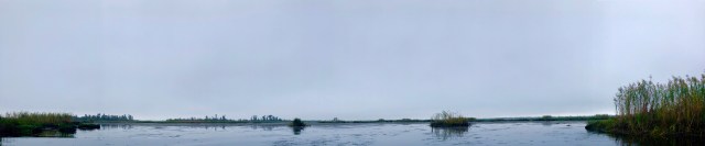
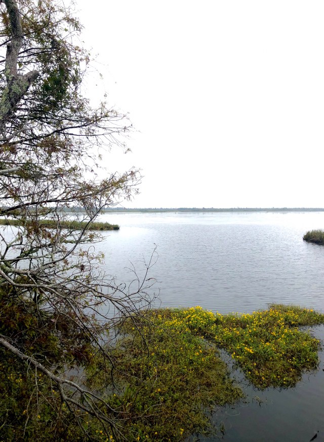
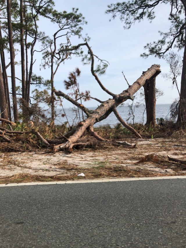
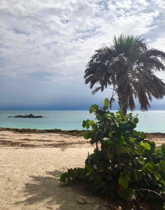
A typical post-Irma tree framing a typical Keys vista – glad this buttonwood is coming back

Along the route I was trying to sort out why it all seems so much more relaxed today. I was on a single, two lane road, with no options and a decent amount of traffic volume, but it was completely not stressful. I thought, well, stunning blue green water to each side of me that flashes bright white over the sand flats and spangles the southern sun in a thousand directions — maybe that’s it. But it clouded up later, and still no stress. Then I was thinking it was the lack of commercialization, but hey, even in the keys they need a dollar, and there is plenty of parasailing, glass boating and sandal shopping down here. But no stress. Most all of the bridges have a little side section for the fishermen, and they were out early, jigging and hauling. I never crossed a bridge with fishermen that at least one wasn’t landing a fish. Everything just seemed to be easy going.

Finally, I gave up wondering about it all and just let it be. Stopping wherever I saw an interesting view, or sandy lane. Never caring that most of them amounted to nothing any more special than what I’d been looking at for hours. On Big Pine Key I saw a few of the Key Deer. They are an endangered species of deer that are about the size of my dog Geraldine. Maybe a hair taller. Like a white tailed deer, only reduced in size down to something that can survive on an isolated island with a long dry season and not much to eat. They all seemed very easy going too. Not in a hurry to cross the street, or worried about you or the car. The place has this effect on everything.

A Key deer

I turned off one time at a sign because I thought it was funny — “No name key.” You have to be seriously relaxed to say, when you get asked to name an island, “it’s called no name.” Turns out there is a little hole in the wall bar at the edge of no name key, called no name pub. And that place is where I learned a lot about living stress free. And about meeting people where they stand.

The bartender was a young guy, maybe early 20s. Happy, welcoming, attentive. I ordered a draft of no name amber (these folks no a good angle when they see it) and settled in to figure out this perpetual bliss.

“You from here specifically?”

“Yep. Lived here all my life.”

“Obviously you like it.”

“Can’t imagine anywhere else.”

“You stay here for Irma?

“No. Man, I had my sister and her boyfriend down here and they kind of freaked out the night before, so I took them to Miami.”

“You seem disappointed.

“Oh man, my friends all stayed and one of them has a video of waves 6 feet high breaking under the stoplights on the highway. Seriously.”

“Was there water in here?”

“Yeah. Six feet deep where you are sitting.”

“This was all in September, 2017, that’s barely a year ago.”

“Uh huh.”

“I saw how all the trees are dead, from Irma, right?”

“Well it used to be a lot worse. A lot of them are turning green again.”

“I guess hurricanes are gonna come and go, but one thing that sounds worse is having the sea levels rise from warming. Y’all worried about that?”

“I don’t know. I mean some people are saying like in 10 years the water is going to come up like 8-10 inches. So, I don’t know.”

“You are three feet above sea level, 10 inches would change a lot of stuff.”

“Yeah. Probably.”

I should point out that at no point (other than his apparent shame at having run from the hurricane) did his pulse quicken or his demeanor change at all. Catastrophic weather, the potential for dramatic geographic change from sea level rise, nothing. This-is-today-I-am-here-in-the-bar-with-great-people-on-a-lovely-day-in-one-of-the most-beautiful-places-on-earth-and-that’s-awesome. More than anything, that sums up the ethos down here, and it is contagious.

The guy in the seat next to me at the bar came back from wherever he’d been and tucked into a basket of wings. I scooted sideways a little and said, “let me give you a little elbow room, you got some serious work to do there.” He said, “I appreciate that, you know that. I really do.” And that started a conversation wherein we discovered many things about each other and shared many laughs. Big Tony, and his son Little Tony are delightful people and as good a bar partners as you could hope for. We come from different places, but we share a common recognition (mine at least more recently acquired) that meeting someone where they are is more important than finding out if they stand with you.

Oh, and if you get tot he No Name Pub, I can recommend the grouper sandwich.

No Name Pub

Key West is cool. It holds a little over a third of all the residents of the keys, so it’s dense, but it’s cool. As the destination, it’s crowded with tourists too, but by the time they get there, they’ve all been infected with the same “Keys ethos,” so its cool. At the far southern end of Key West, at the Fort Zachary Taylor State Park they were setting up a wedding — white columns, filmy backdrop, silver chairs, the works. Pretty cool to get married with that backdrop. A group of six fairly rowdy tourist showed up on their rental bicycles and began exclaiming “there’s going to be a wedding.” They rambled over to a picnic table and several folding tables with a couple of dozen folks sitting around them and said “hey, there’s going to be a wedding did you see?” The folks at the tables said they did and that in fact that’s what they were here for. Long story short, 30 minutes later the rowdy group had explained it was a 35th anniversary trip and the state park wedding party had invited them to the wedding. See? It’s cool.

I will say that I found the touristy shenanigans to be very manageable in Key West. It felt like New Orleans with a blue water view and only about a tenth of the French quarter. I’d like to come back, maybe rent a house for a month or so and see if I could get permanently infected with the vibe so I could take it anywhere.

As far south as I could go. Watching a storm roll in over the Florida Straits from Key West

Tonight, I’m back up mid-keys, just at the north end of 7 mile bridge in Marathon. I’m going to spend the evening at a bar recommended to me by the guy cleaning the pool at an apartment complex. I expect to learn more and will report the same. Tomorrow, I head back to the mainland and across the Tamiani Trail though the Everglades National Park and Big Cypress National Reserve. I’m going on an airboat trip into the Everglades. I will stay on the western corner of the Everglades before turning north up the coast to see what I can find there.

The edge of capacity

Sunset to the west of my campsite

Old Gamble didn’t disappoint. I had a marvelous night on the ocean and slept away all the craziness of the overdeveloped edge of northeast Florida. Good thing, too, because its a long way to Miami and there was lots more craziness, it turns out, to come.

Sunrise through the tent screen at Gamble Rogers State Recreation Area

Since I did make it to Miami, and beyond, it seems only right to spend a little time on the history of Florida — I’ve now traversed its entire eastern edge — sans the broken line of keys I will tackle tomorrow. The reality is, Florida deserves the most improved award in every sense.

A scant 650 million years ago, Florida was at the South Pole. 450 million years later, it was just north of the equator in the middle of the continent Pangea, surrounded by thousands of miles of desert. Pangea broke all to hell 115 million years ago and there was the familiar shape of Florida. It emerged as an island about 30 million years ago, give or take, and when it did, most everything else was frozen, so the sea level was about 330 feet lower than today. So Florida was a lot bigger — space which it could use today, but more on that later. The Paleo-Indians who first made homes in Florida did so 14,000 years ago. They hunkered around sinkholes with fresh water and generally took advantage of the climate and the land and did okay. Around 8000 B.C. things got hotter and the sea levels rose. Being reasonable people, the Paleo-Indians moved when the water came up. In fact, they spread out and started living on the coast and doing things they hadn’t done before. This is good for intellectuals, because now we can discuss how they either disappeared or evolved into a different culture. I think it makes rather more sense to think they said, hey, there’s a coastline! We didn’t know the world more than a several miles from our home before, so we didn’t know there was one. Let’s see what we can do now. And they did.

And, basically, ever since, people have been clamoring to the coast of Florida. Now, to be fair, in the early 16th century, the Spanish showed up and basically upset the apple cart. All that hanging out and doing good got corrected real fast when the right and proper Europeans showed up, and the native people got sick, and the ones that didn’t got converted in Catholic missions — and we all have a story or two about catholic school. It wasn’t smooth going for either group — the Spanish were frustrated that the native people didn’t just go along, and the native people were, well native people, so they were wondering what the hell the Spanish were here for anyway. Soon, the slaves and indentured servants from the British colonies from the north figured out they could escape to Florida (the first snow birds!) and chill out with the native people and upset the Europeans on both sides. Really the only thing that settled all this — to the extent it is settled — is commerce. Once everyone figured out how to make money by being Florida, everyone got on board. I’ve skipped a bunch of stuff that’s important, but people from the north still come to Florida to settle, and people in Florida — including the native people — figured out how to make money on that. Heck, even the great Seminole tribe, nearly rendered extinct by all the European bosses and cross-bred with slaves from the north, are now getting their retribution one chip at a time in the Seminole Hard Rock Casino. God bless them. More power to them. They got jobbed early on and now they’re the ones doing the jobbing. That is America.

And that is Florida from the northeast border to Miami. A place that figured out what a good thing it had and is by God exploiting it to the hilt. I don’t particularly like all the traffic, but I appreciate a good hustle when I see it. And I like seeing a place where the edge was sort of an accident to the culture and became the defining characteristic. Florida didn’t build itself from the edge, it built itself to the edge — at least that’s the case on the east coast. We shall see about the west.

I woke up rested to the glorious sunrise over the Atlantic and spent at least a good 30 minutes or so traveling a pure, delightful edge — rich with nature and sea breeze, nary a condo in sight. Then I got to Ormond Beach, not so bad, still possibly “quaint.” But oh, Daytona. The gloves came off and the towers came up and the commercial catastrophe began. Interrupted only by the Canaveral National Seashore, which is awesome even if it is only to protect the space program, the mayhem continued unabated for the rest of the coast. It changed tax brackets a few times, but the point was still the same. I found one place, only one, that felt calm and original and genuine. Hobe Sound. Now, it takes a dollar or two, but Hobe Sound is old school, not pretentious, and genuinely felt like it had been there for a while. For all I know it is new and pretentious as hell, but the folks I talked to and the scenery I saw eased my mind. I’m fairly sure I can’t afford that sort comfort, however.

Ficus trees over the road at Hobe Sound

At West Palm Beach I simply ran out of capacity to handle more success on the edge. I bailed out to the Florida turnpike and built up my reserves for Miami. Coming of age in the early 80s, I knew Miami. Don Johnson, Scarface, Miami. I think it’s mostly legal now, but it hasn’t veered far from the stereotype. I pried my way out to South Beach where appearance is very important and prices reflect the engineering required to jam that many people into that small a space. The thing is, you can stack people and even cars vertically with a slide rule, but you can’t move people and cars in a stack. You have to line them up.

Miami ranks 5th in one study for worst traffic, behind Los Angeles, New York, San Francisco and Atlanta. I’ve been to all those ahead of Miami — heck I live in one of them — and I’m telling you, Miami is worse. More interesting than my opinion, however, is the fact that all of the top 5 except one, are on the edge. People want to be on the edge and the edge defines the space left for the roads after the people cram in and up, and well, there you go. Success on the edge, either the west or east coast, comes with a price. The traffic. I see other countries building man-made islands to get more people on the edge than the edge has allotted for. That may be coming here, but for now we have cruise ships.

Happy to have a huge protected National Seashore to guard Kennedy Space Center

At Port Canaveral, fresh off the peaceful emptiness of the Canaveral National Seashore, the condo builders became shipwrights and now you can get beyond the edge with a few thousand of your closest friends. The boats are lined up and the traffic is brimming with enthusiasm to get to the dock.

This is all happening while the central part of the state is, save for Orlando, essentially empty. We can thank the geology for some of that — it’s wet and unstable — but at the rate we are drying it up, that too may change. I’m spending the night in Homestead, on the edge of the Everglades basically, and they have managed to create out of the sand and swamp a gagillion new homes down here.

Tomorrow I’m heading to the keys, where I think the pirates may still have a stronghold and therefore the edge may be a bit less stiff with steel. But who knows. After a couple of days down there, I intend to get right into the Everglades and learn whether Mother Nature can hold all this madness back, or whether someone is going to figure out how to build a mountain with “sea views” in the middle of the state.

I value all of my experiences on the edge. I appreciate the grit of everyone who hustles a way forward in this challenging environment. And regardless of the chaos, I still haven’t had a bad experience when I talk to folks. They are good people, even if they are building horrible buildings with no way to move the people in them around. But I’m hoping to find a different approach in the keys, or on the western edge of “the land of many flowers.” Or maybe a little warmer weather to raise the seas some more so we can start over.

The beginning of the end

My campsite for the night on Flagler Beach

Thank God for Gamble Rogers. Not only is he the orator of the finest song introduction ever made (see the movie “Heartworn Highways, for his performance of “The Black Label Blues”), a very fine guitar picker, and a decent singer; he had the good sense to die while trying to save a drowning man at this spot just next to Flagler Beach so the state could create a peaceful park and nature preserve with his name on it. Without it right now, I would be pulling my hair out. But I’m ahead of myself. Let’s start at the top.

I blinked the taillights out of the driveway this morning in the dark at around six a.m. and pointed the old grey Landcruiser south and east towards Savannah, which is where I last left the edge. After a predictably crazy escape through the traffic of Atlanta, the ride to the coast was uneventful. Not so the drive the south from Savannah to Kingsland, Georgia, which was very eventful — in a good way.

The collective ports of Georgia — Savannah and Brunswick — essentially bookend the east coast of the state, and they are powerful engines of the economy. They are responsible for 8 percent of the state’s GDP, 9 percent of its total employment and $106 billion of its sales (11 percent). Interstate 16, which I took to get to Savannah and Interstate 95 which connects not only Savannah and Brunswick, but also the entire east coast, are a big part of this — the stuff has to get to the boat and from the boat. It would be tempting, but ill-advised, to just ride 95 down the eastern edge. Doing so would rob you of the opportunity to use old US 17 from Savannah to the state line.

From Richmond Hill to Shellman Bluff, Harris Neck and Sapelo, from Eulonia to the Golden Isles, and on to Woodbine and Kingsland; US 17 paces you through the old South among the ancient live oaks and pine stands, in a way that no interstate can. Punctuated by markers noting this skirmish, or that Confederate Hospital, or some other Union encampment, there are notions here of what was. But rather than celebratory, they begin, after a few miles, to feel observant — of the terrible price we pay when we fail to get along. Of a victory by many over a few for the rights of all. Of a time that we have to remember in order to avoid it forevermore. And over it all spread the mighty live oaks, bearing the scars and the struggles, hung with moss and determined to be more than an alley to the plantation — to be instead, a living testament to survival even in the face of horror.

The people of this stretch mirror their herbaceous overlords. Determined to make a way when the big road left them behind. Determined to be a repentant culture, reminded every few miles of the need for kindness, they are doing well. From gas station to cafe, to roadside shrimp market, the people of southeastern Georgia are remarkable. A simple “good morning” gets you a warm response and a follow-up “how are you?” No transaction ends without a hope for you to “have blessed/great/fantastic day.” Plus, there is a great diner somewhere between Woodbine and Kingsland that’s been cooking honest food since 1948, remains packed with all sorts of folks at lunchtime, and has a waitress who referred to me exclusively as “Baby.” So there’s that. These are small things, but it is in these small things, repeated and absorbed and believed, that people heal. And in that healing, there is a peace and pace to this area that is enviable.

Also, there are cemeteries. What seems like a lot of cemeteries to me. All are named and well kept and, interestingly, denominational. As in not just a cemetery, a Baptist cemetery. Because, God forbid your mortal remains be subject to the same ground as some backsliding Methodist. I don’t have a real explanation for this, but it seems to me folks who take good care of their dead, even if they are segregated by method of baptism, are caring people.

Shortly after Kingsland, you cross an impossibly narrow bridge over the St. Mary’s River and into…well, Florida. It only takes about 10 miles for that whole peace and pace thing to go to Hell.

You can pick up the A1A at Yulee, FL, but despite the romance, it is not a nice drive. The hustle starts at Atlantic Beach and doesn’t stop until Flagler Beach, just south of St. Augustine. What once could have been described as “quaint beach towns” could now only be described, charitably, as “mixed up.” The shoulder is jammed with tradesmen parking every manner of cement mixer, gantry crane and work truck. The houses range from ground hugging bunker with peeling paint, to brand spanking new stucco tower with cobblestone drive — immediately next door. So precious is the space on the edge that no engineering feat is too difficult in order to get a view of the water we so joyfully got out of to start all of this experiment. Your only break comes in the few places along the way (Ponte Vedra) where zoning by mayhem is replaced by autocratic horticultural, gated perfection that only comes with seven figure entry fees. Otherwise you can get your nails done, check the latest lot prices and try the fried clams all within 10 feet of each other while enjoying a wonderful view of a construction site.

I really have neither positive nor negative feelings about this. It is the marketplace at work. Very little supply meets overwhelming demand. Ready, set, go! It is, however, not relaxing in the least. I do think it got away from them in a few places. Like St Augustine. There is no place in America that was established by Europeans and has enjoyed continuous habitation for longer than St. Augustine. Which basically means its the first place we kicked the locals out of and managed to never cede back. Its history is a mishmash of back and forth control by the Spanish and the British and eventually the Americans, but we or our progenitors have been there since 1565. This seems to me to be a place where the old world would be on stage. And it is, insofar as the Spanish fort remains in the “Old Town” center and the “Bridge of Lions” crosses a picturesque harbor. There’s just too much “Ye Olde Town Trolley Tour” and all you can eat shrimp mixed in to really get at it. The famous striped lighthouse is pretty and you can visit it if you can get to it behind the lot full of beautiful glazed pottery across the street from the Alligator Farm. Seriously.

Mercifully, if you keep at it, you will find Flagler Beach and the Gamble Rogers State Recreation Area. Flagler is old school. Surfer vibe. Where, as a community, no one seems to give a shit who has the biggest house. Or whether the house is painted. Or whether it’s too early for a cocktail. And while GRSRA is not the greatest state park ever, squeezing into a space right on the ocean between a teardrop camper and a pup tent feels like heaven after a day on the northern end of the A1A.

Proof that really is my campsite (above), and lots of, well…proof (below).

Here’s hoping Jimmy Buffett was right and, as my latitude continues to change, so too will my attitude.

Returning to Venice

In a couple of weeks, I will back the old gray Landcruiser out of the garage and return to Venice, LA. To get there, I will head to Savannah, GA where I last left the edge, and then just keep the water on my left until I get to Venice, LA where this entire journey on the edge began. I am about to complete a circumnavigation of the entire lower 48 states — punctuated by several transects of the same at the start and end of each leg — that I started in March of 2016. Since then, I’ve made two trips a year, always picking up where I left off and continuing around the country clockwise.

There is really no good explanation for all this. I outlined the thinking when it all started, and I still agree with it today. Hit the road, meet people where they are, see the country, bring no preconceptions, record what I see/experience. And now it will soon be over.

Before that, though, I will visit the edge that once was the first edge for many seeking the “New World,” and now may well be the last edge for many finishing their mortal journey on earth. Florida, for the most part. I will travel the east coast to the Keys, turn around and travel the gulf coast to Venice — with brief stops in the Everglades and, hopefully, a tour of the Tennsaw River Delta in the tail of Alabama. I will sleep in odd places, meet great people, see amazing things, learn interesting stuff. I may have things to say about all of it that are funny, compelling, boring, or, more likely, a little bit of all of that. All I can guarantee is that I will be different when I return that when I left, and that I will treasure every minute — good and bad.

As usual, I can’t wait to get started. Over the next weeks, I will check the truck and gear, and stare at routes without really planning one. Part of me doesn’t want to start because this will mark the end. Part of me can’t wait to start because this will mark completion of the goal. Part of me knows that Venice, while the end of the lap around the edge, will also be the beginning of another crazy idea to do something else, another adventure, another chance to rethink how I view people and the this glorious country in which everyone, everyone, starts a journey of their own, of some type, every day.

If you have been following along at http://www.ropeandchain.com, please look for the updates on daily posts. If you haven’t been, please join in — you can catch up by clicking “Edge Trek” where you can read the intro and then see every post from the beginning (just scroll to the bottom and read up). If you enter your email, you will get a heads up for each post (disclaimer — I have no idea what WordPress does with those emails). You can also follow mlewis1965 on Instagram and see daily pictures with a link to the blog.

Go out and find your edge.