The Enchanted Forest


Most everyone has a vision of an enchanted forest.  I won’t tell you yours.  I will tell you about the Sol-Duc River and the accompanying old-growth fir forest of Olympic National Park.  Whatever your imagination is calling up about your enchanted forest now, double it.

We are sort of straddling the line between the eastern and western sides of the hat, if you recall yesterday’s post.  We aren’t yet fully in the temperate rain forest, but we are also not fully in the dry side the result is old growth forest hung deep with moss and lichen.  Quiet, but for the rushing sounds of the Sol-Duc river, and soft underfoot with the spring of decomposition.  It is a forest of every shade of green in the paint box.  Waxy, dark ferns, pale hair-like mosses, and everything in between.

We get a campsite and walk out into the forest.  Every step is a revelation in miniature.  Our pace is steps at a time because we keep stopping to study something else unseen. My son has the best analogy for this place: he calls it the coral reef of forests.  As I think about it, he’s right; these shapes and forms and details would be as at home underwater in vivid colors as they are here in their shades of green.  Their languid, variegated, featherish forms wave in the breeze as so many corals in the current.

It is cold up here still.  Snow remains in patches and the damp air cuts deeper in the 30s than one might expect.  But we are smitten with this place.  We will go higher still tomorrow for  another hike before descending to the coast.  Our first day and night are confirming the “Jordan” status of this park.  We will see if it can last the full game.

Olympic National Park

Note: I am going to post this in both “The Edge Trek” and in “National Parks,” but the posts for Sunday-Wednesday will all be “National Parks.”  I am technically off the edge, so to speak, right now to go deep into Olympic National Park with my son.  After Easter, I will return to the edge for a few more days and will be posting notes there accordingly.

Today was a day to straighten up the rig, re-supply a bit and generally get ready for a different sort of adventure for the next few days.  Part of the getting ready for me, involves doing a little learning about where I’m going to be and its history. I generally do this the same way anyone would; by consulting multiple sources, cross checking them against each other, reaching out to noted experts in the field for their unique perspective…Actually, I use Wiki for a quick overview, and then I dig into the bits I think are interesting directly by reading the cited articles and any subsequent threads to which they lead me.  For example, there is a study on old growth forests of the northwest cited in the Wiki write-up that was written by two US Foresters in 1993 and is 32 pages long.  I will read that tonight because I’m interested in it.  Anyway, today’s post will be a brief fact sheet on where I’ll be for the next few days.  The posts from the park will be more my typical type.

There have been humans on the Olympic Penninsula for over 12,000 years.  Until the 1500s, those humans were all likely predecessors to, or part of the indigenous Indian cultures we still find on the penninsula today.  The Hoh, Ozette, Makkah, Quinault, Quilente, Queets, Lower Elwha Klallam and the Jamestown S’Klallum tribes are the current representation of those cultures.  There are parts of the penninsula which belong to them, and which they control and own completely and which are neither National Park nor National Forest.

The official efforts at protecting the Olympic began in 1897 with good old Grover Cleveland (I don’t really know anything about Grover Cleavland, but it sounds like his name should always be preceded by “Good Old” for some reason).  He designated the bulk of the area as a Forest Reserve.  In 1909, Teddy Roosevelt named Mt. Olympus a National Monument in an effort to protect a unique strain of elk without having to discuss it with Congress.  The effort was successful and the “Roosevelt Elk” now roam all the way into Northern California.  There is a picture of some a few days back in the blog.  These elk don’t exist anywhere else and are bigger and genetically different from other elk in North America. Finally, Franklin Roosevelt got the deal completely done and created Olympic National Park as we know it in 1938.  In 1976, it would also gain the designation International Biosphere; in 1981, World Heritage Site, and 1988, Congress would designate it National Wilderness.  I feel like I’m going into the Michael Jordan of National Parks.

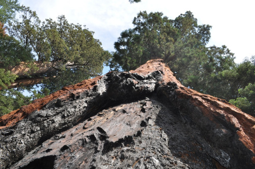
Alot of this fawning over the area and unique genetic material is because Olympic is almost cut-off from anywhere else.  In the natural world, this separation creates special opportunities for plants and animals.  Opportunities that can’t or don’t happen in areas where migration and cross-pollination are commonplace.  You can sort of think of Olympic as a steep, high pointed hat with a broad fishing bill on the western edge, hanging on a hat rack. The hook on the hat rack connects it to the rest of the state of Washington.  The high peak is the Alpine Zone, highlighted by Mt. Olympus at almost 8,000 feet and representing the highest concentration of glaciers of any non-volcanic peak in the lower 48.  It has one glacier over 3 miles long.  To the east of the peak, the side of the hat is dry, old growth forest ending at Puget Sound.  To the west of the peak, the side of the hat is temperate rain forest of conifer trees.  There is 100 inches of difference in rainfall between the two sides of the hat because of the rain shadow created by the Alpine Zone.  Finally, at the bottom of the western side of the hat, is a coastal area along the Pacific.  There are 62 miles of it and it includes the longest continuous sections of undeveloped coastline in the lower 48.

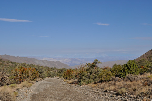
Over the next few days, we will visit and camp in three of the four regions — the old growth forest, the pacific coast and the temperate rain forest. Much like learning about the edge by being on the edge, there is nothing like taking a walk in the forest to see what you really think about it.  I don’t expect to have much if any cell coverage (thank God), but I will record it all in word and picture and look forward to posting exactly what I think about it all here.

Black Canyon

tumblr_mquvvmhm891rwuuw2o1_500

Camping at Black Canyon of the Gunnison on the north rim is a peaceful experience – though the storms this time of year can be fierce. We rode a wind/hail/flash flood storm out for the first hour or so in camp. At first our handy awning gave us a front row seat to the gathering storm, but eventually it was no match for the elements and we retreated to the car to stay dry.

Continue reading “Black Canyon”

Great Basin to Black Canyon of the Gunnison

Today was a day to drive. Sunrise on top of Wheeler Peak found us headed down and out of the Great Basin. The park is essentially on the Utah border, so our drive today is mostly a traverse of the beehive state. HWY 50 takes us halfway across and then we switch to Interstate 70 for the remainder, and on into Colorado.

Continue reading “Great Basin to Black Canyon of the Gunnison”

Great Basin

tumblr_mqtrbx0tho1rwuuw2o1_500

Great Basin goes on my list of secret parks. Not that people don’t know about it, or come to visit it. Just that it is so much more mellow, more remote, more available to you when you are here. 4,000 feet of altitude from the lower camps to the upper camp, a actual glacier on the mountaintop, high mountain lakes, the oldest trees on the continent, wildlife, diverse flora, and what feels like very little traffic. Good recipe.

Continue reading “Great Basin”

From the Valley to the Peak

tumblr_mqtr5orneb1rwuuw2o1_500

We left Yosemite to the east which afforded us a chance to see a huge section of the park that, at least from the looks of things, doesn’t get the traffic we found in the Valley. The Eastern section is high Sierra at its finest. Anchored by Toulumne Meadow and the granite domes of Medicott, Fairview, Pothole and Lembert, the trip out via HWY 120 is just wonderful.

Continue reading “From the Valley to the Peak”

The Chase

tumblr_mqjrv7aphs1rwuuw2o1_500

It was hard to leave Atwell Grove. Only the promise of the road ahead could pry us out of that magical spot. Our plan was to head back down to the main entrance to Sequoia, follow the General’s Highway to the see the largest tree on the planet and hopefully get an education on these giants in the museum and to do all that before the crowds arrived. Then head out into Sequoia National Forest to a place called Big Meadow and spend the afternoon fishing Big Meadow Creek.

Continue reading “The Chase”

A Walk Among the Giants


tumblr_mqjrvzou6c1rwuuw2o1_500

We opted to spend our first night in the southern portion of Sequoia National Park known as Mineral King. You turn off before the main park entrance and drive an hour and half up and into the area. Unlike the roads of yesterday which drew you up to speed and then threatened you with sudden death hairpins, this route in just requires an absolute adherence to a speed of about 15 miles an hour. You can never take your eyes off the road and there is no straight in it. It is about 1 1/2 cars wide but folks we met (two) were exceedingly courteous and appeared perfectly willing to notify the authorities should we tumble over the edge. We didn’t, and in fact, enjoyed the drive. Something about having to just go slow causes you to absorb a little more of what is happening. What is happening is a steady preparation for the impact of an up close view of a living thing that is over 2,000 years old. You see a giant sequoia immediately on the roadside just before you enter the park proper. It stopped our breath. Collectively.

Continue reading “A Walk Among the Giants”

Out of the Valley of Death Rode…the two of us

tumblr_mqiv18dab21rwuuw2o1_500

As often happens in the hours following a harrowing experience, morning broke atop Telescope Peak in Death Valley with utmost peace. The sun was out, it was a cool 49 degrees and one would never know that only hours before we had been in the midst of chaos. Over coffee and breakfast we discussed the drive down the mountain. We reviewed the several places that were likely to have washed out in the storm and so in the middle of the peaceful morning we dredged up a box full of worries.

Continue reading “Out of the Valley of Death Rode…the two of us”