

After I left Venice my plan was to loop south and west of New Orleans back down to Grand Isle for the night at Grand Isle State Park. Traffic and rain fought back and I ended up making most of the trip from New Orleans to Grand Isle in the pitch black, wet night. And by pitch black, I mean subterranean-coal seam-with-no-lantern. Since most of the road to Grand Isle is on LA 1 and LA 1 is mostly elevated above marshy hummocks and bayous and no one is begging for street lights and very few people live along the route, it is really dark. You get my point. By the time I pull into my campsite I don’t know anything about how I got here.
The rain had stopped and I could hear the gulf, just over the dune against which I was parked. Sleeping on top of the car afforded nice sea breezes and a relaxing night, encouraged only slightly by good bourbon.
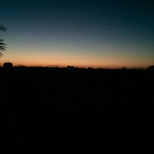
Daylight came with a spectacular sunrise and clear skies and, after a brief sunrise stroll on the beach, I set off to retrace my route on LA 1 with the benefit of actual vision. I have a theory that anytime you can find a state road numbered “1” you will be rewarded if you drive it. That theory remains intact. LA 1 is a great road. As it floats along over water, marsh and hummock, you feel as close to a piece of country as you can get. Since you wouldn’t be able to walk, and you wouldn’t be able to boat through this ground, LA 1 offers the only access. You find sections of open wetland where the state is constructing floating islands of native grasses, open water “lakes” of mixed gulf and riverine run-off, and you find the softer edge. This is a living edge – moving and changing and caring not one bit about the final piece of solid ground that is Grand Isle. You get the impression that, under the right conditions, all the little islands could team up and just slide out to the gulf and make a new place. If they wanted to.
I retraced LA 1 back north, turned west to skirt the southern edge of Houma, and then headed south along the Little Caillou River to Cocodrie, LA. This is the heart of the coastal Atchafalya. The stuff of cinematic Louisiana, the Atchafalya is dense with Cypress and Tupelo and Yaupon, dressed heavily in Spanish moss and bromeliad, redolent of sweet rot and teaming with life. Here folks live at the river’s edge and the dense swamp’s door. In almost every case, the boat is closer to the house that the car. Oddly, speed limits are a focal point. The residential stretches of Little Caillou road are 25 mph. I’m not a big fan of speed on these trips, but 25 is s-l-o-w. Ultimately I made sense of it. When you live in a place where a boat wake in the back yard washes the bedroom floor, it’s natural to create a sort of no-wake zone in front of the house too.
Everyone here on this edge works. They work at fishing, they work at catching bait for fishing, they work at repairing boats for fishing, they work at cleaning fish from fishing, they work at cooking and selling fish from fishing. And they work at living on the water level at the water’s edge. Most simply raise their dwelling a foot or so off the ground, wear rubber boots and call it a day. Some have more elaborate drainage plans, and some just say the Hell with it and let the water lap around the foundation. They are happy, congenial and welcoming to strangers. Their life on this edge is intential and satisfying. The coastal Atchafalaya, like it’s wonderfully lyrical namesake, is a soft and living place of continuum. The river flows, the swamp breathes and everything to the north – away from the edge – holds little meaning. Like they water at the doorstep, life here happens up close, in the immediate area.
Cocodrie means crocodile in French, I think, and one gets the impression the name is well earned as you travel the Little Caillou. Once in the actual town of Cocodrie – the edge itself – crocodiles are not to be found. After all the life along the way, the town isn’t really anything other than a place to turn around, or launch a big boat to service the offshore platforms. The life on this edge is in the approach. And it will be there for as long as there is water.
Back north then, into the main heart of the Atchafalya, past Morgan City and onward via US 90 toward Delcambre and Abbeville. For the first time I actually gain some elevation above actual sea level (by the time I get to Abbevile they are actually able to bury people in the ground instead of on top of it). From Abbevile I turn south back to the edge via highway 82 to Grand Chenier and Gulf of Mexico. My route from Grand Chenier hugs the edge along the Gulf to the Sabine Pass and the Texas border. In that stretch, for almost all of it, everything between the road and the Gulf is empty of humans and exploding with life. Turns out the hot sauce man – Edward Mcilhenny from nearby Avery Island – liked this six mile wide 26 mile long stretch of coast so he bought it. A year later, perhaps after a bad pepper harvest, he sold it. To the Rockefellers. That was 1914, and ever since, protected by some fancy lawyering, these 86,000 acres have been home to wildlife and nothing else. Being an opportunistic bunch, the local Creoles (this road is called the Creole Nature Trail) hug its borders with duck camps and fishing camps in a few spots, but mostly this edge is as it has always been.
It’s my first experience with a straight line along the edge. I guess 300 million years ago when Africa peeled away it wasn’t a clean break. And 65 million years ago when a meteor crashed into the gulf and blew hell out of everything, no one had a plum bob. The edge is alive, shifting and changing – they say 10,000 acres of the Rockefeller preserve is gone, back to the sea – as it always has. American ingenuity and commerce made sure this section will continue enjoy and suffer the vagaries of life on the edge.
Commerce is having a different affect on the edge at Sabine Pass and Port Arthur. Miles and miles of nature have been replaced with acre upon city acre of industry. Liquid Natural Gas facilities, oil refineries and all manner of pipe-laden steam spewing bastions of progress assault you as you reach the Sabine. It’s hard not to marvel at the ingenuity. It’s hard not to gag at the contradiction. There doesn’t appear to be any blending of environmental incompatibility – there is pristine gulf front and then there is this huge industry. It’s not messy, it’s just incongruous. As I take Texas state HWY 87 toward Sea Rim Park, the road actually goes through one of these things, a refinery I think, for a MILE. I took a video I hope to post at some point so you can get a sense of it. I’m not naive about the need for progress, or the fact that I can make trips like these because good people build refineries and good people work in them, and I get to have gas for my car. I’ve just never seen it happening. I know economics play a role in keeping places like these on the edge, but I can assure you, the lack of people plays a role too. You’d never get one of these refineries in Nashville.
Life on the edge is soft as the banks of the Little Caillou or the feathers of Snowy Egret in the Rockefeller Preserve and then it is not. The edge continues, hung as it is with all types, productive and placid, living and industrious.
