It seemed perfectly normal to overnight at Lake Elsinore. There is some history to the lake, there is a scenic drive over to Joshua Tree, and I’d been at it over 8 hours. None of this bears any knowledge of California freeways. What I thought would be a nice little drive around Mt. San Jacinto and into Desert Hot Springs, and from there the West Gate of Joshua Tree, turned into a contest in following the GPS lady — who DOES know about California freeways, and more particularly, the penchant of Californians, who also know the freeways, to cut through and between anything on any road in order to avoid the jams. Staring at a map I can’t tell you how I got to Joshua Tree. But I did, thank God.
The last time I was in Joshua Tree, Foster and I came in the North Gate fairly late in the evening and drove straight to Jumbo Rocks to set up camp. It was among the best nights I’ve had, ever. The next day, we travelled a wilderness road down through the center of the park and out the south central portion. The point is, while our time there was perfect, we didn’t see most of the park. I intended to remedy that.
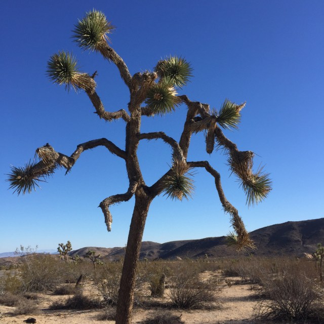
I spent most of the morning visiting the western half of the park. From Hidden Valley, to Keys View, generally speaking this is the higher end of the park. It really is a magical place. All the geological forces that created this tumble of granite and sand were just looking for a way out; but, in total, it almost seems like they had a plan. The views are fitted neatly between framing outcrops, and the closer you get to the ground, the more interesting the park becomes. Many folks think there is a “spirit” to this place that doesn’t exist anywhere else, and I’m not going to argue with them. I don’t want anyone to steal my body to bring out here and burn like Graham Parsons, but having visited a great many parks, I do agree there is something here.
For nostalgia sake, and because I so miss having him with me, I made my way back to Jumbo Rocks for the night, to the exact spot where Foster and I stayed. It was as I remembered, minus his sunset guitar playing. Also, when here last, the place was empty — tonight, it is full. I worried about this as I watched others making camp, but such is the power of Joshua Tree that when the sun began to set, I didn’t notice another person. Until last light. Just as the sun splashed the last rays of color from beyond the horizon, a lone chant rose from the faraway Hexie Mountains to my north. Silhouetted on the top of a ridge, the outline of man, arms raised and spread wide, grabbed at that last light and sang his worshipful Indian song. I could never imagine this, but I could never find anything as appropriate.

In the morning, my plan had been to spend the day in the park and stay one more night. I learned, however, that I need to be lined up for the festival campgrounds at 9 am Thursday, and I have a day’s worth of work to do in Indio storing things and buying things and re-organizing in order to be ready. So I take half a day instead, and cover the eastern and southeastern sections. Here you pass through and fall away from the Hexie’s and into the great Pinto Basin and Pinkham and Thermal canyons. It’s a completely different park over here and no less stunning. Gone are the large, tumbled granit boulders of the upper sections, replaced by broad desert of smaller darker stone formations and so many more of the epynomous Joshua Trees. Entire fields of jumping cholla and ocotillo cacti and uninterrupted vistas across the Colorado desert to the Coxcomb mountains in the east, the Mojave to the north and the Eagle Mountains to the south. It’s a much bigger park here in every sense of the word. I take my time, stopping and hiking on various short trails, until I emerge at the South Gate near Cottonwood Springs.
The Box Canyon Road is a happy accident. Instead of turning toward Indio, as I thought I would, I catch a sign for the Box Canyon Road with the note that the Salton Sea is 13 miles away. Following — as the name implies — a box canyon through the Orocopia range, CA 195 aka Box Canyon Road, is a delightful drive. Flat and twisted, it stays hard against the pink white canyon walls until you emerge with the north shore of the Salton Sea at your feet. From a distance, the Salton Sea looks beautiful. Shimmering blue amidst the surrounding desert and so long the southern end is not visible. Up close, not so much. As I parked and walked out to the beach I gagged on the stench. I don’t know how to describe it to you, except that it is a funk the likes of which I’ve never smelled. It’s not rancid or putrid or foul. It’s just, well, funky. By the time I reached the shore, I found the cause.

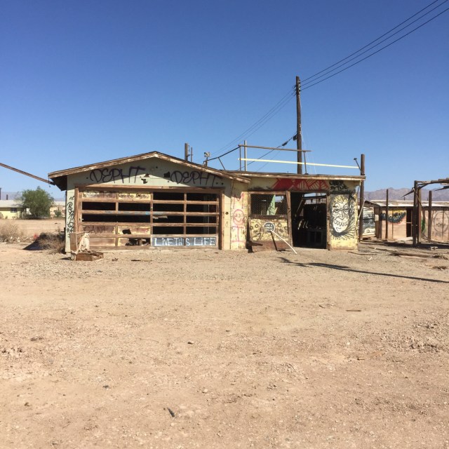
If you’ve been following along, you’ll recall that the Salton Sea gets the bulk of its water from the excess irrigation runoff of the Imperial Valley to its south. This is water that left the Colorado (not on its own you remember) pure and clean, before being washed over the southwestern Arizona and southeastern California desert to grow crops. There it gains countless additives — some from the farmers and some from the minerals in the desert that it perks through and over on its way to the New and Alamo rivers and from thence the Salton Sea. Coupled with the evaporation from the desert sun, these factors render the Salton Sea very…salty. The agricultural runoff blooms algae, lots of it on the bottom and in the water column. So the blue you see from a distance is just a reflection of the glorious California sky. Up close the water this a red brown sludge of floating plant matter and dead fish. Because the fish asphyxiate when periods of excess salt and algae rob the water of sufficient oxygen. The result is that they float to the surface where many are gobbled up by sea birds — and if there is one thing recommending the Salton Sea, it is an excess of every type of fish eating fowl you can imagine — or, as most of them do, they was up on shore. Because they are so salty and the sun is so hot and the air is so dry, they are mummified there in the grotesque contortions of their demise. Nice right? All of this and about 100 degrees air temperature. It is a fresh Hell of a place that is probably prophesied in some text somewhere with a meaning that we should all know. For now, I marvel that anyone ever comes here. What settlements there are — Bombay Beach as an example — are what Ghost Towns must have looked like on the day or two before they became official.

I made it up to Indio from there and will spend tomorrow putting things in a storage unit (the list of things I can’t bring into the festival was incompatible with the list of things one needs to spend almost two weeks alone on the edge in a vehicle) and re-stocking for the festival camp. I need to be in line for our space at 9 am Thursday morning and will hopefully have everything set up when Leah arrives later that day. As is my custom, I will report as accurately as possible on four days of rock and roll and old people re-living their youth.