

Early morning was wet and cold, so as I let the car warm up and clear the windows, I dug out a detailed map of the Superior National Forest and found a route via a series of Forest Service roads that would minimize the amount of “backtrack” I had to make after getting out to Grand Portage. I eventually popped out of the Forest at Grand Marais, had a handful of miles to Grand Portage, and then turned around to head south to Duluth.
A morning ride through any forest is great, but one through Superior National Forest, with a cottony fog hanging over every body water, the fall colors in the trees, and the promise of the big lake they call Gitchee Gumee at the end of it is very great. For Forest Service roads, the ones in Superior are actually better than average. The hunting population was generally off the roads, and from the sounds of gunshots, was doing pretty good. I kept to the roads, and when I stopped for a picture, or took one of the two tracks, I kept an eye out. The forest steadily gains altitude as it approaches the “rim” of the depression that would fill with water and become Lake Superior. The mixed hardwood is accented by rock outcroppings and the ever present water. Lakes, ponds, rivers — all gin clear — work their way through the forest, to the rim and over the edge. Between gunshots, the only sound is the hum of the tires and the wind doing its best to separate the last of the fall leaves from the trees. It’s a good tonic and a good way to get your head on straight for the day.
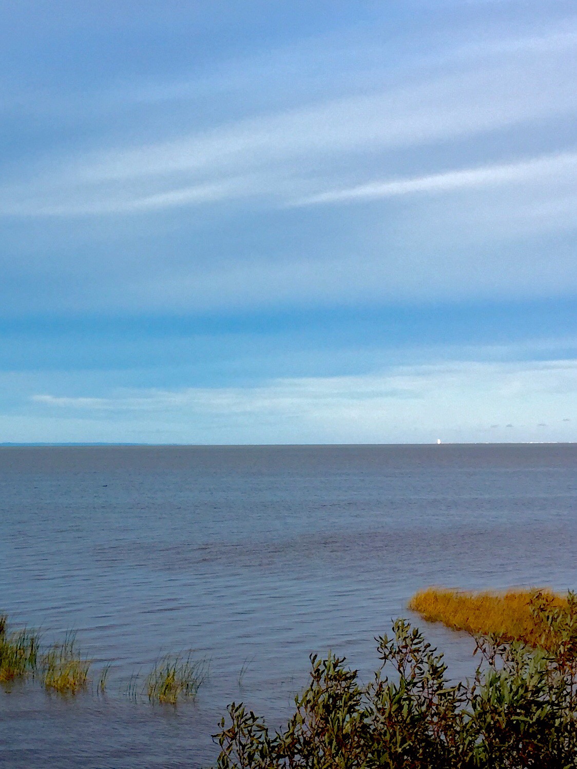
While you have the sense of the big lake every time you get a view of the horizon, you don’t actually see it until you top out on the rim — and it fills the sky. I can see how early explorers were sure it was the great sea they were expecting to link them to the orient, until they tasted it. As a body of water, it is something: average depth is 482 feet, deepest point is 1,333 feet; there are 2,726 miles of shoreline; you can see up to 60 feet deep in the clear waters; and, it covers 31,829 miles of surface area. (And don’t worry, I will get to Gordon Lightfoot an the Edmund Fitzgerald when I get to Sault Ste. Marie)

Minnesota highway 61 is sort of like the midwestern version of the Pacific Coast Highway. From Grand Portage to Duluth, it rolls 145 miles or so, all of it immediately along the shoreline of Lake Superior. While it doesn’t have the gut tossing drama of the Pacific Coast Highway, it does have the same tenacity of purpose. Most of the rock formation that edges the Great Lake is a sandstone formation left over from the warm sea that once spread from the Appalachians to the Rockies, but there are “pillars” of igneous rock that were forced up through the porous sandstone by volcanic pressure, and these “pillars” often reach out to the shoreline itself. This creates picturesque, foaming waves, formed largely by the wind, crashing along the roadside and making it difficult to stay in your lane. The road is smooth and basically straight for the entire run, interrupted only by speed limit changes for each little community. And that’s really what settled my perspective on this section of the edge.
Up to this point, the edge has been a sparse place. From Venice, Louisiana to Southern California, to the Straits of Juan de Fuca, and all the way across the 49th parallel, the edge — with a few posh exceptions on the west coast — has been a place of very few settlements, remotely clinging to a place nearer to something else other than the United States. While there are areas of wilderness from Northwestern Minnesota to Northeastern Minnesota, all of it is accessible to major metro areas, and all of it is in a state where the culture is decidedly “outdoor-oriented.” The result is that the edge up here is populated and busy. But the entire length of of the western shore of Lake Superior has a kind of late-60s, early 70s vibe. Everything is well kept and clean, but it is dated. The resorts, the homes, the commercial buildings, all look like they were in their heyday in the 70s. And almost none of them are ostentatious in any way. Simple buildings, in a beautiful place, populated with simple, good people. I have no evidence for this, but as I thought about it, this area was the home of industry that last had any real power in the 60s and 70s. Timber, iron and steel, copper. The move to get a place on the lake, or in the woods to get away from it all must have happened in a big way during the heyday of those industries. And the people who made those moves — hard-working, blue collar people — remain that today. Just older. They may be retired, but they get up, take care of the house and yard. Take care of the boat and cut the firewood. They go to church (mostly mass from the look of it) on Sunday, have coffee at the cafe every morning, and don’t meddle.

The fact that this is the most accessible edge, east of the Mississippi, reaching down into the country more than just surrounding it, in the figurative midst of the bulk of the country’s early industrial heart, is making this trip around this section of the edge more of a road trip than an adventure. But it is proving just as important. I’ve had to reign in expectations, and enjoy what is in front of me, rather than make the journey fit some model. And that is very much in keeping with the idea to start this exercise.
At Duluth, I turned east and north into Wisconsin and out onto the little knob of the state that juts into Lake Superior. I have no sense that pride of state is any less in this area, and I’m certain the state itself values the area, but the area is a thing unto itself. To begin with, it is basically empty. At the very northeastern tip, adjacent to the Apostle Islands National Lakeshore, there is some significant activity. The town of Bayfield is sublime — frozen in time and crisp as a newly laundered shirt, it is the model of shoreline towns. The Indian reservation has, of course, a casino, which despite it’s isolation was busy. But other than that, the entire section of the state along the lake is empty. The vast forest lands are peaceful in their isolation, but unremarkable in topography and formation. The rivers here are iron rich and prone to clay over wash when rains are heavy, so today, the southern shore of Lake Superior was frothing red from the shoreline to about 300 yards out. I’ve made it almost to the Michigan border and will be interested to see tomorrow how tings change when I cross onto the upper penninsula of that state.
My plan — and I’ve been wrong about these plans so far — is to move across the top of the Michigan Upper Peninsula through the Porcupine Mountains Wilderness, the copper mining area and all the way to Grand Marais, where I hope to camp on the beach and find some agates for my wife. But who knows. I will find the roads, and I will stick to the edge, and I will see what I will see. I like the working man flavor of the edge here. I expect I will like Michigan as well.
