The edge of renewal


Before I get started tonight, I have to say RIP to Don Rickles. One time in my life I bought something from an info-mercial and it was the entire set of Dean Martin Roasts.  I gave them to my Dad because he used to let me stay up late on the bedroom floor watching them.  Red Buttons, Jonathan Winters and Don Rickles were the funniest thing I’d ever seen; or, frankly, have seen since.  I miss a time when we could just all laugh at ourselves and each other without getting all wound up about stuff.  The guy was all love and I will probably be up all night re-watching funny clips of him.

Today was my day to visit the volcano.  Thirty-seven years or so ago, Mt. St. Helen’s erupted surprisingly in the worst volcanic explosion in the history of the United States. Seismologists say the mountain went from dormant to active to explosive in a flash.  The lack of preparation/predictability meant lives lost and massive property damage. Occurring prior to the advent of countless experts on the television, the footage was just a simple narrative of what looked like Armageddon.  Visiting today, I was a bit awestruck; but not by devastation, by renewal.

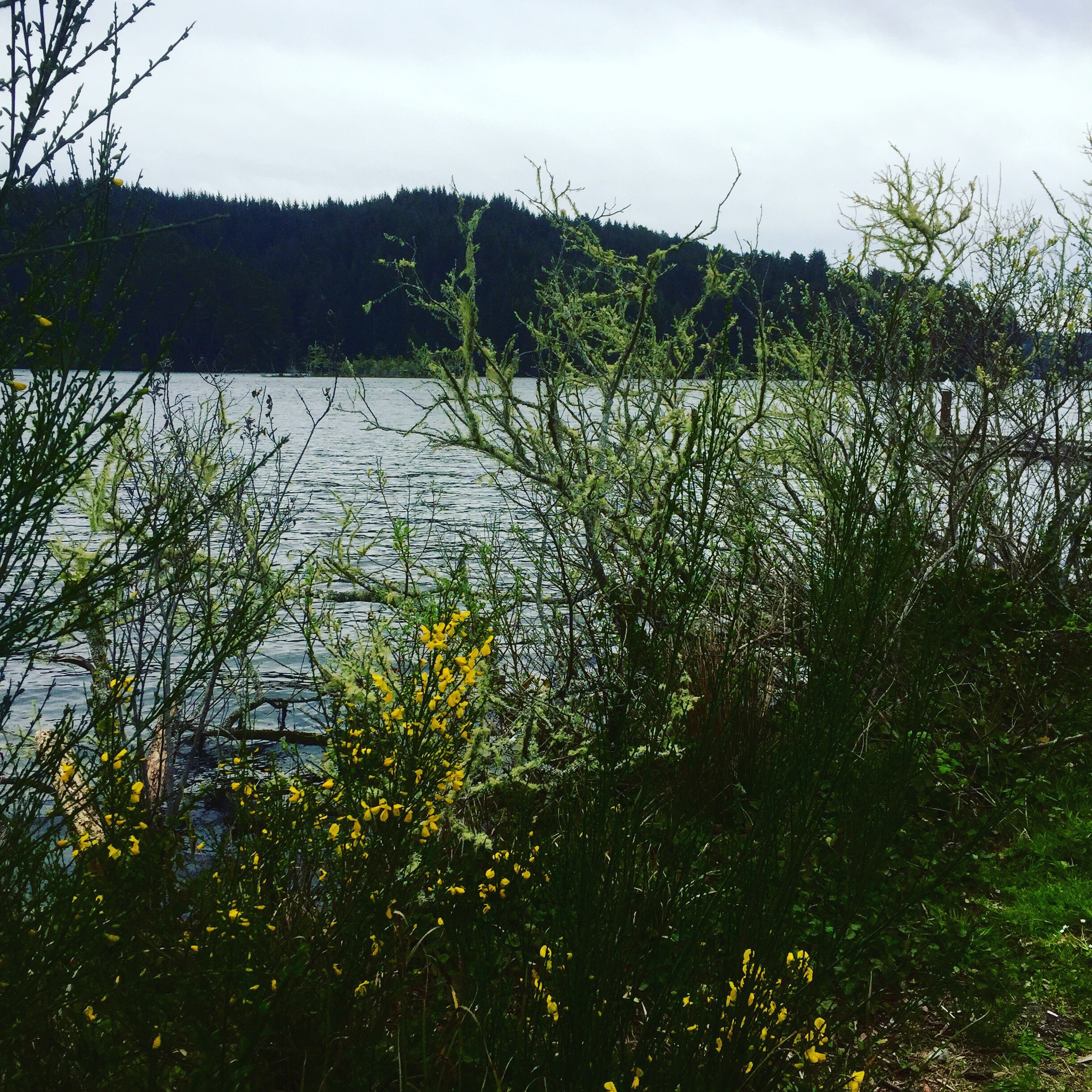
The ride up from the coast was a slow climb along the southern shore of the Columbia river into the heart of timber.  Along the river, great processing plants for wood chips, paper and saw timber sprawled out with shipping docks on one side and rail lines on the other.  While severely industrial, unlike the refineries of say, Port Arthur — also on the edge — the product of these facilities is visible.  Neat stacks of freshly cut trees spread over acres awaiting the saw blade, great mounds of bark steaming the morning sun ready for shredding, and perfect squares of tightly wrapped 2×4’s headed for the Home Depot near you.  These are the factories of a renewable resource, obvious because they are surrounded by acre after acre after acre of more trees and clear cuts and fresh plantings.  I can’t argue for the practice of logging by clear cut, but I can rest easy knowing that there will always be trees.  These guys are making sure of that.

The view across Silver Lake to the cloud-wrapped Mt. St. Helens
At one point, before leaving the river to head east, there is a lowland area where the crop of choice is birch trees. I’ve never seen a birch tree farm before, but it is marvelous.  Straight and white and just beginning to shade green with new buds, the neat rows are mesmerizing and beautiful.  Even and precise they are like a tightly looped carpet over the ground that you can somehow see through.  I’m certain they too will be cleared one day, but I’m equally certain more will be planted.  I’m glad I caught these at the right time.

I leave the Columbia to head north to Castle Rock and then east on the Spirit Lake Highway to Mt. St. Helens.  It’s a 52 mile drive to the endpoint near the crater. Shortly after starting this last segment I swing into the Ranger Station to bone up on the details and there I learn that damn near the whole place is closed down.  The road to the observatory is closed about 4 miles from the top, the entire southern access is buried under a foot and half of snow, and every information center along any route is closed.  So, I go as far as I can.  Through Silver Lake and along the Toutle River up as far as just past South Coldwater. This means I enter the blast zone a little over halfway through the route.

Hoffstadt Creek Bridge

I enter the blast zone at the Hoffstadt Creek Bridge to the northwest of the crater.  This means I’m on the southwest edge of the zone because the blast was mostly to the north of the crater.  The total zone was roughly 150,000 acres of complete devatastation.  There was nothing left. For some perspective, the Hoffstadt Creek Bridge was gone and had to be rebuilt.  The bridge is over 2,300 feet long and 370 feet high. It was just one of 19 bridges, 16 miles of railroad, and 659 miles of road lost.

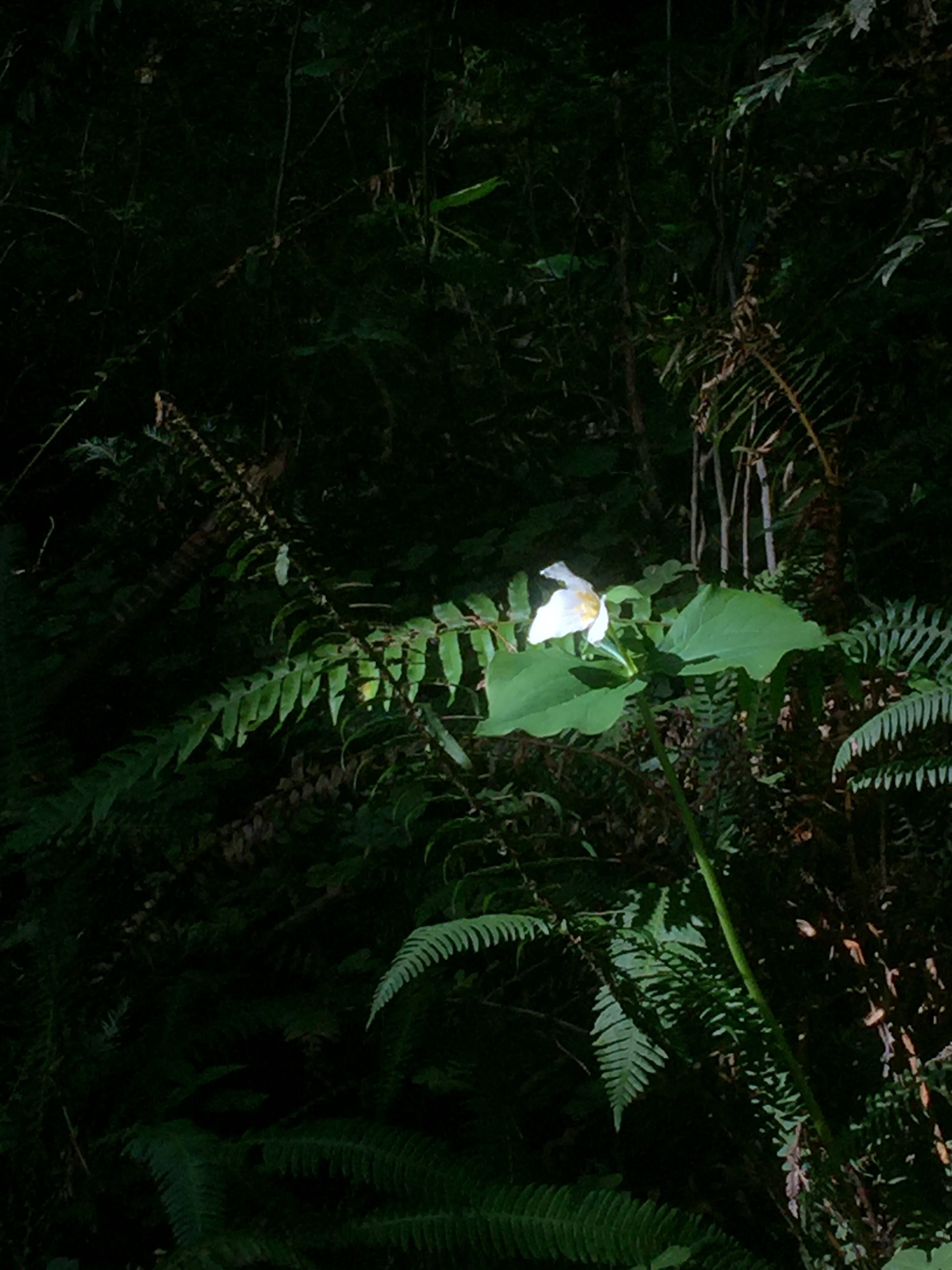
I never once today had any sense of any devastation at all.  Only the churning, chocolate milk Toutle River provides any indication of the massive amount of sediment/ash that once covered all of this. The Corps of Engineers had to build a special catch-basin to help contain the sediment.  Everything else, everything, looks fresh and new and beautiful. Certainly a great deal of credit goes to the timber industry.  Weyerhaeuser spent over $9 million in the early 80’s replanting damn near every tree.  Nature did the rest.  There are deer and elk, birds and fish, and everywhere trees.  There are open areas where you can see the stumps of trees blown down when a pyroclastic flow of rocks, super-heated steam and highly charged gas screamed down the mountainside.  But like the meadows of Yosemite, these open areas are vegetated with grasses and flowers and provide a nice foil to the deep green of the forests.

Castle Lake and Mt. St. Helens

I watched a documentary last night about all this and listened to scientists say that everything we thought about the natural recovery, all our understandings and long-held beliefs, and settled science, were wrong.  Within weeks of the eruption, they found gophers that had survived.  Next were Prairie Lupine, growing where they shouldn’t be. Soon came insects, salamanders and more.  The work of the timber industry meant forests were back sooner and, in short, we re-wrote our understanding of what nature can do.  So today, Mt. St. Helens feels fresh and renewed, and my long-distant memory shard of devastation is re-written as well.

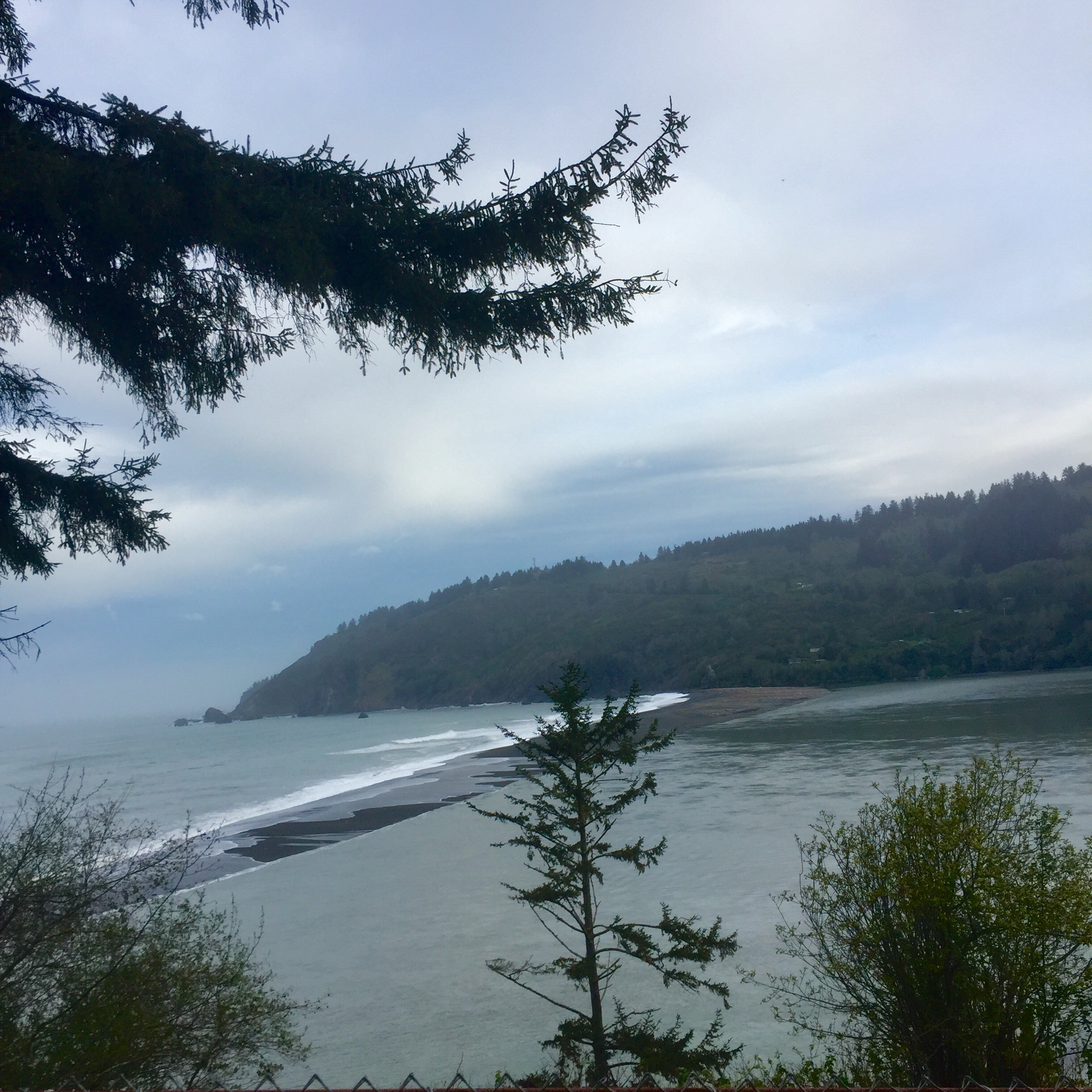
On the way back to the coast where I left off, I stayed on the north side of the Columbia following the official Lewis and Clark Trail.  Somehow someone determined that while the terminus is on the south side of the river at Ft. Clatsop, the approach was on the north side.  It’s much nicer.  You can feel the great river spreading out and it breaks into braids of relaxation as it nears the coast.  I expect the explorers felt the ocean was around each bend.  The valley of Columbia and then the Grays River here on this side are stunning, with deep green pastures flush to the river edge full of grazing elk.

Out for an afternoon snack along the north shore of Grays River

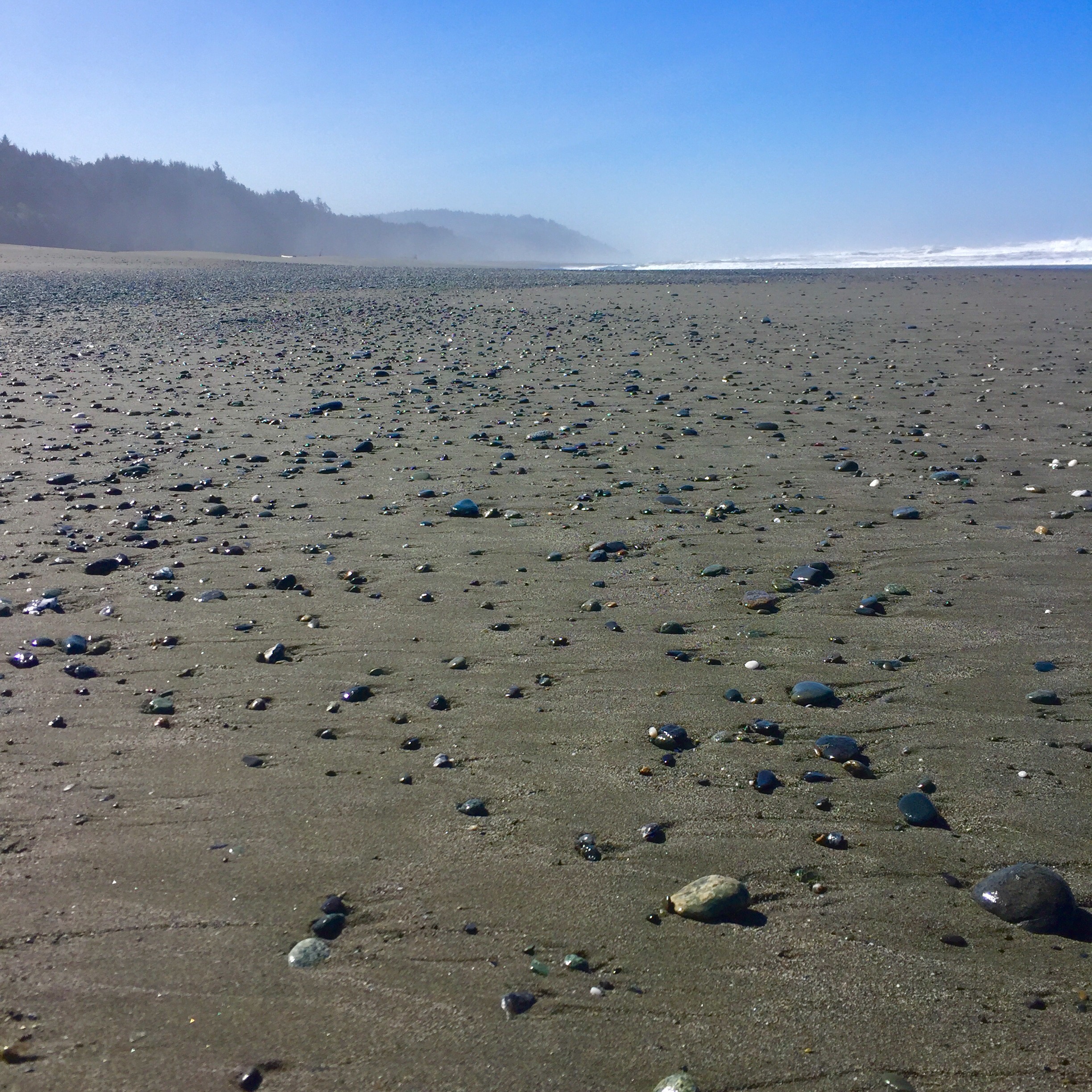
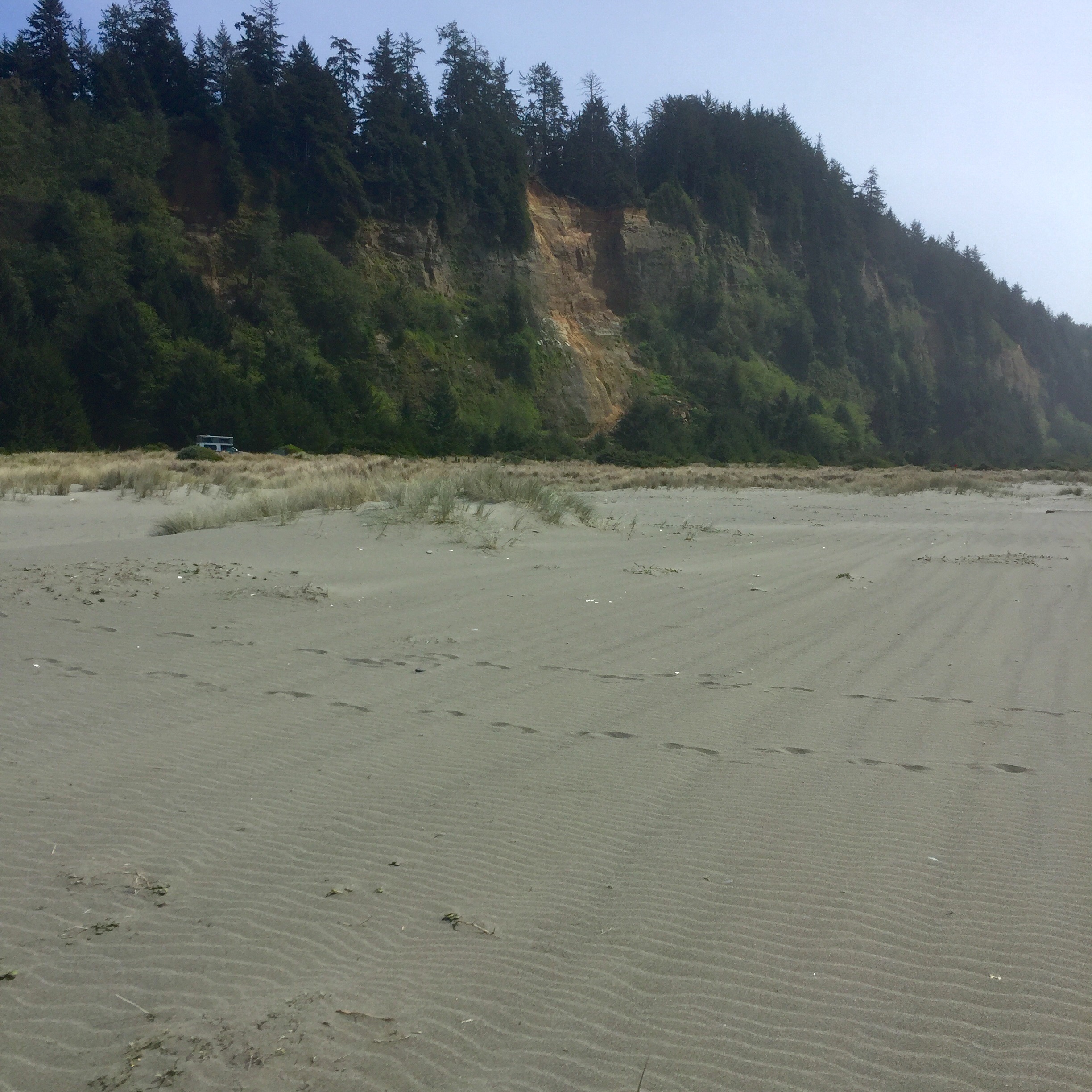
Just east and north of Astoria, Oregon, I angle north to the edge of what is Willapa Bay.  Broad clam-rich tidal flats spread out in all directions dotted with locals up to their calves in the muck leaning on their rakes for a bucket of bi-valves.  Around Southbend at the head of the bay, I follow state road 105 back west to stay hard on the edge to Westport, and around South Bay to Aberdeen.  These protected bays mean the topography here in Washington is almost exclusively peaceful beach, complete with fishing villages and all manner of stout craft for making a life here on the edge.

The head of Willapa Bay looking west

Tomorrow I will complete the western edge and turn east at the Straits of Juan De Fuca.  I’m due to pick up my son in Seattle on Sunday for a sojourn deep into the Olympic National Park and by then, I will have completely circled it.  But until then, I have a few more days on the edge.  And, after today, I too am feeling renewed.

The edge of the storm

It seems a long time since the storms of Missouri at the outset of this journey, but I haven’t had any rain since then.  With countless wash-outs, mudslides, road closures and down trees, I’ve seen evidence of rain, but no actual rain.  That ended today and, by the looks of it, it’s going to be wet for a while.  

Morning in Lake County

I started out today in Lake County Oregon which is aptly named for a near constant chain of lakes just inland of the coast that turn the 101 into something of a penninsula for several miles.  To the west is the Pacific and a continuous row of towering dunes, the east, a broken range  of mountains fronted by a chain of flat, clear lakes.  Again, the forces that build, take away.  All the sand shuttled to the edge of the sea by the area rivers, you’ll recall, rises up on the North American Plate and forms the dunes; these, in turn, grow and seal off the rivers that gave them birth enough to create lakes on the inland side.  Like so many beaver dams biting the hand the feeds them. While it’s mildly reminiscent of the bayous and Gulf of Mexico arrangement I found on the edge in Louisiana, the steep mountains and fir forests make it somehow more European, if that makes sense.  As usual, we are the only thing that spoils (in my opinion) this tableau. The dunes are a commercial success for this area of Oregon because people like to recreate on them.  Specifically, people like to ride motorcycles and four-wheelers and dune buggies on them. I think Oregon does a good job managing this, and there is no evidence of destruction that I could see, however, the marketplace is a demanding thing and marketing is prolific for all manner of rental services and guided tours.  It all turns into a little too much of a roadside carnival in many places.  

Once across the Suislaw River, the 101 returns hard to the edge and to an ever grayer sea.  There is a storm at sea and it’s rolling inland.  My weather radio crackles on about a stalled cold front, and low pressure systems building along it, and swell heights and intervals, and small craft warnings, and all sorts of dire sounding things.  The throbbing ocean invites an unwilling shoreline to share its misery around every bend in a series of froth-framed views worthy of a J.M.W. Turner painting.  Combined with place names like “Devil’s Elbow,” “Seal Rock,” and “Cape Perpetua” the world takes on a more ancient feel.

Heceta Head Lighthouse

The storm begins to make landfall at Cape Perpetua in a foggy, sheeting rain that will stay with me for the remainder of the day (and from the looks of the forecast, forever).  It reduces visibility enough to render the views basically meaningless, and my attention is drawn to the more immediate.  This is not all bad.  For instance, I have the remarkable and nostalgic experience of a FULL SERVICE GAS STATION when I stop for fuel.  Seriously. Shuffling around in the seat to gather some trash before the exercise of manning the pump, I realize there is someone hovering by the window. When I open the door, he says “morning, what can I do for you?” Turns out Oregon is a full service gasoline state (at least this is what he tells me) and I spend a few happy moments chatting about the area and discussing national parks (he was intrigued by all my stickers) with him while he does the dirty work. I like full service gas stations.

Cape Perpetua and the road north

I also like how ubiquitous town pride seems to be.  The road here plies its way through small town after small town and every one is proud.  Of what represents a great variety, but each is very proud.  For instance, one is “world’s smallest harbor.” Another “world’s shortest river.” Not to be outdone, another is simply “world famous.” And each one sports a tiny, drive-through coffee shop of some local variety that has the absolute best coffee, according to them.  Amidst the heavy rain and fog and cold, I don’t see anyone in these towns who seems angry. Everywhere people are happily going about their daily routines, drinking coffee and showing off their “world’s whatever” gifts.  Without umbrellas.  In the lower 48 states, this area has the most rain of anywhere — over 100 inches a year.  As a business person, one would think this would be a hotbed for umbrella sales.  But no one carries them.  In six hours of driving through and around the area, I saw one, and it was being carried by a woman from California.  The locals seem to have decided they are very likely to be wet at any given point and hauling around extra gear that isn’t going to stop that from happening while simulaneuously poking all the other folks in the eye when they shuffle up for coffee just isn’t worth it. So they walk and stand around with their hoods up, chatting and shopping in the driving rain as if everything is normal. Which, for them, it is. 

The 101 generally cuts off the points and capes along the edge, but most of them are some sort of state park and generally have access roads.  Which I happily take.  On one such diversion out to Cape Lookout I find myself deep in a fir and birch forest, shrouded in fog and surrounded by man-sized ferns.  For three or four winding miles it feels like Jurassic Park.  It is oddly calming. Despite the fact that, once at Cape Lookout, there isn’t much looking out to do owing to the weather, I am glad I made the effort. The edge is the edge, 24/7 no matter the weather.

Cape Lookout

Tonight I am in Astoria. It, too, is a proud town, oddly choosing to highlight things like being the location for the movie “Goonies” ahead of things like, well, like being the first U.S. City on the west coast. Or being home to the terminus of Lewis and Clark’s famous transect.  It mentions those of course, but the t-shirts are focused elsewhere.  In 1811, John Jacob Astor’s Pacific Fur Company anchored up here at the mouth of the mighty Columbia River and claimed the place. Just two months later, the first man to come down the entire length of the Columbia, British explorer David Thompson, arrived from the other side to do the same, but alas, he was too late.  Astoria was American and would soon have the first post office west of the Rockies to prove it.  There was a good deal of fur business back and forth, and treatying associated with the war of 1812 that muddled up who actually owned what, but it was all settled by 1849 and the town grew into some prominence.  Once the fur business dwindled, the fishing and timber business took over and, until fairly recently, your Bumble Bee tuna was canned here.  The whole place is wet.  Originally built almost entirely on pilings sunk in the silt of the Columbia River, and almost entirely of wood, the whole town has burned to the ground twice. Construction materials have changed since then, but wet remains the prevailing nature of the place.

I’m headed inland tomorrow.  For some deep-seated, only explainable on a couch reason, I have three distinct memories of national tragedies (or what struck me at the time as national tragedies) growing up.  I remember Eisenhower’s funeral in 1969, which I watched sitting on the shag carpeted floor of 55 Woodhaven Drive on a grainy television screen; I remember Mt. St. Helens erupting in 1980; and I remember the Challenger explosion in 1986.  This is not to say I don’t remember any other national events, Reagan getting shot, Ford getting shot at, Vietnam footage from the trenches, etc. Just that these three events stand out as national tragedies in my memory for some reason.  I don’t know why and God knows I don’t have the stomach to figure it out, but I do have the ability to confront one of them.  I’m doing that tomorrow by driving up to Mt. St. Helens.  Site of the most destructive and deadly volcanic explosion in US history. And an odd memory fragment of mine. The volcano has been quiet since 2008 and I’m counting on it taking a day off tomorrow as well. So I will climb to about 8,000 feet, see the elephant, so to speak, and no doubt learn a great deal more about all the plates and shifting and grinding of the land we call home.  Then I will return to the edge to ride out the gathering storm.

The edge of correction

Seems like only yesterday i was wondering if the edge would hold.  Of course, that’s because I actually typed those exact words yesterday.  Then, at about 10 minutes to eight, the actual spot in the picture of the Gold Bluffs that I published yesterday, broke off.  Off.  BOOM, like a mortar landed, and then the whole middle section tumbled down the bluff with a hiss.  Nobody got hurt, and we wouldn’t know until this morning if it blocked our road out (it didn’t, not entirely), but boy howdy does it get your attention.  Awarding a victory to the edge, it seems, may have been a bit premature.

I was up and out early this morning, anxious to check the road and, frankly, anxious to get out of California.  I love California, I just feel like over the past two trips I’ve been in it for a long time.  I was ready to see Oregon, and learn new things.

An early departure from the beach to see if the road held

It didn’t take long.  Since about Eureka, CA, yesterday, I’ve been noting a difference in the edge.  Giving credit to the redwoods for holding the banks, I attributed the difference to them. What’s really happening is very different, and may move things a tick more in the direction of the Pacific. It’s at about Eureka that the Cascadia Subduction Zone and the North American Plate meet. This, in fact, rather than the sea and the edge, is where the battle is raging.  The North American Plate – that’s us – is moving southwest, and the Cascadia Zone (which is three plates and runs all the way to Vancouver) is moving east.  The Cascadia plates are not as heavy as the North American Plate and so they are sliding under it.  This pushes the North American Plate up, but it also scrapes off the top of the Cascadia Plates and leaves the resulting sand and rock piled up on the edge. Sometimes the resulting pile is populated by trees, sometimes it is a tumble of rocks, sometimes it is piles of sand. And it is all happening well below us as the country continues to grow and change.  As the evidence at Gold Bluffs last night suggests, the edge is always changing.

At the mouth of the second largest river in California, the Klamath, I see the shifting sands of the edge face to face.  There is a sandbar here where the river meets the sea and it moves contnuously, at some times nearly separating the river from its intended target altogether.  Further north, deeper into the Cascadia Subduction Zone, I see a softer edge.  To be sure there are still rocky promontories, but things are rounder.  There is more earth involved.  The valleys are broader and the hills are less violent.  Dense groves of fir replace the redwoods and stand, waiting for the axe, as far as the eye can see.  This is timber country.  Hillsides are dotted with clear cuts, soaking in the sun that will nurture the next generation of timber framing. While unsightly, it only takes seeing a couple that are 10 or 15 years old and full of beautiful young fir to give one a sense of renewal.

The shifting sandbar at the Klamath River

I miss the western most part of the Oregon edge at Point Blanco due to a closed road, and have to settle for the second westernmost further north at Cape Arago.  Between them, I get up close and personal with the effects of the Cascadia Subduction Zone around Bandon.  The famous golf course notwithstanding, the bulk of this area along the edge is massive, Sahara-like sand dunes.  Shining tan dunes contrast with the gray sands of the beaches and demonstrate a different a source material.  100,000 years ago is when it started.  Sands from the surrounding rivers, chiefly the Umpqua trundled downstream only to be met with a rising coastal plain where the North American Plate slid over the Cascadia Plates.  There they piled up, shaped by the winds, and there they remain.  The youngest of them began forming 7,000 years ago. Dotted with tree islands of dark green Spruce and Fir, they are oddly beautiful.

Just north of the dunes, I find Cape Arago.  Bang out into the ocean north of the shipping village of Coos Bay, it is marked by the Cape Arago Lighthouse steering boats clear of the rocky Wilsons Reef.  Sir Francis Drake supposedly anchored up here in the shelter of the point in the early 1500’s and the cape is named for his French surveyor. I chat with an old dude sitting in the wind with his binoculars who comes here regularly to look for whales.  He doesn’t photograph them, he just looks at them.  Said he’s been doing it for years.  He seems supremely happy.

Cape Arago and the reef

I’m anchoring up tonight in Reedsport, OR. There isn’t much here, but I did find a decent hotel. After a week and half mostly sleeping outside, I could use a little re-boot.  Tomorrow I will keep pushing north to the Washington border at Astoria and, perhaps, make a side trip inland to see Mt. St. Helens.  I expect to have many more of my pre-conceptions and ill-drawn conclusions shattered along the way.

Holding the Edge

Morning Commute

Rather than waking up this morning anxious to see new things, I awoke only wanting to spend more time in the trees of the Humboldt Redwoods. So, happily, my morning commute as it were, started with about 24 more miles of them as I followed the Avenue of the Giants north to its terminus at the 101. They played their role as stately sentries guarding close the shoulders of the road, and I played mine as deeply awed interloper.  It was a great way to start a day.

The 101 basically follows the coastline from here to the Olympic Penninsula, so there isn’t much route finding to do.  Oddly, unlike the areas further south on the western edge, there are many times up here where the ocean may be only a couple of hundred yards off to the west, yet there is no evidence of it.  So deeply wooded and steeply graded is the topography that the sense of being near the ocean is often completely absent.

The first change comes at Humboldt Bay, and it is equally surprising.  Thanks largely to the Elk and Eureka Slough Rivers, a broad alluvial plain begins about 2 miles east of Humboldt Bay.  This means that when you top the last ridge to the south and get a view of it, it looks like, well, it looks like anywhere on the Gulf Coast.  A wide open, flat, marshland dotted with shorebirds and waterfowl and criss-crossed with the remnants of each river now ebbing and flowing with the tides.  The bay itself is as calm as an evening bath.  Nothing at all like the raging torrent I’ve grown accustomed to. With a great long sweep, the 101 follows the bay around to the east and back north and west where you get a sense it’s all coming to an end.  The northern end of the bay is a sheer wall of dense redwood that must be switchbacked to ascend.  North of the bay, the old Pacific is back, spoiling for a fight.  This time, however, there is a new ally for our besieged western edge.

Stomping like so many Goliaths right to the shoreline are the redwoods. Having planted themselves they now need this ground to survive, so this battle is personal.  All along the way to Redwoods National Park the ocean seems to realize the game has changed.  Gone are the washouts and cliff faces and in their place is a steady truce — the ocean is no less powerful, but that power seems to have decided not to show off quite so much.  

At Redwoods National Park (or really National and State Parks, as this is a series of connected parcels of protection that have various controlling entities) I swing by to meet with the Ranger and decide what to do. First thing, the main road — basically the only road — through the center of the park is closed.  Completely.  Not because of a mudslide or a upheaval or anything like that.  It’s closed because on the giants, my old and proud sentries, fell.  Across the road. When one of the tallest trees in the world falls, all sorts of stuff goes wrong.  They’ve been weeks trying to get the section covering the road cut out and expect to be more trying to make a road out what is no doubt now a deep trench where it fell.

A little sunlight goes a long way deep in the redwoods

With many of my options precluded, I elect to follow a narrow, rutted, almost impassable road over the ridge, through a state wilderness area, and out to a beach called Gold Bluffs.  Here I find a minor victory for the edge. The 250 foot or so bluffs were clearly taking a pounding, they are sheer and slides are frequent.  But with redwoods growing right to edge — and sometimes over it as young ones sprout in the slides — the edge won. A thousand yards from the base of the bluffs if the ocean, peacefully polishing stones deposited by all the nearby rivers and depositing them back out on the broad, long, beach.  In place of the once crashing surf at the base of the bluffs is a thriving dune system of marine grasses and conifer shrub.  There are elk from the Roosevelt Elk herd that graze here and the edge is firmly re-established.

Gold Bluffs Beach

As I ride further north tomorrow, we will see if it can hold.

The Gold Bluffs

The Edge of Destruction and the Peace of Power

It’s a daily, beautiful, battle out on the western edge

I’ve been in Napa for a day to see an old friend.  Sometimes you need to see someone and you find a way to make that happen, no matter what sort of crazy journey you are on.  I’m glad I did.  Napa is a peaceful place, and I had a wonderful evening and day with my friend and his family.  Today, I left to the north, through Calistoga to Porter Creek, which I followed until it hit the Russian River, which I followed until it hit the Pacific Ocean.  From Stewart’s Point to just south of Fort Bragg, I travelled the “1” again.  I thought it might get old, this road of 10,000 post cards, but it doesn’t.  With near continual elevation changes and flora from deep forest to open pasture, there is a new frame around each bend for each new view.

It is, however, a place of almost frightening raw power.  To ride the “1” is to witness the battle of natural forces — the relentlessly pounding Pacific versus the proudly defiant rock walls of the continent, and the third player in the game; the water from the east.  While the shoreline has it backed bowed against the ocean, that same back is turned to the eastern mountains, where rain and snow — prodigious this year — land and begin a headlong rush downhill to the sea.  Everyone knows it is hard to hold back anything if you don’t have good footing, and this year, footing for the coastline is sketchy.  The erosive eastern tide of snowmelt and rainwater is washing out chunks of the coastline, and the “1” with it.  We, or at last I, am conditioned to respect the power of the crashing surf — it shakes the ground when you stand on the rocks to to take a picture of it — but the rain and snow seem more docile.  Not so here on the western edge.

Forced off the “1” I cross over the mountains via Route 20 and turn north again on the 101, which will join the “1” at Legget and continue from there to Olympic National Park in Washington.  Everyone out here calls roads by the word “the” and then the number, I don’t know why.  Anyway, the 101 takes me to Humboldt Redwoods State Park, via a scenic offshoot called Avenue of the Giants. 

Avenue of the Giants

The thing about Humboldt Redwoods is that it is the largest old growth redwood forest in the world. In the world.  And while these coast redwoods are not the oldest trees on the earth, or even in the US, they are the tallest.  Age is more an honor than a contest, however, and these trees have the honor of being around since before Christ, at least a few of them do.  I take two different hikes today through two different sections of the Rockefeller Forest in the wilderness section of the park.  On the ground, amongst these giants it is deeply peaceful. Coins in your pocket seem an intrusion as you walk along.  Their power is one of permanence.  As soon as you are about to be awed by the tallest redwood in the world (which I was, it is 361 feet tall and over 53 feet around) you realize that size is not nearly as important as staying power.  And this joker has staying power.  While the coastline was breaking off in chunks, many of these trees were enduring lightening strikes, floods and sawyers’ blades, only to refute them all and stand tall.  Stately, quiet, power.

Lower Bull Creek Area, Rockefeller Forest

I will move on up the coast tomorrow to Redwoods National Park, where I will see more, but not taller redwoods.  I hope to camp on the beach there. Like the rugged violent coastline, I don’t expect the presence of more redwoods to get old. I feel better when I’m around them.  I feel more certain about our future.

The Western Edge

Seen in the distance, Ragged Point marked the spot where the road was closed

California Highway 1 is pretty much the epitome of what it means to travel on the edge. Planted and paved in a narrow space between the surging Pacific Ocean and the cliffs of the stubborn continent, it is literally and figuratively, the edge.  And you can drive on it.

Having spent restful night tucked in a cove behind Montana de Oro itself, amidst fir and Eucalyptus that hissed in the ocean wind, I awoke to ride the “1” north. The plan was to make it San Francisco and then turn inland for two days in Napa to re-charge, wash some clothes and see an old friend. Plans on the edge, as I know by now, rarely survive in tact. It turns out that Highway 1 is very nearly washed away between basically Hearst Castle around San Simeon and just south of Monterey. I drive to the spot of the closure where, by happy accident, I get to see a colony of Elephant Seals before turning back to find a route inland around the damage.  Among their many charms, Elephant Seals spend most of March and early April lying on the beach blowing snot out of their noses and shedding all their hair. The molted hair and skin leaves a piquant odor in the air and provides an all you can eat buffet for the noisy seagulls.  There are several hundred seals flopped up on the beach itching and snorting.  The males grow to 5,000 pounds and are 16 feet long. The females are a svelt 1,800 pounds and 12 feet long.  Not even including the juveniles you can begin to get a sense for the amount of hair and skin we are talking about. Educational, yes, and an interesting thing to check off the bucket list, but at this time of year at least, unpleasant.

The Elephant Seals of San Simeon are generally unconcerned about what we think of them

So as it turns out, the rugged western edge is a fragile thing. A continent unmotivated to cede its ground and a sea determined to take it away. Add in a year of record rains, a good portion of which having hit the ground wants very badly to run to the sea and the edge is getting it from both sides.  The combination has proved too much this year and the mudslides and road collapses have forced an alteration to my plans.  I weave my way back over the coastal range and find suitable route north as far as necessary to rejoin Highway 1.  The same rains that have washed out the highway on the edge have fueled a spectacular outbreak of fertility on the eastern side of the coastal range.  The broad green valley, already known for its vegetable production is chock-a-block with new growth and every grower and farmhand is wearing a smile.  I think about the early settlers here as I drive along.  Some saw the coastal range and thought, just one more time we will see what’s on the other side.  Others saw the fertile valley on the eastern side and, after weeks in the desert, said this is where we will settle. And there they did, ultimately producing the bulk of an entire nation’s fruit and vegetables.  The other group crossed one more range only to damn near fall into the sea.  But there they settled also, hanging towns in the narrow gaps in the cliffs and exercising all manner of engineering to cantilever and prop up what soon became centers of fishing and financial and technological industries.  With the ocean as a backdrop and no plows to push, the western edge became the more popular and the required development pushed further still the boundaries of what one can and can’t do to a terrain to establish a home.  Periodically, we are reminded when we pushed too far — and the land simply takes it back. Whether through a shifting of the ground itself, or the sloughing off of hillsides under the weight of heavy rains.

Atop the coastal range looking west

Such is the beauty of this rugged edge that, regardless of the risks and penalties, we simply call in the big machines and start again.  California will re-open the lost sections of the Highway 1, edging them a bit closer into the cliffs, supporting them a bit more strongly with engineeried devices.  And one day, the land will take those back too.  Man decided the northern and most of the southern edge of our country, but nature created the western one.  And it’s not inclined to have its choices altered. And so the struggle continues out here on the edge.

From Mojave to the Sea

West on the Mojave Road

At some point in the history of North America, the Mojave Indians forged a series of trails from their homes in the Mojave region to the Pacific Ocean.  This allowed trade with other tribes, and gave them a chance to get out of the arid desert region of southeastern California, traverse the mountains and explore the new terrain of the coast.  It enabled them to find the edge. And it allowed them to return home, richer and more informed, and perhaps more appreciative of the very special place that is the Mojave.  The Spanish Missionary Francisco Garces followed their tracks sometime later and made the same journey, and, in 1826, Jedidiah Smith became the first white man to follow this path and reach the Pacific overland from mid-America.  Today, along the exact same route, tested at times by the terrain, I left the Mojave and headed west to, as Jedidiah did, reach they Pacific from mid-America.

While I would be much aided by modern conveniences and roadways, for the first four hours, I followed his route — the route of the Mojave.  A simple two-track path out of the New York Mountains, across the lava fields and groves of Joshua trees, at a pace of around 10 miles an hour.  Where I travelled, they had travelled, where I went, they had lead. I saw one other traveler the entire route before arriving at a paved road and making my way to Baker California and from there onward to the coast.  I spend a fair amount of time appreciating the land over which I travel, but I don’t, I think, spend enough time realize how it is and why it is I am able to travel it.  Other people, for other reasons, with greater burdens than mine, found it, settled it, mapped it, routed through it and made it a way forward.  Today, amazed by all that I saw, I took a minute to think about them and to offer some measure of gratitude for my path to the edge.

At Baker California I was reminded of a quote my son recently sent me.  I can’t vouch for the attribution, but I believe it.  The quote is, or is close to, “Men argue, nature acts,” and it is attributed to Voltaire.  In Baker, nature acted.  50 mph constant straight line winds blew out of the west and scattered sand, dust and soda from the dry lake at Mojave in an apocalyptic scene of chaos.  Men and women scattered as well, from one lane to another in fist-shaking rage at all around us.  I tried, vainly in some cases, to focus on progress and to remember previous travelers and their hardships. And I kept my focus where their’s no doubt was — on progress to the sea.

With only a little slacking of the wind, I crossed the nation’s fruit basket between Bakersfield and Mojave, mesmerized and appreciative of the rows of almond and fruit trees.  I thought about the massive irrigation that kept them growing with water from the Colorado, and I thought about the signs posted saying “no water = no jobs.” And I thought about Voltaire.  This year, after many years without, nature is acting in abundance when it comes to water.  Not since 1983 have we seen this depth of snow pack that fuels the Colorado and other rivers that provide the water that grow our fruit. While we are arguing over who owns what water and what causes it to be more or less in abundance, nature is raining and snowing like we haven’t seen in years.  I don’t know why.

What I do know is that from Mojave along the Smooth road to Paso Robles, the result is as obvious as it is glorious.  The land is green.  In row after row of hills as large and smooth as great pachyderms’ backs, the grass is tall and green and lush.  In years of similar cycles the Mojave Indians making this trek must have thought they’d arrived in some paradise, as different from their homes as night is from day.  They knew very little of other places, but by comparison, my experience is vast, and I have not seen ground and terrain as beautiful in any place. I wonder if it will be this way next year, in any years hence, and I decide that it has been before and it will be again. To think otherwise is to project a dominion over this land that I simply do not believe we possess.

Closer to Paso Robles the great beasts of hills give way to slower rolling ground transected by the the geometry of vineyards.  The rhythm of the vine rows and stakes carries a tune as you pass along before the city intrudes. There is some sense of a terminus, but no evidence of one as I drop through the valley of the National Forest just south of Los Osos, draped with gum and Eucalyptus, hidden and dark and peaceful.  And then it happens.  The great ocean fills the scene as far and as wide as any author has ever described.  The edge.

Here at Montana de Oro I am at the western edge.  An edge that is so only grudgingly.  A land that fought and fights to continue.  Jagged and raw it cedes only to the power of thousands of miles of hydraulic force born in Asia and stenghthed with every swell until it breaks this landmass off at the Pacific cost.  This is an edge wrought not by men, but by nature.  This is as far as we could push, as far as we could dream.  To here we could travel, from here we could trade, but we could not make more land, we could not will more opportunity.  From this western edge, we would stand, turn eastward and realize that we now knew the extent of our country.  But we would have to make it one. And so we have.

Sunset at the Western Edge

Tomorrow, I follow this edge north. To learn more of who and what made the travel possible, and to learn more of what it means to know limits — and how to make the most of them.

Into the Mojave


An early start out of western New Mexico meant I could cross Arizona, a corner of Nevada and make it to the northeastern edge of the Mojave National Reserve by one o’clock.  The getting here was one of those legs of a trip that this that happen when distance needs to be covered — straight, unremarkable, 10 and 2 on the wheel and keep your mind on the objective.  I am not, generally speaking a fan of central Arizona.  So I pointed the big landcruiser west and focused on the task at hand.
Rewards come in all shapes and sizes, and mine today is in the form of a remarkable piece of our country, biologically diverse, starkly beautiful and utterly alone in a corner of California — The Mojave.  My approach from the northeast was intentional; I planned to drop in via the Ivanpah Road and follow it south to the southern edge of the New York Mountain range, and from there take the New York Mountain Road to the entrance of Carothers Canyon.  Basically all of the roads in the Mojave, other than  four or so main ones are narrow two-tracks that alternate between soft sand and teeth-jarring rock  corrugations.  After a brief stop to air down the tires in the hopes of preserving my fillings, I found the ride to be extraordinary.  Once again, I found that being in a place, really in it like you are when the track is as wide as the car and no one else is around and the scenery wraps itself around you, deepens your appreciation for all of its aspects.  The wildness, the harshness, the beauty, the scope.  Progress is slowed to a manageable, safe pace of around 10 mph, and frequently the terrain forces you stop, assess, plan a route and work your way through obstacles. 


It is tempting the think of the Mojave from afar, as a desert.  While there are portions that match that cliche, most of it is a varied environment both beautiful and surprising.  Caruthers Canyon is broad u-shaped canyon at 5,400 feet of elevation the walls of which are the southwestern peaks and ridge lines of the New York Mountains.  Camped hard against the absolute head of the canyon, with a 7,500 foot mountain on the southwest rim I am amidst pinyon pine, at least three different varieties of cacti, juniper, desert wildflowers and sage.  A few yards from camp a seep spring moistens the head of a wet water creek that, by all evidence, runs rough and wild out the canyon when the rains are present.  The camp is tracked by deer, coyote and lynx tracks and it is as remote and unviolated as you can possibly imagine.  Certainly others have been here, both recently and over the years, but such is the Mojave that the only proof lies in the sandy two-track 4×4 road you must navigate to get here. It is a special place.

Tomorrow I will leave it and I wil reach the edge on the Pacific Coast at Montana de Oro.  But first, I will leave this canyon and find the old Mojave Road, following the same track it has since it originated, and follow it west to the western edge of the Mojave and into Baker California. I am anxious to get to the edge again, but I will carry Caruthers Canyon with me always. It is more than just a stop on the way to the edge.  It brought me into the Mojave.

The Edge of a Journey

In the early 1820s, travelers headed west would often find themselves on the Santa Fe Trail as a means to get there.  From Missouri, across Kansas, Colorado and into New Mexico.  The trail crossed the great grassland prairies before rising into the mountains of northern New Mexico.  Today, I started my journey the same way — Missouri, into Kansas along much of the same route.  The old travelers were on the edge of something remarkable and life changing.  I think I am too.

Around 10 o’clock last night after a very nice first day, the sky lit up and put on a lightening show non-stop for six hours.  I lulled to sleep to the sound of the rain and the distant thunder and roused periodically to the bright flashes, and I don’t remember ever worrying about anything. It was, if there is such a thing, as peaceful a thunderstorm as you could imagine. This morning, rain still falling, I got the camp buttoned up and headed west into Kansas wondering why I didn’t worry.  And then wondering why I was wondering about not worrying. I was headed for the Cimarron National Grassland, a place I’d never been and I decided that I must have just replaced worry with wonder.

The Cimarron National Grassland is one of 20 National Grasslands administered by the Forest Service and is over 108,000 acres of land in total.  The Santa Fe Trail runs for 23 miles of its length through the middle of Cimarron as does the Cimarron River, more on which later.  Rather than finding rolling fields of tall prairie grasses, I found rolling hills of, well, I don’t really what.  There is cactus, sage, certainly some grasses, and the low areas are dotted with cottonwood trees. And there is horizon to horizon a constancy of rhythm to it that it takes your breath away.  The idea that one lone point of rock was so important as a navigation point is testament to the sameness of it all.  Called, appropriately, Point of Rocks, it was a point from which one could see other travelers in the distance, or by which one could navigate along the trail.  Everything else, everything, is the same.  Through this all runs the Cimarron River, though “through” is not the right word.  Under is the right word.  If you look on a map you will see the Cimarron River.  If you come here to it, you will not.  It runs under the grasslands.  As a result, you can only identify it by the cottonwood trees along the shallow depression where one presumes it sometimes rises to make an appearance.


Amidst all this vastness, I find a campsite along the Bank of the not a river and within hours am surrounded by yipping coyotes, various raptors and Merriam turkey.  This is before the stars show up.  When that happens the whole notion of vast takes on a new meaning.  With no light pollution, crisp dry air, and nothing taller than your waist (Point of Rocks not withstanding), the night sky is a pallet of which only the Creator was worthy.  Mercury, Mars, star clusters, all the old favorite constellations explode in clarity and depth only possible when you get this far away from everything.  And somehow they mean more here.  They have a permanence and stewardship to and of this space, watchmen of travelers through this vastness, stenographers of a history that we only print in pages.

I’m not on the edge yet, but for many travelers in the past, this day’s journey was an edge.  They were leaping off.  Pressing on.  Going forward into what they knew not.  And these stars, and this grassland saw them on their way.  As they are each doing with me.  Much to my delight.

The Edge of Familiar

Since just after I was born, maybe a year or so, I have spent every formative moment of my life living east of the Mississippi River.  I grew up east of the river, went to college east of the river, fell in love east of the river, got married east of the river, fathered children east of the river, built a home east of the river.  Fitting then, that as I set out for my longest journey west of the river, that I should start essentially where I began — at my parents home in the town where I grew up.  I haven’t lived at home for 30 odd years or so, but every doorknob, floor creak and cabinet latch remains utterly familiar.  I can navigate the house and grounds in the dark, as if the house somehow imprinted itself into my eyes all those years ago. I’m glad I started out from the big house on the hill.

Out of the driveway, my first few hours was also a drive I could probably made with my eyes closed, or at least half closed. Countless pre-dawn trips up HWY 412 to the duck lease make the road a talisman for me.  It wass the beginning of something i loved and tried to be good at, the beginning of a exciting time away from things which we couldn’t really control.  And it will be so for me today.

Across the last wrinkles of the New Madrid fault, the landscape finally gives way — after towns called Alamo and Bells, Friendship and Fowlkes, Tigrett and Dyersburg — to the alluvial plain of the Obion and the Mississippi.  Atop the last fold jammed skyward, I suspect, when the New Madrid ripped a hole on the northwest Tennessee border called Reelfoot lake that was big enough to make the Old Man River himself flow backwards to fill it, I get the first of many vistas to the west, the uninterrupted horizon re-ordered lower and broader.  It seems as if there is no end to how far you can go.  Fresh on the other side, Missouri begins rolling and rising to the Ozarks and I am again in the wooded hills of the familiar.

I think I read somewhere that north west Arkansas and southern Missouri are hotbeds for retirees, and I can see the allure. It is really beautiful country.  The terrain is varied and lush.  The rivers are fast and attractive and plentiful.  The depth of the pasture land seems a pretty good indicator that there is an aquifer underground here.

That supposition is supported at Roaring River State Park.  Here, said aquifer decided it was time for a little fresh air and jammed its way through the granite via Roaring River Spring where it dumps 20 million gallons of fresh, cold water on the ground every day.  A businessman from St. Louis bought 2,400 acres on the courthouse steps in 1928 and turned around a few days later and gave the whole thing to the state of Missouri for a park.  The state knew a good thing when it got handed it and built a very well executed trout hatchery tight where the water comes out of the ground, supplying plentiful (and huge) trout throughout the river.  They release fish every day, I think.  It was my plan to catch one of the submarine-sized trout you can stand on the bank and watch patrolling around.  I didn’t.  But I did have a massively relaxing few hours trying.  Watching the wizened old verterans turn and slide up to my fly pattern, bumping it with their nose before slipping back into their comfortable spot to wait for the real thing.  The park is very popular and unless you can get in your zen on a small stretch of water and ignore all the commotion, I wouldn’t recommend it.  But I have a camping spot next to the river — which is indeed roaring — and the spaces all around me are empty.  So there is that.

I have a long way to go to the edge, but today I made a start. I’m heading west.  Across the great grassland prairies, through the Rockies and San Juans, across the Mojave, and through the Sierra foothills to the coast.  There is nothing like getting started.  Soon I will strike the western edge at Montana de Oro and from thence north all the way to the Straits of Juan de Fula.  None of it even sounds familiar to my ears. It sounds like the edge.