The edge of any stress whatsoever

The sky would be as much a part of today’s landscape as the water

This morning I eased out of Homestead and headed down to Upper Key Largo and the Crocodile Lake Wildlife Refuge. I did so via Card Sound Road — which I recommend — and needed only about 10 minutes to realize today was going to be very different. All of the sudden, there is nothing. Mangrove and grass flats as far as you can see, interrupted only by the power lines and a few areas of ground high enough and sturdy enough to have low pines or buttonwood trees on them. I was struck by how much the area looks like the prairies of the Midwest. Looking across them side by side, it would be hard to tell the difference — of course today all of it is growing in a water, but that’s the sensation of seeing it.

Further south, about the middle of Key Largo, I picked up US 1 again and settled in — only road south, only road back. There is traffic on it, but today at least, everybody was cruising along at 45 mph, windows down, just getting ever more relaxed with every mile.

I discussed all the geologic bumping and grinding that got the Florida land mass here and the keys are the result of a part of that. 130,000 years ago changes in glaciation associated with the Sangamonian Stage meant that the sea was somewhere around 25 feet higher than it is today. During this time, most of South Florida was covered by a shallow sea. Along the edge of the Florida plateau, which was under this sea, reefs formed — basically from Miami around to the Dry Tortugas. Then, about 100,000 years ago, more stuff froze during the Wisconsin glaciation, and the sea level dropped 300-350 feet below where it is now. Bingo. The keys were born. Essentially, the exposed reef eroded, vegetated, and formed limestone cap rock in the loose chain we now know as the Florida Keys. Rising sea levels created this geology, and falling sea levels created this place.

The further south on US1 I got, the more I noticed what looked like masses of dead trees in the hummocks and roadsides and across the flats. Brown and naked of vegetation, they had a day of the dead sort of effect. This was Irma’s doing. In September of 2017, a cat 4 smacked Cudjoe Key, and several keys north got the worst of it. It’s amazing how little structural damage I saw. What is visible is what happens when mangroves and buttonwoods root deep into the limestone and grow stunted and short because of the dry season and can’t physically be overturned. They get undressed by 130 mph winds. With no leaves, and therefore no source of energy, many of them have died. A few are re-sprouting from the base, but many are dead. Standing dead. Their dry, brown limbs clawing at this glorious sky that once, not so long ago, brought them Irma.

A typical post-Irma tree framing a typical Keys vista – glad this buttonwood is coming back

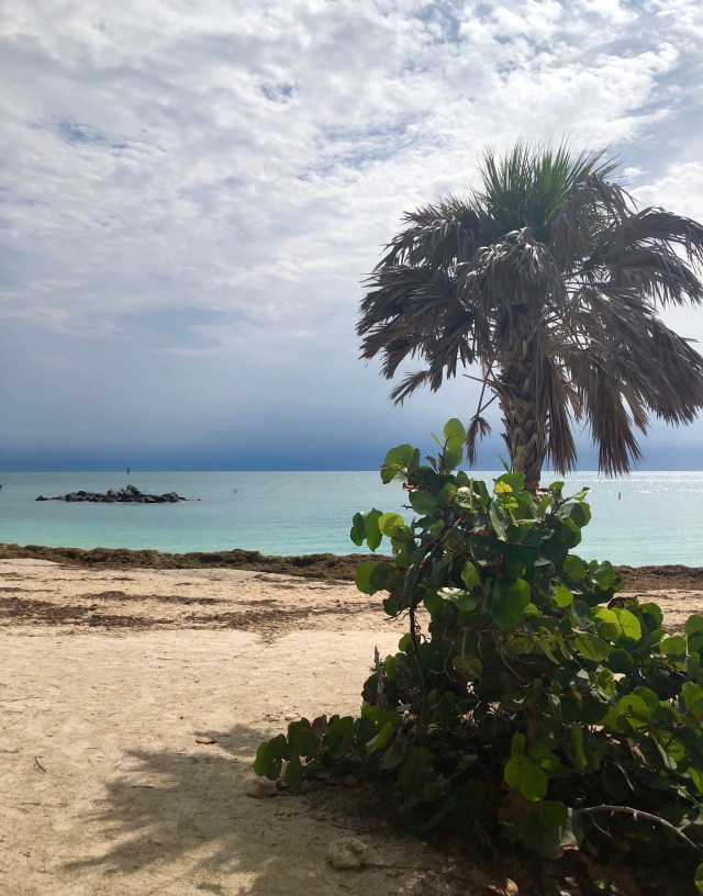
Along the route I was trying to sort out why it all seems so much more relaxed today. I was on a single, two lane road, with no options and a decent amount of traffic volume, but it was completely not stressful. I thought, well, stunning blue green water to each side of me that flashes bright white over the sand flats and spangles the southern sun in a thousand directions — maybe that’s it. But it clouded up later, and still no stress. Then I was thinking it was the lack of commercialization, but hey, even in the keys they need a dollar, and there is plenty of parasailing, glass boating and sandal shopping down here. But no stress. Most all of the bridges have a little side section for the fishermen, and they were out early, jigging and hauling. I never crossed a bridge with fishermen that at least one wasn’t landing a fish. Everything just seemed to be easy going.

Finally, I gave up wondering about it all and just let it be. Stopping wherever I saw an interesting view, or sandy lane. Never caring that most of them amounted to nothing any more special than what I’d been looking at for hours. On Big Pine Key I saw a few of the Key Deer. They are an endangered species of deer that are about the size of my dog Geraldine. Maybe a hair taller. Like a white tailed deer, only reduced in size down to something that can survive on an isolated island with a long dry season and not much to eat. They all seemed very easy going too. Not in a hurry to cross the street, or worried about you or the car. The place has this effect on everything.

A Key deer

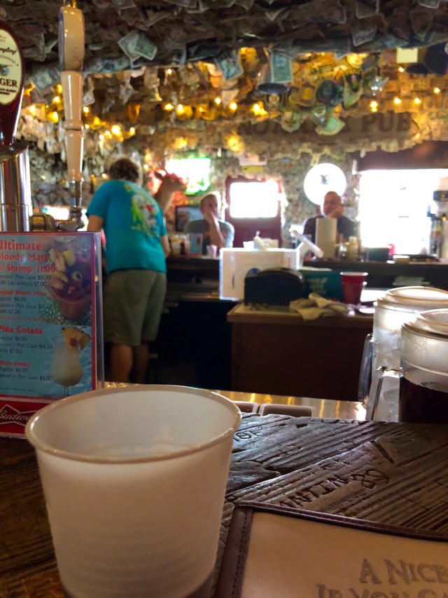
I turned off one time at a sign because I thought it was funny — “No name key.” You have to be seriously relaxed to say, when you get asked to name an island, “it’s called no name.” Turns out there is a little hole in the wall bar at the edge of no name key, called no name pub. And that place is where I learned a lot about living stress free. And about meeting people where they stand.

The bartender was a young guy, maybe early 20s. Happy, welcoming, attentive. I ordered a draft of no name amber (these folks no a good angle when they see it) and settled in to figure out this perpetual bliss.

“You from here specifically?”

“Yep. Lived here all my life.”

“Obviously you like it.”

“Can’t imagine anywhere else.”

“You stay here for Irma?

“No. Man, I had my sister and her boyfriend down here and they kind of freaked out the night before, so I took them to Miami.”

“You seem disappointed.

“Oh man, my friends all stayed and one of them has a video of waves 6 feet high breaking under the stoplights on the highway. Seriously.”

“Was there water in here?”

“Yeah. Six feet deep where you are sitting.”

“This was all in September, 2017, that’s barely a year ago.”

“Uh huh.”

“I saw how all the trees are dead, from Irma, right?”

“Well it used to be a lot worse. A lot of them are turning green again.”

“I guess hurricanes are gonna come and go, but one thing that sounds worse is having the sea levels rise from warming. Y’all worried about that?”

“I don’t know. I mean some people are saying like in 10 years the water is going to come up like 8-10 inches. So, I don’t know.”

“You are three feet above sea level, 10 inches would change a lot of stuff.”

“Yeah. Probably.”

I should point out that at no point (other than his apparent shame at having run from the hurricane) did his pulse quicken or his demeanor change at all. Catastrophic weather, the potential for dramatic geographic change from sea level rise, nothing. This-is-today-I-am-here-in-the-bar-with-great-people-on-a-lovely-day-in-one-of-the most-beautiful-places-on-earth-and-that’s-awesome. More than anything, that sums up the ethos down here, and it is contagious.

The guy in the seat next to me at the bar came back from wherever he’d been and tucked into a basket of wings. I scooted sideways a little and said, “let me give you a little elbow room, you got some serious work to do there.” He said, “I appreciate that, you know that. I really do.” And that started a conversation wherein we discovered many things about each other and shared many laughs. Big Tony, and his son Little Tony are delightful people and as good a bar partners as you could hope for. We come from different places, but we share a common recognition (mine at least more recently acquired) that meeting someone where they are is more important than finding out if they stand with you.

Oh, and if you get tot he No Name Pub, I can recommend the grouper sandwich.

No Name Pub

Key West is cool. It holds a little over a third of all the residents of the keys, so it’s dense, but it’s cool. As the destination, it’s crowded with tourists too, but by the time they get there, they’ve all been infected with the same “Keys ethos,” so its cool. At the far southern end of Key West, at the Fort Zachary Taylor State Park they were setting up a wedding — white columns, filmy backdrop, silver chairs, the works. Pretty cool to get married with that backdrop. A group of six fairly rowdy tourist showed up on their rental bicycles and began exclaiming “there’s going to be a wedding.” They rambled over to a picnic table and several folding tables with a couple of dozen folks sitting around them and said “hey, there’s going to be a wedding did you see?” The folks at the tables said they did and that in fact that’s what they were here for. Long story short, 30 minutes later the rowdy group had explained it was a 35th anniversary trip and the state park wedding party had invited them to the wedding. See? It’s cool.

I will say that I found the touristy shenanigans to be very manageable in Key West. It felt like New Orleans with a blue water view and only about a tenth of the French quarter. I’d like to come back, maybe rent a house for a month or so and see if I could get permanently infected with the vibe so I could take it anywhere.

As far south as I could go. Watching a storm roll in over the Florida Straits from Key West

Tonight, I’m back up mid-keys, just at the north end of 7 mile bridge in Marathon. I’m going to spend the evening at a bar recommended to me by the guy cleaning the pool at an apartment complex. I expect to learn more and will report the same. Tomorrow, I head back to the mainland and across the Tamiani Trail though the Everglades National Park and Big Cypress National Reserve. I’m going on an airboat trip into the Everglades. I will stay on the western corner of the Everglades before turning north up the coast to see what I can find there.

The edge of capacity

Sunset to the west of my campsite

Old Gamble didn’t disappoint. I had a marvelous night on the ocean and slept away all the craziness of the overdeveloped edge of northeast Florida. Good thing, too, because its a long way to Miami and there was lots more craziness, it turns out, to come.

Sunrise through the tent screen at Gamble Rogers State Recreation Area

Since I did make it to Miami, and beyond, it seems only right to spend a little time on the history of Florida — I’ve now traversed its entire eastern edge — sans the broken line of keys I will tackle tomorrow. The reality is, Florida deserves the most improved award in every sense.

A scant 650 million years ago, Florida was at the South Pole. 450 million years later, it was just north of the equator in the middle of the continent Pangea, surrounded by thousands of miles of desert. Pangea broke all to hell 115 million years ago and there was the familiar shape of Florida. It emerged as an island about 30 million years ago, give or take, and when it did, most everything else was frozen, so the sea level was about 330 feet lower than today. So Florida was a lot bigger — space which it could use today, but more on that later. The Paleo-Indians who first made homes in Florida did so 14,000 years ago. They hunkered around sinkholes with fresh water and generally took advantage of the climate and the land and did okay. Around 8000 B.C. things got hotter and the sea levels rose. Being reasonable people, the Paleo-Indians moved when the water came up. In fact, they spread out and started living on the coast and doing things they hadn’t done before. This is good for intellectuals, because now we can discuss how they either disappeared or evolved into a different culture. I think it makes rather more sense to think they said, hey, there’s a coastline! We didn’t know the world more than a several miles from our home before, so we didn’t know there was one. Let’s see what we can do now. And they did.

And, basically, ever since, people have been clamoring to the coast of Florida. Now, to be fair, in the early 16th century, the Spanish showed up and basically upset the apple cart. All that hanging out and doing good got corrected real fast when the right and proper Europeans showed up, and the native people got sick, and the ones that didn’t got converted in Catholic missions — and we all have a story or two about catholic school. It wasn’t smooth going for either group — the Spanish were frustrated that the native people didn’t just go along, and the native people were, well native people, so they were wondering what the hell the Spanish were here for anyway. Soon, the slaves and indentured servants from the British colonies from the north figured out they could escape to Florida (the first snow birds!) and chill out with the native people and upset the Europeans on both sides. Really the only thing that settled all this — to the extent it is settled — is commerce. Once everyone figured out how to make money by being Florida, everyone got on board. I’ve skipped a bunch of stuff that’s important, but people from the north still come to Florida to settle, and people in Florida — including the native people — figured out how to make money on that. Heck, even the great Seminole tribe, nearly rendered extinct by all the European bosses and cross-bred with slaves from the north, are now getting their retribution one chip at a time in the Seminole Hard Rock Casino. God bless them. More power to them. They got jobbed early on and now they’re the ones doing the jobbing. That is America.

And that is Florida from the northeast border to Miami. A place that figured out what a good thing it had and is by God exploiting it to the hilt. I don’t particularly like all the traffic, but I appreciate a good hustle when I see it. And I like seeing a place where the edge was sort of an accident to the culture and became the defining characteristic. Florida didn’t build itself from the edge, it built itself to the edge — at least that’s the case on the east coast. We shall see about the west.

I woke up rested to the glorious sunrise over the Atlantic and spent at least a good 30 minutes or so traveling a pure, delightful edge — rich with nature and sea breeze, nary a condo in sight. Then I got to Ormond Beach, not so bad, still possibly “quaint.” But oh, Daytona. The gloves came off and the towers came up and the commercial catastrophe began. Interrupted only by the Canaveral National Seashore, which is awesome even if it is only to protect the space program, the mayhem continued unabated for the rest of the coast. It changed tax brackets a few times, but the point was still the same. I found one place, only one, that felt calm and original and genuine. Hobe Sound. Now, it takes a dollar or two, but Hobe Sound is old school, not pretentious, and genuinely felt like it had been there for a while. For all I know it is new and pretentious as hell, but the folks I talked to and the scenery I saw eased my mind. I’m fairly sure I can’t afford that sort comfort, however.

Ficus trees over the road at Hobe Sound

At West Palm Beach I simply ran out of capacity to handle more success on the edge. I bailed out to the Florida turnpike and built up my reserves for Miami. Coming of age in the early 80s, I knew Miami. Don Johnson, Scarface, Miami. I think it’s mostly legal now, but it hasn’t veered far from the stereotype. I pried my way out to South Beach where appearance is very important and prices reflect the engineering required to jam that many people into that small a space. The thing is, you can stack people and even cars vertically with a slide rule, but you can’t move people and cars in a stack. You have to line them up.

Miami ranks 5th in one study for worst traffic, behind Los Angeles, New York, San Francisco and Atlanta. I’ve been to all those ahead of Miami — heck I live in one of them — and I’m telling you, Miami is worse. More interesting than my opinion, however, is the fact that all of the top 5 except one, are on the edge. People want to be on the edge and the edge defines the space left for the roads after the people cram in and up, and well, there you go. Success on the edge, either the west or east coast, comes with a price. The traffic. I see other countries building man-made islands to get more people on the edge than the edge has allotted for. That may be coming here, but for now we have cruise ships.

Happy to have a huge protected National Seashore to guard Kennedy Space Center

At Port Canaveral, fresh off the peaceful emptiness of the Canaveral National Seashore, the condo builders became shipwrights and now you can get beyond the edge with a few thousand of your closest friends. The boats are lined up and the traffic is brimming with enthusiasm to get to the dock.

This is all happening while the central part of the state is, save for Orlando, essentially empty. We can thank the geology for some of that — it’s wet and unstable — but at the rate we are drying it up, that too may change. I’m spending the night in Homestead, on the edge of the Everglades basically, and they have managed to create out of the sand and swamp a gagillion new homes down here.

Tomorrow I’m heading to the keys, where I think the pirates may still have a stronghold and therefore the edge may be a bit less stiff with steel. But who knows. After a couple of days down there, I intend to get right into the Everglades and learn whether Mother Nature can hold all this madness back, or whether someone is going to figure out how to build a mountain with “sea views” in the middle of the state.

I value all of my experiences on the edge. I appreciate the grit of everyone who hustles a way forward in this challenging environment. And regardless of the chaos, I still haven’t had a bad experience when I talk to folks. They are good people, even if they are building horrible buildings with no way to move the people in them around. But I’m hoping to find a different approach in the keys, or on the western edge of “the land of many flowers.” Or maybe a little warmer weather to raise the seas some more so we can start over.

The beginning of the end

My campsite for the night on Flagler Beach

Thank God for Gamble Rogers. Not only is he the orator of the finest song introduction ever made (see the movie “Heartworn Highways, for his performance of “The Black Label Blues”), a very fine guitar picker, and a decent singer; he had the good sense to die while trying to save a drowning man at this spot just next to Flagler Beach so the state could create a peaceful park and nature preserve with his name on it. Without it right now, I would be pulling my hair out. But I’m ahead of myself. Let’s start at the top.

I blinked the taillights out of the driveway this morning in the dark at around six a.m. and pointed the old grey Landcruiser south and east towards Savannah, which is where I last left the edge. After a predictably crazy escape through the traffic of Atlanta, the ride to the coast was uneventful. Not so the drive the south from Savannah to Kingsland, Georgia, which was very eventful — in a good way.

The collective ports of Georgia — Savannah and Brunswick — essentially bookend the east coast of the state, and they are powerful engines of the economy. They are responsible for 8 percent of the state’s GDP, 9 percent of its total employment and $106 billion of its sales (11 percent). Interstate 16, which I took to get to Savannah and Interstate 95 which connects not only Savannah and Brunswick, but also the entire east coast, are a big part of this — the stuff has to get to the boat and from the boat. It would be tempting, but ill-advised, to just ride 95 down the eastern edge. Doing so would rob you of the opportunity to use old US 17 from Savannah to the state line.

From Richmond Hill to Shellman Bluff, Harris Neck and Sapelo, from Eulonia to the Golden Isles, and on to Woodbine and Kingsland; US 17 paces you through the old South among the ancient live oaks and pine stands, in a way that no interstate can. Punctuated by markers noting this skirmish, or that Confederate Hospital, or some other Union encampment, there are notions here of what was. But rather than celebratory, they begin, after a few miles, to feel observant — of the terrible price we pay when we fail to get along. Of a victory by many over a few for the rights of all. Of a time that we have to remember in order to avoid it forevermore. And over it all spread the mighty live oaks, bearing the scars and the struggles, hung with moss and determined to be more than an alley to the plantation — to be instead, a living testament to survival even in the face of horror.

The people of this stretch mirror their herbaceous overlords. Determined to make a way when the big road left them behind. Determined to be a repentant culture, reminded every few miles of the need for kindness, they are doing well. From gas station to cafe, to roadside shrimp market, the people of southeastern Georgia are remarkable. A simple “good morning” gets you a warm response and a follow-up “how are you?” No transaction ends without a hope for you to “have blessed/great/fantastic day.” Plus, there is a great diner somewhere between Woodbine and Kingsland that’s been cooking honest food since 1948, remains packed with all sorts of folks at lunchtime, and has a waitress who referred to me exclusively as “Baby.” So there’s that. These are small things, but it is in these small things, repeated and absorbed and believed, that people heal. And in that healing, there is a peace and pace to this area that is enviable.

Also, there are cemeteries. What seems like a lot of cemeteries to me. All are named and well kept and, interestingly, denominational. As in not just a cemetery, a Baptist cemetery. Because, God forbid your mortal remains be subject to the same ground as some backsliding Methodist. I don’t have a real explanation for this, but it seems to me folks who take good care of their dead, even if they are segregated by method of baptism, are caring people.

Shortly after Kingsland, you cross an impossibly narrow bridge over the St. Mary’s River and into…well, Florida. It only takes about 10 miles for that whole peace and pace thing to go to Hell.

You can pick up the A1A at Yulee, FL, but despite the romance, it is not a nice drive. The hustle starts at Atlantic Beach and doesn’t stop until Flagler Beach, just south of St. Augustine. What once could have been described as “quaint beach towns” could now only be described, charitably, as “mixed up.” The shoulder is jammed with tradesmen parking every manner of cement mixer, gantry crane and work truck. The houses range from ground hugging bunker with peeling paint, to brand spanking new stucco tower with cobblestone drive — immediately next door. So precious is the space on the edge that no engineering feat is too difficult in order to get a view of the water we so joyfully got out of to start all of this experiment. Your only break comes in the few places along the way (Ponte Vedra) where zoning by mayhem is replaced by autocratic horticultural, gated perfection that only comes with seven figure entry fees. Otherwise you can get your nails done, check the latest lot prices and try the fried clams all within 10 feet of each other while enjoying a wonderful view of a construction site.

I really have neither positive nor negative feelings about this. It is the marketplace at work. Very little supply meets overwhelming demand. Ready, set, go! It is, however, not relaxing in the least. I do think it got away from them in a few places. Like St Augustine. There is no place in America that was established by Europeans and has enjoyed continuous habitation for longer than St. Augustine. Which basically means its the first place we kicked the locals out of and managed to never cede back. Its history is a mishmash of back and forth control by the Spanish and the British and eventually the Americans, but we or our progenitors have been there since 1565. This seems to me to be a place where the old world would be on stage. And it is, insofar as the Spanish fort remains in the “Old Town” center and the “Bridge of Lions” crosses a picturesque harbor. There’s just too much “Ye Olde Town Trolley Tour” and all you can eat shrimp mixed in to really get at it. The famous striped lighthouse is pretty and you can visit it if you can get to it behind the lot full of beautiful glazed pottery across the street from the Alligator Farm. Seriously.

Mercifully, if you keep at it, you will find Flagler Beach and the Gamble Rogers State Recreation Area. Flagler is old school. Surfer vibe. Where, as a community, no one seems to give a shit who has the biggest house. Or whether the house is painted. Or whether it’s too early for a cocktail. And while GRSRA is not the greatest state park ever, squeezing into a space right on the ocean between a teardrop camper and a pup tent feels like heaven after a day on the northern end of the A1A.

Proof that really is my campsite (above), and lots of, well…proof (below).

Here’s hoping Jimmy Buffett was right and, as my latitude continues to change, so too will my attitude.

Returning to Venice

In a couple of weeks, I will back the old gray Landcruiser out of the garage and return to Venice, LA. To get there, I will head to Savannah, GA where I last left the edge, and then just keep the water on my left until I get to Venice, LA where this entire journey on the edge began. I am about to complete a circumnavigation of the entire lower 48 states — punctuated by several transects of the same at the start and end of each leg — that I started in March of 2016. Since then, I’ve made two trips a year, always picking up where I left off and continuing around the country clockwise.

There is really no good explanation for all this. I outlined the thinking when it all started, and I still agree with it today. Hit the road, meet people where they are, see the country, bring no preconceptions, record what I see/experience. And now it will soon be over.

Before that, though, I will visit the edge that once was the first edge for many seeking the “New World,” and now may well be the last edge for many finishing their mortal journey on earth. Florida, for the most part. I will travel the east coast to the Keys, turn around and travel the gulf coast to Venice — with brief stops in the Everglades and, hopefully, a tour of the Tennsaw River Delta in the tail of Alabama. I will sleep in odd places, meet great people, see amazing things, learn interesting stuff. I may have things to say about all of it that are funny, compelling, boring, or, more likely, a little bit of all of that. All I can guarantee is that I will be different when I return that when I left, and that I will treasure every minute — good and bad.

As usual, I can’t wait to get started. Over the next weeks, I will check the truck and gear, and stare at routes without really planning one. Part of me doesn’t want to start because this will mark the end. Part of me can’t wait to start because this will mark completion of the goal. Part of me knows that Venice, while the end of the lap around the edge, will also be the beginning of another crazy idea to do something else, another adventure, another chance to rethink how I view people and the this glorious country in which everyone, everyone, starts a journey of their own, of some type, every day.

If you have been following along at http://www.ropeandchain.com, please look for the updates on daily posts. If you haven’t been, please join in — you can catch up by clicking “Edge Trek” where you can read the intro and then see every post from the beginning (just scroll to the bottom and read up). If you enter your email, you will get a heads up for each post (disclaimer — I have no idea what WordPress does with those emails). You can also follow mlewis1965 on Instagram and see daily pictures with a link to the blog.

Go out and find your edge.

4,017 miles

When I first started this exercise of traveling around the edge of the lower 48 states, I decided early on to go in order — that is, to pick up where I left off and continue around. I decided this after the first segment from Venice, LA to Big Bend National Park in Texas. The basis for the decision was that, 1) there some benefit in seeing how things change as the geography changes next to those things, and 2) it meant I couldn’t “plan” for what a particular area would be like weather-wise — I couldn’t say, pick warmer times to be up north, cooler times to be down south — I would just have to endure whatever the folks living there endured. I’m glad I am doing it this way. It somehow feels more correct to finish where I started. But it does mean I’ve caught some weather. This trip was no different. From Cleveland to Savannah, in April, I didn’t get out of a winter coat until Ocracoke, Island, NC. And I need two even there to make it through the night in the tent.

I’ve said before that I am really amazed at how I don’t seem to ever catch anyone having a bad day when I meet people out on the edge. That may be the one unifying thing I take away from all this — people are nice. This is the first segment where, while I didn’t run into any mean people, I definitely got a sense of the reserved nature of folks in the upper northeast. I felt like my interactions there started with a bit of distance. Like I was being sized up. My view was, and is, that when someone shows up and tells you he is taking a lap around the country on the ground, in order, from Venice, LA all the way around, he should be greeted with some reserve. He should be sized up a bit. So, I don’t mind. In fact, I usually say “I know this is odd, but…” when I describe my journey. In some parts of Maine — the northern interior before I got to the Acadians — I could almost see the gears turning in folks’ heads, coming up with all the things they would do if they had the time and ability to do what I was doing. And that list never included actually doing what I was doing, I could tell. And I recognized that when they said, in that distinct accent, “well, thanks for stoppin’ by” they really meant “boy will I be glad when this nut is gone.” But, again, they were perfectly nice about all of it and I didn’t have a single negative encounter, again, on this entire trip.

As for the edge itself, it’s hard to compare this to any section I’ve been on before. With the exception of a couple of spots on the West Coast, I’ve not been in areas of this much population before. And in particular, this much continuously populated area. Even on the West Coast, the density was heavy, but intermittent. For a large section of this trip it was non-stop. In that regard, Maine was a nice intermission for this segment. While I was in it, it was a little bewildering, but on reflection, I needed it. That period of being wholly alone for long periods built up a space that could accept being wholly surrounded in the sections that followed.

Being essentially that spot from which it all began, the East Coast from Boston to Washington, more clearly than any other, shows the edge as a starting point, rather than a boundary. I talked earlier about how hard folks up there have worked to find an escape on the edge. There isn’t much space left since folks started building right away when they landed, so it takes massive amounts of money in most parts, and in others, massive amounts of steel and concrete as the condos rise vertically, in order to look east instead of West. Other areas, people were going to, this one they are/were going from, as we built the nation. So the people that settled here piled up instead of out. Again, the parallel is on the West Coast, where the same thing happens, but only because they ran out of space to keep going. Culturally this is a big difference — the West Coast is newer, for sure, but it is also the product of folks who journeyed across the entire country to get there. SO, out west, when I told my story, I was more likely to get “wow, that is so cool” in response as opposed to “thanks for stoppin’ by.” On the East Coast it was a journey, to be sure, but across an empty ocean from a totally different approach to governance than the one we would build here. And it was a journey of necessity, to escape persecution in most cases, rather than a choice. But uniformly, east, west, north, south, middle, I am finding a diverse and approachable country. Some areas may emphasize some portions of our founding ideals more aggressively than others, but I have not felt a stranger — even as a child of the Deep South — in any part of the country so far. I think that’s a big deal. I have felt strange, but not a stranger.

Until this trip, I think I tended to greet people and situations with a set of ideals and expectations against which I judged and prepared for them. In other words, I brought myself to them. In that way, I strengthened my own worldview through experiences that validated it. Since this trip, I think I tend to meet people where they stand, to confront situations as they are, in the context of everything I have experienced to get to that person or that situation. And, importantly, I don’t get to choose people or situations — I have to take what I get as I motor around the edge. Meeting someone in rural Northern California after crossing the entire continent to get there is different than dropping in out of the sky and meeting them. This is not to say I have altered any of my core beliefs because of all this, merely that I have a gained a perspective on how and why others have theirs. And that perspective has certainly added depth and color and nuance. That’s a big deal, I think.

I still have one section left — basically all of the Florida Coast, with a smidgen of Georgia, Alabama and Mississippi thrown in, before I return to Venice, LA. At the outset, my son and I wondered if it would different out on the edge, where people were closer to everything else than they were to the heart of America. It is. But it is different, too, in the heart of America where people are further from the edge than to anything else. What is shatteringly the same is that, if you meet them where they stand, in the context of the history and struggle of the place in which they stand, you find America. It isn’t always pretty, and it isn’t always something you want to emulate or live in, but it is us, and the alternative(s) are so inferior that millions leave them to come here. Just as we did.

I said early on that the border, the edge, defines the limits geographically of what we call America and that everything inside those borders demonstrates America as an idea. It’s becoming ever clearer to me that this sentiment starts at the edge. And doesn’t stop until it, too, runs out of ground.

South from the Outer Edge

Sunrise at Ocracoke

(Note: I updated yesterday’s post with photos, if you want to go back and see those.)

I got up very early to do two things: 1) see the sunrise over Ocracoke, and 2) Leave no risk of missing the early ferry to Cedar Island. The ferry ride takes two hours and this time of year it only runs early in the morning and in the middle of the afternoon. It was a cold night, but not north Maine cold — maybe high 20s — and for once the wind stopped blowing about 9 o’clock. It was a pleasant, good sleep, that comes when it is cold and the sea is crashing away rhythmically and there is nothing else. Ocracoke is the gift that keeps giving.

An early morning ferry ride from Ocracoke Harbor

Once clear of the dock, it was power napping in the sun for the next two hours (there is nothing to see on the crossing except water). Among all the collective great things about the North Carolina Outer Banks, is that their ferries don’t hassle me over my gas tanks. It meant I could travel a long way south on the outer banks, and it meant I could come ashore at Cedar Island.

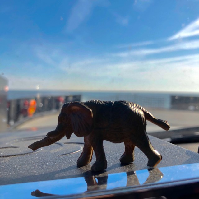
My talisman, Toomai, comes ashore at Cedar Island aboard the ferry

In addition to the beauty of the Cedar Island Wildlife Refuge — which is formidable — the island is a great introduction to the next section of the eastern edge. The edge here south of Ocracoke is what is known as the Core Sound, protected by the Core Banks. At Harker’s Island, the coast bends back west behind what is called the Back Sound, down to Beaufort. From there on the coastal islands are not so much barriers as playgrounds. Anyway, when you come ashore at Cedar Island, everything seems slower. There’s more room for the water to wander and more braided, twisting marsh creeks with squatting duck blinds in the bends and ramshackle docks here and there. As peaceful as Assateague and Ocracoke and the rest of the Outer Banks — from Currituck, Corolla, Duck, Nags Head, Kitty Hawk, etc., there is a tension there. And real power. The power is obvious — you are way out against the Atlantic. The first defense. The point man. The tension is realizing how little you have to work with. Once on the shore of the core sound, you are on the mainland and the core sound is closer to you. It’s calming. You can see it in the towns along the way. Folks sell crabs from the front porch. The mini-market at the crossroads seems to always be the place where things get done. Yards are clean, but not necessarily neat. These towns feel of the sea, and the pace feels of the tide — not the crashing waves and winds of the banks.

It may be they are just drawing their collective breaths, because the outer banks have earned the nickname “Graveyard of the Atlantic.” Depending on the source, you can find over 600 or over 1,000 ships lost in wrecks on the outer banks. Add in some Civil War battles (the Monitor lies on the bottom offshore here), frequent storms, the collision of two Atlantic currents — the Labrador and the Gulf Stream — and pirates, and you have the recipe for the Graveyard. Calico Jack, Anne Bonney, Mary Read and Edward Teach (Blackbeard) all called Ocracoke and the Outer Banks home for their piratic pillaging. And it was the calm shoreline behind the banks — like Cedar Island — with all its creeks and channels and hiding places that made raiding the big boats offloading at the Outer Banks easy prey. So, the edge inside the banks is quiet, even secretive, and it always has been.

From Cedar Island it is a winding, slow ride around to Morehead City, then out onto Atlantic Beach, Emerald Isle, North Topsail, and on and on to Wrightsville Beach. Then it’s a quick run inland to slip south of Wilmington and get across the Cape Fear River before continuing south to Oak Island and Ocean Isle. And then your in South Carolina. If you aren’t trying to ride right on the edge, most of this is repetitive. These are all vacation towns, unashamedly so, and they have increasingly begun to all look alike. Whenever possible, the old, hunkered down against the hurricane beach homes are being replaced with the vertical, multi-gabled, pottery barn homes that are easy to instagram and rent. They are attractive if unimaginative, and as far as I can see, they are well built. The next big storm up here will tell. But the net affect is to bore you if you see one after the other. By the time I get to the rent-me champion of Myrtle Beach, I can’t take anymore.

I bump one row inland on the roads and use SC 701 and 17 to ply the back bay areas and delve into the Francis Marion National Forest. It calms me. Interestingly, this area feels a lot like Cedar Island, even though it is back from the shoreline. I finally kick west of Charleston to avoid the traffic and settle in for the night.

Tomorrow I will finish this section of Edge Trek 2018 when I reach Savannah. It is the penultimate segment. In the Fall, I will finish my lap, going from Savannah down the Georgia and FLorida east coasts to Key West before turning north to follow the western coast of FLorida around to the panhandle, Alabama and MIssissippi coasts and, finally, to Louisiana, from whence all this foolishness came. As usual, I will have some cumulative thoughts about this run from Cleveland around to Savannah. And, as usual, I will spend most of the ride from Savannah to Atlanta piecing those together in my mind. Regardless, this segment was different from others as all others have been different. The edge changes as it surrounds and defines the limits of this American idea, and I have changed as I have explored it. I don’t know that I have found America, but I have found peace and understanding about America. And so, no matter the conclusions I draw, I will be forever grateful for these opportunities to back out of my driveway and take a drive on the edge.

The Outer Edge

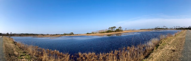
Assateague Pond and the work of the pine bark beetle

Assateague was just as good with the sun rising over it in my rear view mirror as it was the day before. But the edge continues south and so must I. Down the index finger to the Chesapeake Bay Bridge-Tunnel, over and through which you get to Norfolk. The bridge-tunnel is 23 miles long, and was opened in 1964 — the year before I was born. I know how I feel in the morning, and I don’t have hundreds of thousands of people riding on my back every day. I felt for the old boy. For $13 you get to save a bunch of time and get a spectacular view of the bay. I videoed the trip over and under, but it’s waaaay too long to post with this. So far, since opening, more than 100 million vehicles have passed over and under. Today, I added one more.

Somehow, once on the other side, I felt like I was legitimately inVirginia. I have no claims on the state one way or the other — though I did spend four of the best years of my life in it — but the DelMarVa kind of felt like its name, a little bit of a lot of things and not really any of any of them. It took getting off it, to the barrier island of Assateague, to get much of a sense of place. Some of this is because the peninsula is in a bad way. The two Virginia counties on it are the poorest (or nearly) in the state. The idea of being a waterman or a crab fisher or an oysterman on the bay, and having a home and raising a family are gone. It’s an interesting process, and one that seems to happen a lot on the edge. The foundation of a place is built by people around a set of skills. Those skills become either obsolete, illegal, or so regulated that the cost isn’t up to the price. The people who built it (and those like them) leave, the folks left don’t have any skills or resources, and the place, and all its rich culture falls to ruin. One of the folks I talked to was asking if I’d been to Tangier Island, which is in the middle of the bay. I said I had not and asked if that was something I should do. He said, well, once, you should go once.

Tangier used to be a relatively thriving community of watermen and crab fishers and oyster men. Maybe 800 or so on the island with no connection to the mainland except boat and air. They didn’t care, they could catch crabs and fish and oysters, and take them to the mainland and make money. Money they needed very little of to live and thrive on Tangier. They knew how many traps they needed to catch enough crabs to make enough money to set enough traps the next season. They knew. They knew when to keep crabs and when to throw them back so they would make more crabs for the traps they would set next season. They knew. Then someone, somewhere, with power lines and roads and water and no salt on the windowpanes read a study and said this is the number of traps you can set. No more than this. And it wasn’t enough. The population on Tangier is dwindling now and the residents are working on rigs or just moving ashore. The thing is, too often, in my opinion, the folks who make a living off natural resources are not considered the experts on the natural resources. We assume that the greed of the corridor I just came through applies to everyone — but it doesn’t. The guy who will starve next year if there aren’t enough crabs is not going to exploit the crabs. He doesn’t need a bunch of studies to tell him when the stocks are low, he just takes less and charges more. He needs the resource.

I thought about those folks on Tangier when I was crossing the bay. I hoped somehow there was someone out there figuring out how to hang on. To keep the possibility of a life away from all the corridor possible. To keep the noise of everything except the wind and the water somewhere else.

I think the peninsula will be okay. But it will be chicken that saves it. I can’t say if that is better or worse, but Perdue and Tyson have big processing plants, and immigrant populations are becoming citizens and building their own success stories with big chicken houses and that’s not a bad thing. The processing plants are a bit piquant, and I’ve seen much better architecture than the huge chicken houses, but the market is working and poverty is being fought tooth and beak with a new weapon. Maybe in a hundred years when the place is thriving again, they too will get told how to manage birds and they too will have to seek their fortunes elsewhere. Maybe it’s all a cycle, no matter the romance of the beset.

The old gray Hundy finally gets her feet on the edge north of Corolla on the The Outer Banks

Once on Virginia proper, it was barely a cup of coffee before I was crossing over to the Outer Banks of North Carolina. This is the edge of the edge of the edge. The graveyard of the Atlantic is a series of barrier islands and shoals that basically encircle the coast of North Carolina. It’s a daily battle out here of wind and sea and sandy land. The shoals move a lot, but the wind is good next to the shore and that, over time, has lured sailors too close. Over 600 ships are on the floor of the sea off this coast. Out here we’ve lost boats to the Germans, lost horses that swam ashore, learned to fly and found a place to hide. I drove the entire Outer Banks, basically from the Virginia line, on the actual beach, through Currituck where I got on pavement, Corolla, Duck and Kitty Hawk. From Kitty Hawk to Hatteras, where I ran out of road and ferried to Ocracoke. The southern section, from Kitty Hawk to Hatteras, is National Seashore and that continues onto Ocracoke. This makes a big difference. Most of the section north of Kitty Hawk is pretty much a vacation land. There’s a good deal of that south until you get clear of Nags Head. Then it is almost as it was. Empty beaches and dunes on one side and wide marshlands dotted with wooded hummocks on the sound side.

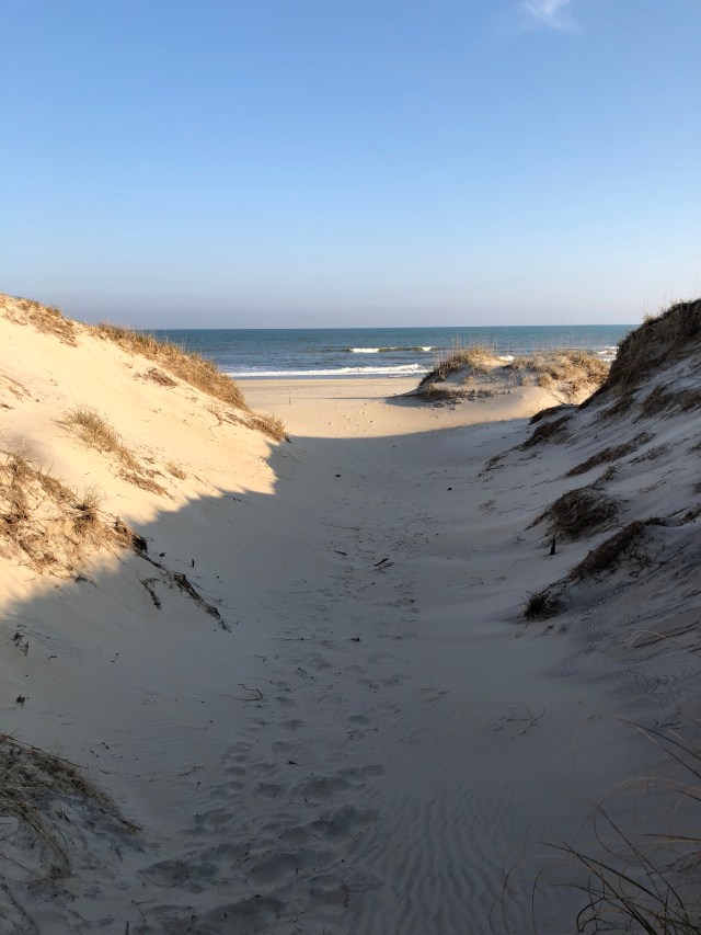
The beach at Ocracoke Island, Outer Banks

This is doubly true on Ocracoke. I would like to stay here. There isn’t anything, save a small collection of houses and businesses at the south end. It’s all National Seashore. It is sublime. It’s kind of how I want the edge to be everywhere — a big empty, perfect, unmolested space that guards all our foolishness, like a buffer zone, from the outside. A place where, if you sit long enough, you can remember what we are supposed to be — not what we hear and struggle with everyday. But the edge is an edge of a country. A country we built and fought for and fought over. A country that values our individual liberty over everything. And sometimes people, individuals, get away with stuff. That’s how it is. Someone somewhere makes a decision that changes everything on an island in the middle of nowhere. A group of people figure out how to make a ton of money doing something no one ever imagined, and we all go along because we like what they figure out. And the edge gets crowded in some places, and in some places that where crowded it gets empty again. It can’t be different, because if it were different it wouldn’t be here.

The quiet emptiness of this outer edge. Ocracoke Island.

A Changing Edge

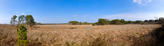
The salt marshes of Assateague Island

I woke up in the middle of the night remembering a ferry ride somewhere early on in the edge trek — must have been the Texas coast somewhere — when I was called back from boarding because I had gas cans on the bumper. My plan today was the Cape May-Lewes Ferry and I have two 5 gallon Jerry cans on the bumper. So, I started checking on the Ferry rules and discovered I had been foiled by The Man. Each car on the Cape May Ferry can have one gas can, empty or full, totaling no more than something like 6 gallons. Unless that car is pulling a boat. The boat can have two gas cans, empty or full, with the same amount of gas. So if you are pulling a boat you can have three gas cans. But if you aren’t pulling a boat you can only have one gas can. There’s a 50/50 chance I could have just slipped on, but basically to be safe, I could buy a boat, give up one gas can (I love my metal Jerry can), or find another route. I chose the latter. In the end it was shorter time-wise, but I was looking forward to the boat ride. I did it once before with my son and it’s a nice ride.

Instead, I plotted another route down through New Jersey, across the Delaware River, along the Delaware coastline to Maryland and over into Virginia just south of Pocomoke City. I traversed the eastern side of the DelMarVa peninsula. If you look at the map, from Philadelphia south, there is what looks like a hand hanging down — its wrist is at Wilmington, DE, its closed fist is due east of Washington, DC, and its long index finger is pointing at, or trying to touch Norfolk. This is the DelMarVA peninsula. It also happens to be the entire state of Delaware essentially, but they long ago figured out how to stay quiet and make all the money. They are probably satisfied that it isn’t the MarDelVa or the VaDelMar peninsula.

I said it yesterday, I think, but New Jersey is a very nice state. Once south of about Elizabeth, I found the entire central part of the state and southern part of the state to be delightful. Beautiful mixed hardwood forests, clean agricultural communities, Christmas Tree farms. Certainly there were areas of transportation warehouses and other industry clustered near strategic points, but the state is nice. Same with Delaware. Once out of the neck at the Delaware River, the state is lovely, with good — if expensive — roads and nice communities. The folks in the gas stops and cafes are uniformly nice and respond when you “hello” them.

I have a list of things to do after each of these trips and one of the things on this trip’s list is to figure out how and why Virginia ended up with the index finger. Looking at the map, it makes no sense, but own it they do and that’s where I ended up. I wanted to visit a relative — she is the daughter of my maternal grandmother’s cousin, so I don’t know what that makes her to me, but we share a lineal blood line of the same family from northern Arkansas/southern Oklahoma and there aren’t many of us left, so it is important. To me. She lives around the Onancock area and I was thrilled to meet her and have a nice visit. After our chat, I backtracked up to Chincoteague/Assateague to visit the National Seashore there. Assateague is a barrier island that is basically the first knuckle of the index finger — Maryland owns the north part, Virginia the south part. I was on the VIrginia part.

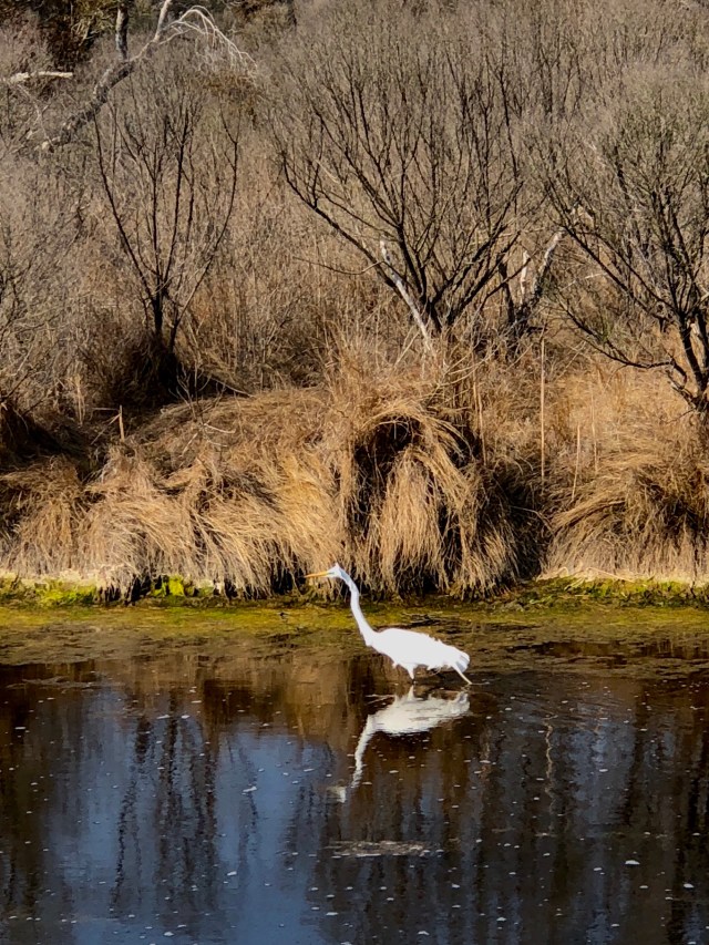
An Egret so wet from fishing he’s having a bad feather day and a squirrel so old he’s gone white on Assateague Island

There is no permanent population of people on Assateague. It is all preserved for wildlife and the coastal forest habitat. It’s moving north a little bit each year because of a set of jetties that were built to maintain navigation for Ocean City Maryland. At its current rate of movement I’m not sure anyone is going to notice for a few million years, but still, we messed with Mother Nature, so I’m worried about the results. For now, it is a sublime place. You have probably heard about it because of the ponies. Either a group of Spanish horses swam ashore after their ship wrecked nearby (they have found a wreck, so this is plausible), or they are descended from colonial horses that were roaming free and got away from their owners. Either way, they are a unique genetic line. At less than 14-point-something hands high at the shoulder, they are by stature, ponies. But they have the genetic markings of horses, so some believe their small size is an adaptation to the environment. Regardless, they are the charming ambassadors for this windswept paradise on the eastern edge of the eastern edge. The herd is divided between the Maryland end and the Virginia end. A fence prevents cross-breeding. The Virginia ponies are owned by the Chincoteague Volunteer Fire Department. How this happened is a mystery, but it is one of the better pieces of data I’ve come across on the edge. The Maryland herd is owned by the state. Once a year, the firemen round up the Virginia ponies and swim them across the channel to Chincoteague where some are auctioned off. This benefits the fire department and provides the necessary control of the wild herd so they don’t overrun the resources of the island. The Maryland side just sterilizes a few of the mares each year to accomplish the same thing. You can decide which method you think is better.

The fat, wild Chincoteague Ponies of Assateague Island

While the Virginia ponies can go pretty much where they want on their end of the island, they generally stay on the western side in a salt marsh where they have their preferred feed of salt marsh grass. Because of the salt content, they drink about twice as much as a normal pony their size would. So they are fat. Bloated belly fat. And adorable. I hiked a trail around the salt marsh for a couple of miles and finally found a few of them. Enjoying a hike on this beautiful island, finding these iconic ponies, and spotting deer, more birds than I could count, and squirrels so old they look like Santa Claus, was an example of why I love this whole exercise so much. If you get a chance to visit Assateague, please do. It’s accessible and remarkable.

Easternmost Virginia gives way to the Atlantic Ocean at the edge of Assateague Island

Tomorrow I will poke south over and under the Chesapeake Bay, and follow the coastline of Virginia down and out onto the Outer Banks of North Carolina. I’ve been there before with my son, and I hope to camp in the same spot. It’s been a long ride already from Cleveland around the top of Maine, and I think a night under the stars by the sea will do me good.

The Corridor

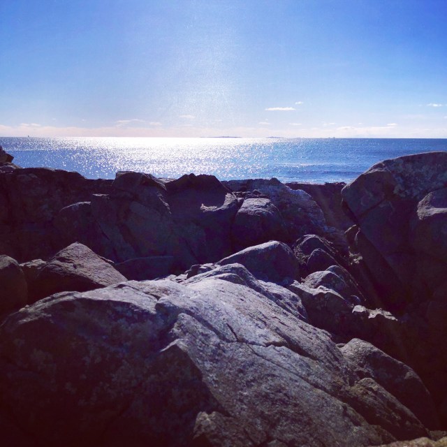
The morning sun lights up Star Island off the coast of Rye Beach, New Hampshire

The most densely packed region of the Western Hemisphere is the I-95 corridor between Boston and Washington, DC. With over 50 million residents, it accounts for 17% of US population within only 2% of US landmass. It averages 1,000 people per square mile while the US average is 80.5 people per square mile. It holds 20% of US Gross Domestic Product. Today, I skirted it and drove through it on the Edge Trek. After spending the first part of this trip in the least densely populated portion of the US east of the Mississippi with fewer than 1 person per square mile in Northern/Western Maine. It was a culture shock to say the least.

My plan was to stick to the coast on US 1 and US 1A as much as possible in the hopes I could skirt the madness of the Megalopolis. This works until cities like Portsmouth, Boston, Providence, Bridgeport and New York — all of which are hanging over the edge — come into play. In those cases, the hope was that I could time things so that my drive south was against traffic flow, or happened in an off-peak time period. To put it bluntly and immodestly, I ruled.

The early morning was glorious — down the rest of the Maine coast and through New Hampshire, enjoying surprising places like Rye Beach, New Hampshire which managed to be a beautiful vacation spot on the coast without being too touristy. Then came Massachusetts. Geographically, Boston is like a pac-man mouth, with the big city as the throat and it’s reach out to the edge like the teeth and lips. From Newburyport south to the Cape, everything is within it’s bite. And it even dribbles out down the chin to Providence, RI. You can get there from the city with relative ease, and this means that the edge — for the entire length of the corridor really — becomes a very different place.

This is not to say it is unpleasant, or lacking in beauty in spots. But it has become a place of escape. It is where the madding crowds run away to escape the madding crowds — which of course isn’t happening because the madding crowds are all at the edge trying to escape. It is an edge with its back specifically turned to the west. Specifically aimed at the great empty sea. Specifically altered to be not what is behind it. Elsewhere on the edge sea towns, even vacation towns, seem to have a sense of that which they are hanging off. Here they almost defiantly turn away, anchoring themselves firmly in the face of the rising sun, though occasionally forgetting to leave behind all they hoped.

No where is that more evident than Newport, RI. Originally rising to fame on the backs of the whaling and slave trade business, the city of Newport is now, perhaps, best known for the “summer cottages” along Bellevue Avenue and Ocean Drive. Pound for pound, I’d put Newport against any city in the world for magnificence of residential architecture. And I don’t mean that in a design sense, though the design of many of the “cottages” is sublime. I mean in the sense of utter impracticality, yet inspiring and exhilarating presence. These houses are ridiculously large and lavish and they still manage to occupy their ground in a piece. Scaled to their setting they got their start when rich Southern plantation owners began building places to escape the summer heat. Not to by outdone, the gilded age barons of industry from the big cities like New York and Boston, from Vanderbilts, and Astors, all the way to descendants of the American Royalty like Kennedys (John and Jackie were married there) plopped their “mine is bigger/better/more unique than your’s” homes on lots the size of stadiums so they could escape the din of the city. What they ended up with, was a society as busy and complicated and gossipy as they left behind. Edith Wharton wrote a book about it. What they left us with, thanks to an active preservation group, is a remarkable way to spend a day letting your imagination run wild. To be sure, there are still families leaving behind the melee of the corridor to join the melee of the summer season in Newport, but for the most part, the real gems are preserved and open to the public so that we can pretend. From Greco-Roman marble manners, to towering Victorians, to gleaming white veranda-clad plantation homes, Newport is worth the time to visit and wander.

Newport is also the place where, in 1965 amidst national turmoil, a poor black man from Texas showed up at the Newport Folk Festival with a guitar and, instead of protest folk songs for the largely white audience, sang of real pain, and real love, and real vengeance, and real redemption. Lightnin’ Hopkins stole the show. The irony of that in a place like Newport is nothing compared to actually watching the performance, which you can still do online, and which I strongly encourage.

Having successfully slipped through and under Boston with relative ease, and enjoyed a wonderful few hours touring around Newport, it was time to blast down the Connecticut coastline in such a way as to hit New York City with the best chance of avoiding disaster. That meant a hop-scotch of I-95 and US 1 with the hopes of making it to the Garden State Parkway and across to New Jersey with my sanity in tact. With the help of Wayz and my impeccable timing, I can say the trip was stress-free. I’m crediting the zen rock from yesterday.

New Jersey, in general, gets a bad rap. The bulk of the state — the coastline and the central pine barrens, and the southern farmland are actually very nice. I’ve been through and around in the state many times in the past. I’m looking forward to tomorrow’s trip south as well. Avoiding the vomit-inducing places like Atlantic City is easy, and the whole trip doesn’t take long anyway. I’m trying to get to the eastern shore area of Virginia — specifically the Onancock area — to see a relative who has lived and thrived on the edge there for years. I’m hoping to learn some things. I’m hoping to share those with you when I do. From the most powerful escape artists of the corridor to the happy Acadians of northern Maine sawing trees and dispensing hospitality, the edge continues to intrigue me. As I continue to ply my way southward, I don’t expect that to change at all.

The Turn South

Cadillac Mountain in the distance

Once out to the mouth of the St. Croix river I turned south down the Atlantic coast of the United States. That starts with the rocky, uneven, dramatic coastline of Maine. All of this started more than 600 million years ago. After numerous shiftings, meltings, upheaving, burying, eroding and other stuff over a period of 200 million years through geologic periods with funnier names than they deserve, came the Acadian Orogeny of the Early Devonian period about 400 million years ago. But you already knew that. What you might not know is that event — the Acadian Orogeny — was a mountains building event. It created the Boundary Mountains of Maine and the Appalachian Mountain Range. We clambered through the last of the Appalachians in order to get to Calais yesterday, today we headed out to one of the more notable Boundary Mountains that remain poking up as islands off the coast — Cadillac Mountain, which rises from Mount Desert Island as part of Acadia National Park. Cadillac is one of a handful of mountains that are in the park, the highest, and is said to be the first place in the United States to see the sunrise.

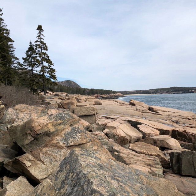
Schooner Head at Acadia National Park

Acadia National Park is the oldest park east of the Mississippi, which admittedly isn’t saying that much, and includes a history as a French missionary colony, and the active participation of one of the country’s greatest philanthropists in its restoration. Like much of the area up here it was caught up in the conflict between the French and British during the Seven Years War when it was ceded from French control to the British and the then governor and legislature granted land grants to the two children of the French explorer Cadillac who discovered it. Around the turn of the 20th century, the state of Maine began acquiring land and the largest portion was granted to the state by a woman in Boston who, I presume, was an heir to the Cadillac family. Having established the land for the public interest a fire burned nearly all of it in 1947. Led by John D. Rockefeller, Jr who personally laid out new carriage trails and oversaw design, the park was restored to its current state.

The Cranberry Islands from Mt. Desert Island

The park is remarkable, chiefly for those carriage trails, in my opinion. They are wide and maintain less than 10 percent grade, and are winding throughout the park. They make for marvelous walking. There is, of course, also the coastline. With the surf crashing at the base of the Boundary Mountains and great granite blocks breaking like tables along the shoreline, it is a dramatic site. The majority of the place was still closed for the season, but I was able to explore, and hike, and get a real sense of what this piece of land, 400 million years in the making has grown to be.

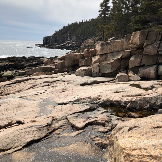
Maine’s iconic coastline

Carrying on south down the coast was as the postcards capture in terms of beauty. What they don’t capture is the rhythm of the place. Punctuating the rocky shoreline are estuaries and basins drawn nearly dry on the outgoing tide, their colorful boats laid over awaiting a fresh batch of nutrient-rich seawater on the ongoing one. Periodic deep harbors tuck in behind granite guardians and are surrounded by iconic villages with histories as rich as the waters themselves. All of it combined repeats and repeats and repeats in a rhythm that is hypnotic. From whaling to codding to scalloping and lobstering, these are all places of the sea as much as places of the land.

A bite of lunch overlooking the harbor at Camden

Just south of Camden comes Bath, and a hint of what is to come. It is a beautiful town, evenly divided, with churches and quaint village shops to the north of the bridge and a great sprawling ship works to the south bedecked in cranes and girders and dry docks. There is industry to be plied here on the edge. And it will continue to thicken, as will the population. By the time I get to Portland where I stop for the say, the corridor of development is in full swing. From here on, Portsmouth, Boston, New York, Philadelphia and Washington will pack the edge with people and power. The scenery won’t be bad, but it won’t be what it has been. Replacing it will be the history of first a foothold, and then a stranglehold on everything else that happens inside the edge. One relatively small stretch along the chain that defines our boundaries will contain more of how what happens within those boundaries than any other place on the edge.

It will be different for the next few days. No more wandering and imagining and relaxing. I will have to be hard on the wheel, fighting traffic and dealing with a landscape more man made and vertical than natural and sprawling. I’m not going to lie, I’m going to get through it as efficiently as I can — my target is Cape May, New Jersey, where, with a ferry ride to Lewes, Maryland, I will be back in the natural setting of the eastern shore with the outer banks to come. I’ll sleep tonight with horns honking in my head and do my best to hold onto the images of Maine as the roads thicken.

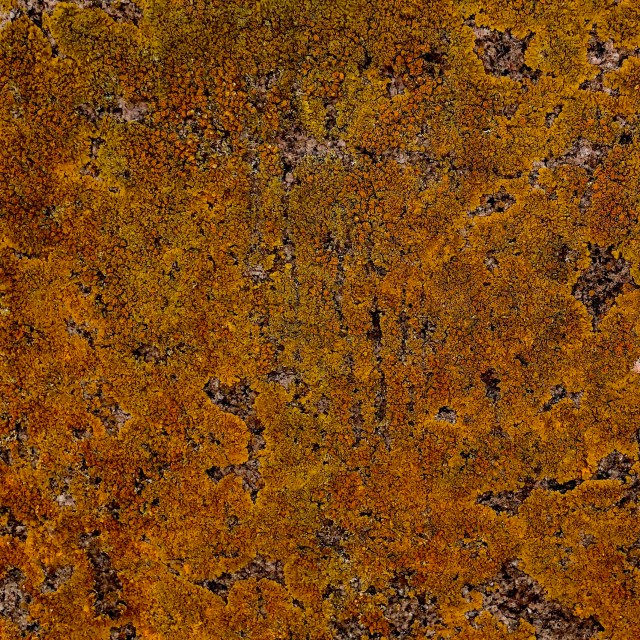
Stare at a rock and find your zen. Going to need this image over the next day or so