Another Corner on the Edge

A pause on the Arastook Wilderness Road in April. This was the drive all the way up.

What a day. Every time I’ve been out on one of the segments of this Edge Trek, whenever I have a frustrating day, it’s almost always followed by a very fulfilling one. Such was the case today. After a wander about yesterday, my mission today was to get to the northern edge, turn the corner and begin the long southern trip down the Atlantic Coast. Before I get to that, a confession: I grossly misread the weather for this part of the trip. Which is to say, I studied the forecast during planning, checked them again before leaving, and believed them. I am comforted somewhat but the fact that everyone up here seems completely surprised by it as well. I had visions of catching smallmouth and brook trout in the waters of northern Maine — waters that are frozen. I was planning for cool nights, maybe around Mt. Katahdin and somewhere in the Green Mountains of New Hampshire — nights that turned from 30s to single digits coupled with an historic windstorm including gusts of 65mph where I was and over 100mph in Central Maine. What I’m getting at is I woke up with 3 inches of new snow and more falling, and I drove right into the teeth of it. It didn’t matter one bit.

Maine has 17.5 million acres of forest land. That is almost 90% of the surface area of the state, and includes almost 25 billion live trees. Certainly there are states with more trees, but I don’t know of any that are more completely forested. This is relevant because that completeness, the sheer un-ending nature of this biomass, has a real effect on you. No individual tree is interesting — they are various spruce and birch and maple mostly — but the whole of them, dense and together for every inch of the ground is almost overwhelming. I left this morning and basically followed the eastern edge of the Allagash Wilderness/North Maine Woods all the way to the top of the state. There is only one road, so nothing to do but get on the Arastook Wilderness Scenic Highway and head north.

The snow kept things quiet, and the deep green Spruce provided a nice canvas for the white accents. The road was fine, if a little vague beneath the covering. It got progressively heavier as I got further north, and by the time I got to the top there was about 6 inches of new snow. On top of the two and half feet already on the ground. So with two hours of zen-inducing straight line between the constant forest I had a very relaxing first couple of hours. Everything to my left (west) all the way to the New Hampshire line represented the least densely populated area east of the Mississippi, and everything to my right (east) was completely hidden (and not very populated either). So it was hard to be tense about anything.

Fort Kent has a fort because of some tension back in 1838-39. There are three Maritime provinces of Canada — New Brunswick, Prince Edward Island, and Nova Scotia. They considered themselves largely independent and were settled by Acadians — Frenchmen, Basque, Native American mixes who were tough, proud settlers. They refused to fight for the British or the French in the French and Indian War (Seven Years War). Somewhere in the St. John’s River valley a British officer captured some French soldiers and believed an Acadian with them was fighting for the French. And thus began a period of attempted eradication of the Acadians from the territory at which most progress was made after the Revolutionary War when loyalist British moved north and wanted land. Acadians were pushed into servitude in several places across the globe. Including Spain, with which they returned to America and helped settle Louisiana. Many also ended up on the western banks of the St. John in what was then Massachusetts. In 1820, when Maine became a state, the governor was very keen to have a good census and clear borders as he and his pals went to work making money. The British were keen to sneak back some of the land they ceded in the Treaty of Ghent, which re-instated the 1773 borders between Canada and Maine (Massachusetts). If you look at a map and go east from Montreal to New Brunswick you will see why they wanted it back. Anyway, lumberjacks were cutting timber where they pleased, politicians were squabbling, Maine called a special census of its own and authorized money for surveying and — for raising the state’s defenses. And the Acadians wanted nothing to do with the British. Things were getting pretty sticky with state militia massing at the border and by 1839, the parents got involved and settled it all with another treaty — signed in 1842. The result is that the St. John’s river is the border until the valley plays out at Hamlin, Maine, and then on a straight line south to the Monument River and through the middle of various lakes until the St. Croix River and from there to the sea. And the Arastook War fort at Fort Kent. And the fabulous Acadian culture of most of northeastern Maine.

Mid-way between Fort Kent and Calais, I visited Al’s Diner in Mars Hill. It is everything that is great about diners. Solid food, a friendly, talkative proprietress, and a great crowd of patrons. The accents were very different but the spirit was familiar if you’ve ever been to a crawfish boil in Louisiana, or a bar in New Orleans. One table as a guy with his 97 year old mother on her day out from the home. He had his wife and sister with him and they all doted on “Mom.” Another table was in deep discussion about a particular Catholic priests view of the transfiguration. Another was a steady weather report back and forth with the kitchen. (Mars Hill had 16 inches of snow this week.). It was delightful. On the way out I talked to the owner about the town and her business. She said all winter the place is packed every weekend with snow mobile riders who come from all over, and snow sledders who come from as far as Pennsylvania. She said 85% of her business comes from visitors. We love our regulars she said, but we don’t count on them to make money. She had the natural hospitality, visiting each table, that I haven’t seen since, well, New Orleans.

I started this whole trek with the great Acadian culture of southern Louisiana and never in my wildest dreams did I expect to find it’s bookend in the northeast corner of Maine. This is why it continues to be such a joy to be on this journey. I’m in Calais tonight, where the St. Croix finds the sea and the Atlantic coast of America starts. I’m on essentially the same road I will be on all the way to Key West, Florida — US 1. I will peel off for the outer banks and one or two other places, but the “1” it is for a long while. Tomorrow I go to Acadia National Park and see what is available this time of year. I’m looking forward to the scenic coastline and a different set of images, but I will not soon forget the dark, dense woods of western and central Maine.

The Deep Woods

Morning sun on a frozen Vermont Lake

Cold and clear with very little wind was a great way to start the day on the edge in northern Vermont. Through Derby Line and Morgan Center, over to Wallace Pond, and finally to Canaan on the New Hampshire border. Technically I think I was east of the Green Mountain range, but there are several 3,000+ foot peaks in the northeast corner of the little club-shaped state of Vermont. It is a beautiful part of the edge with nothing more than some Canadian Flags on the storefronts and a few French language signs to give you any indication that you are anywhere other than America. The little towns are nice little towns, and the in between is a series of well framed vistas with lakes (all frozen), streams, and mountains joining the maple and birch forests in the composition.

At the New Hampshire border, I had a choice to make. The very northern edge of the state juts up above the 49th parallel in a little bubble of three lakes — Francis, and First and Second Connecticut lakes. But there is no road around the edge, just one that splits the middle and goes into Canada. So, I could drive up, see the lakes and drive back, or I could cut the tip of the state off and cross the White Mountains through Dixville Notch and then climb back north in Maine. I chose the latter; down to Colebrook, across to Dixville Notch and Errol, and then up on HWY 16 into Maine. Dixville Notch is famous for being the first votes cast in the first in the nation presidential primary every four years. The town is not a big deal, but I did love recognizing the source of the name. Just west of the town, you arrive at what looks like a wall of mountain, with Dixville and Kelsey peaks over 3,500 feet. Then you see the notch — a broken granite gap that can’t be anything other than a “notch” and the corresponding slot through the mountains. Out west they call these “passes” but when they look like this, they have be “notches.” I liked the little bit of New Hampshire I was in. The scenery is postcard perfect with mountains and forest complementing each other. Also, the gas station chat when I stopped for coffee was pleasant and the old guy was interesting. He asked what I was doing there and I gave him the short version of the Edge Trek and said I was headed over to Maine and up to the northern edge there. “Oh,” he said, “that’s a long way. Maine’s a big state.” I said he should see Texas. “Oh,” he said, “it’s bigger than Maine?” I said just a little. Maine is the 41st largest state in the US, but when you’re New Hampshire…

New Hampshire river in the morning sun

I have mixed emotions about my Maine experience. In terms of the goal of the Edge Trek — it has so far been a failure. There is a substantial edge from the northeastern corner of New Hampshire to the northern border of Maine. All of that border is within the 3.5 million acres of the north Maine woods with no towns and no paved roads – save the small stretch of US 201 that goes west/northwest into Canada. The area is managed by a loose coalition of private timber and state timber interests and it has roads — just not paved ones. And not well marked ones. And not well maintained ones. And not plowed in the winter ones. Determined to get as close as I could, I came east into the Rangeley Lakes area, north into Eustis/Stratton, around the lakes south to North Anson, and then back north all the way to Jackman. From there I went east to Moosehead Lake and Rockwood, and south around the lake to Greenville before turning north again up the Lily Bay road. If you look at all this on a map it looks crazy, but what I was doing was probing for logging roads I could use to get to the edge. The maps I have were pretty good and I could generally find the entrance to the roads, but they were un-plowed and blocked by the snow bank from the main road plowing. By the time I got to Rockwood, on the western side of Moosehead Lake, I realized I wasn’t going to get to the western edge of Maine. But I thought I could get across to Millinocket without going further south — and this would allow me a direct route to the northern edge in the morning. On the eastern side of Moosehead Lake, the Lily Bay road runs north all the way up to the southeastern corner of Baxter State Park where the Golden Road goes east to Millinocket. These are through Plum Creek Timber company land and were reported to be plowed and open. I made it about 8 miles north of Kokadjo, chose the eastern fork (unmarked) of what I believe was Lily Bay road and followed the two track slush in the general direction of north and east. This was a two track, not a plowed logging road. Eventually, the snow was drifted too deep to continue and so I reversed back to a wide spot and turned around. Then I went 60 miles south to Guilford, across to Milo, and back north to Millinocket. I found the terminus of the Golden Road outside Millinocket and it was beautifully plowed. I just never found the other end.

If you are gathering a tone of frustration, you’re comprehension is on point. I really thought I could figure this out and make it through. I want to be mad about it, but I can’t. In the end it is astounding that in 2018 there is a portion of the border of the United States that, at least at this time of year, you can not get to unless you go to Canada and come from that side. And I think I mean astounding in a good way. Like, you have to park it and saddle it and brave it to see it. By the way, the north woods are rumored to have all sorts of mythical creatures in them, including squirrel-like creatures that drop poisonous moss in your eyes at night. So, while frustrated, I will simply head north, along the eastern edge of the north woods, all the way to Fort Kent, round the top and then head south along the Atlantic. I’m looking forward to the lonely ride through the middle of the state and intend to keep my eyes well protected.

A rare gap in the Maine forest and this is what you get to see

I should talk a little about what it is like traveling in this part of Maine. It’s beautiful and unspoiled. And it’s like a tunnel. The roads are rough, narrow and tightly bordered by dark green, almost black, evergreens. As a result, you rarely get a sense of anything except what is directly ahead. There is wildlife — I counted turkey, deer and a fox (or marten I’m not sure) in today’s roster and I’m going to be disappointed if I don’t see a moose tomorrow — but it is only in front of you. Every once in a while, you top a rise, maybe near a clear cut, and you see the northern end of the Appalachian Range — chiefly Mt. Katahdin — but it is gone in a flash, replaced by the dark tunnel of softwood. It is difficult to describe the density of the forest of here — my only comparison is the western slope of the Amazon Rain Forest in Ecuador. If you step into the forest here — maybe 20 feet or so, and turn around three times, you’d be lost. It is very much like a wall on either side of the road. The result is a real sense of isolation. I’ve been in very remote places out west — miles away from anyone or anything — and it didn’t feel as isolated as that two track in the north Maine woods. I would like to think that if I’d stopped and just chilled out a little bit before hammering it in reverse, I would have found Frost’s sense of the “lovely, dark and deep” woods. I might have. They were lovely and dark and deep. But they were also in the way. I’m going to try and be more accepting tomorrow. And I’m going to get to the edge.

A Weathered Edge

Lake Ontario enters the Saint Lawrence River. The foreground and tree branches are iced over from the spray of waves over the sea wall.

At 6:30 this morning it was apparent that the wind gods had decided to take a break. This, of course, was the signal to the snow gods, who took up the cause with fervor. Just east of Rochester, NY, on the banks of Lake Ontario, in April, we were having a white out. From Pultneyville to Pulaski, it was one lane, 10 feet of visibility and 15 minute stops to clear the windshield. And then it stopped. 10:30 am and the skies over Lake Ontario went from impenetrable to absolute bluebird. It wasn’t like the storm front passed or anything, it was as if the clouds evaporated in a matter of minutes. They weren’t off in the east, they were gone. Which was the signal to the now refreshed wind gods…

Of course, I had experienced “lake effect” snow. Cold winds from the northwest cross the lake, picking up moisture and dropping it when they cross the land. The southern and southeastern shoreline of Lake Ontario is actually known as the snow belt. Lake Ontario is the smallest of the Great Lakes by surface area, but not volume. It is deeper by a stretch than Erie. In fact, its deepest point is about 200 feet off shore from Oswego. Just north of Oswego, when the snow has disappeared and the sky was clear blue, Lake Ontario looked almost purple. The water is clear, but, I assume because of the depth, it was the deepest, darkest blue water I’ve seen.

The Tibbetts Point Light at Cape Vincent

I followed the blue Ontario all the way to the northwest corner of New York at Cape Vincent. This is where the Great Lake empties into the Saint Lawrence river and from thence to the Atlantic Ocean. I would keep the Saint Lawrence immediately on my left all the way to Rooseveltown, NY, and I was thoroughly glad to do so. I’ve noticed around the edge, when a significant body of water is involved, the towns seem more organized. Most of the northern edge is a border that is man made, and the towns sort of wander out into the brush and don’t have much identity — save the rail junctions. Along the Great Lakes, and certainly here on the Saint Lawrence, there is work to be had, harbors to be built, fish to be processed, goods to be stevedored. And on the Saint Lawrence, such has been the case since well before we were even us. The principle method by which the French developed the (mid) west well before independence, it would become a key part of the first war we fought as independents — in 1812. From fur traders who found their way all the way to what is now Northern Minnesota, and south to what is now New Orleans via the Saint Lawrence, people have been living and trading and building along its banks for a long time. While the ability to navigate all of it was seasonal, the early French “Voyageurs” built special freighter canoes that made it almost possible year round. The ability for real trade would have to wait until Dwight D. “Mr. Interstate” Eisenhower and Queen Elizabeth officially opened the Saint Lawrence Seaway in 1959. The Seaway used locks and dams to alleviate the Lachine Rapids and make real commercial shipping a possibility.

The Saint Lawrence has such an effect on the geography that when the New York border leaves it, everything turns to, well, average. The towns are boring. The landscape is uninteresting. There is no sense of history or culture. There is nothing really, until the Mohawk Reservation Casino. This is, I’m sure, a tad unfair, but when you drive though town after town and can’t find a single interesting thing — or even different thing — it becomes a grind. The houses are all either built or reconstructed in the vinyl siding era. The farms are non-descript. The landscape neither rolls nor fills the horizon. Frankly there are just enough beautiful rivers cleaving northern New York (to get to the Saint Lawrence) to keep you from going totally bonkers. They last about 60 seconds as you see them, cross them, and then move on. Looking at the map,with all the finger lakes to the south I had high hopes for the edge along northern New York. If you go, stay in the finger lakes region and avoid the edge along highways 37, 122 and 11 like the plague. There is nothing up here east of the Saint Lawrence River boundary.

In absolute proof that there is a God, I got to Lake Champlain and the Vermont border. The lake is beautiful, but it’s the view from high atop the bridge across, halfway when you enter Vermont, that renders all that northern New York drudgery moot. Lake Champlain in the foreground and snow topped Green Mountains lining the horizon. Mountains make every view better, but in this case, it is the mountains and the approach to the mountains and the getting out of northern New York that make it really special.

I stayed hard on the Canadian border through Berkshire and Richford and North Troy, Vermont. I saw my first maple syrup farm 25 miles west of Newport. I crossed through the Green Mountains amidst blue sky and thick snow and gleaming white birch trees. The roads are narrow and have no shoulder. You have to pay attention. But every glimpse you get is glorious. I realized once I got to Newport and settled in, that this is my final one — the last of the 50 states and Puerto Rico that I have not been in. So in addition to significantly improving my mood after northern New York, Vermont is a milestone for me. And tomorrow it will be my starting point for New Hampshire and northwestern Maine.

Western Maine is not well marked for roads. Most of the roads are private and, while you can use them, they are built and maintained for the timber business and its log trucks. They are opened and closed at will. They are abandoned and left open and unimproved. They are sparsely marked. I’m going to do my best — solo — to find a way north in some general vicinity of the edge before turning south along the Atlantic coast. Oh, and it’s in the mid teens at night up here. Wish me luck. I hope tomorrow to get as far north as Jackman, before finding a way across to Millinocket from whence I get all the way north to St. Francis. Stay tuned.

A Ragged Edge

Like a bridge over troubled waters (sorry)

Between the hours of around 7:30 am and 10 am today, the Cuyahoga River did not burn. At least not within the park boundaries. In fact, it didn’t appear in the least bit likely to combust. It is swollen with rain and melt water, running at the very limits of its banks and bridges, and very cool to the touch. (You aren’t supposed to swim in it, but I figured dipping a finger in couldn’t hurt.). There are points in the park that are truly beautiful, but, for the most part, this feels like a “make up call”. Like we were so aware and ashamed of the near total destruction our quest for growth produced here we said, lets try and make up for it by making sure nothing like that can ever happen again. The National Park designation and protection is like a salve; a great bandage under whose cover we all collectively hope this place can recover. It’s 33,000 acres along 22 miles of the river, so I didn’t see all of it, but I did see the full length of the Cuyahoga River within the park. It is crooked, as its name implies, and the mixed deciduous forest throughout the valley around the river is lovely — particularly the presence of giant sycamores with their battered and broken bark shining white among the gray oaks — but it’s not spectacular. What is pretty special are the myriad of walking/biking/horseback trails that course through the park, mostly along the old canal towpaths. I spent a few miles on some of them in the middle of a snow and windstorm and still found them delightful. In the end, it is good to know this old wound is being healed. It’s good to have a protected stretch between Akron and Cleveland to remind us all that industry has its limits and its results. It’s good to have a nice path to walk without any indication of a city at all, and to listen to the sounds of the river, the birds, the trees in the wind and to hear, just maybe, the heavy chuffing and jingling of a pair of mules as they tow their barge.

A beautiful stream at the Brecksville Crossing on the CuyahogaThe Brecksville Crossing Bridge deck. The oldest wrought iron bridge in the Valley gets a deck of end grain wood

Top – the towpath and what is left of the canal.

Middle – a beautiful creek at the Brecksville Crossing of the Cuyahoga

Bottom – my artsy shot. The oldest wrought iron bridge in the valley crosses at Brecksville and its bridge deck is end grain wood

That windstorm, it seems, is a big deal. The steady wind — all day and continuing through tonight in the Niagara Region — is 35 mph, and the gusts are 65 mph. And it is periodically snowing heavily. The snow is not like any I’ve seen. It is almost round, like little “Dippin’ Dots” ice cream. I thought it was sleet, but it’s not ice, it is snow. It is odd, I think. Anyway, the result is that Lake Erie dropped 5 feet on its western end and rose 3 feet on the eastern side, which is where I am. And that’s without the waves, which were cresting at 13 feet in some places. Towns along the shoreline that look to me like they could take on a Russian tank battalion with their bare hands are near vacant as residents stay indoors and power goes out all around. In Buffalo, they close one of the main bridges to trucks for fear they will blow completely off of it. I don’t know if you’ve ever been exposed to sustained periods of sustained high winds, but it is exhausting. When I get out of the truck to hike around — in Cuyahoga or at Niagara — it takes longer to do anything. When I stay in the truck and drive trying to escape it, it takes more concentration and effort to hold things on the road. I ask the local folks about it when I get a chance and they all say, “this is bad.” I ask if it gets like this a lot, and they say, “oh yeah, every year around this time.” Living on this edge means dealing with weather — and I’m hear in the Spring.

I chat with some folks in Buffalo and they are uniformly nice. They are worried about the power situation because they sort of arbitrage the seasons and the fuel bill — they let the oil run out if the ice breaks up — and they need electric power to stay warm if the temps drop after that. It’s going to be in the teens tonight. And the wind is knocking out power all over the place. But the folks I talked to sort of take it in stride. One of them stopped talking to check on her mother and move her to a hotel, but said she’d figure out what to do for herself later. I can only imagine the winter, when feet of snow are involved. It makes me think of all those videos of Buffalo Bills fans smashing themselves through tables. I’ve watched them and thought these people are crazy. I’ve judged their judgment. But now I sort of feel like if you carve out a life for yourself and your family in a place where every single thing you have to do is a battle against the natural world for at least 9 months out of the year; and you want to or need to smash back a few beers and jump through a table as you root for the home team, then go ahead. God bless you. This place is brutal — again, in the SPRING.

Geographically, I hit the edge at Cleveland, on the southern shore of Lake Erie. Erie is the 4th largest (another way of saying almost smallest) of the Great Lakes, and it is the shallowest. With a maximum depth of 210 feet and an average much less than that, it is subject to the great swings in depth end to end that I described above. This is caused by the wind blowing the water from one end to the other. The lake is fed by primarily the Detroit River (though the Cuyahoga pours its, ahem, water into Erie as well) and it empties via the Niagara River. It covers over 10,000 square miles of surface area.

At the northeastern end of Erie are the aforementioned folks of Buffalo, NY in all their glory, and the largest waterfall in North America. Six million cubic feet of water per minute crash over and into the Niagara River Gorge on their way to Lake Ontario. Niagara Falls is really three waterfalls — two on the American side and one of the Canadian side. American Falls and Bridal Veil Falls are our’s, Horseshoe Falls is Canadian. There are two islands that make the three falls three falls — Goat Island being the main one, and Luna being the small one that creates Bridal Veil Falls.

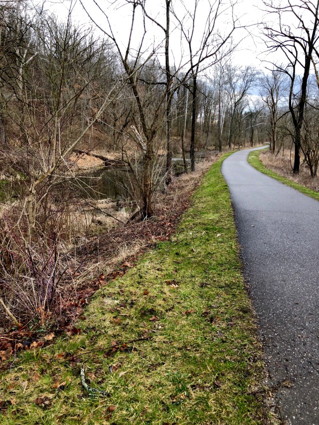
A brief moment of light in the midst of the snow and windstorm shows American and Bridal Veil Falls in the foreground and Horseshoe Falls in the background

And, except for the work of a gardener, all three falls might be burning like the poor Cuyahoga. Around the turn of the 19th century, the town at the brink of the falls was a huckster’s paradise. Every hat trick, tin type, boat ride, souvenir rock from the falls themselves, was finding its way into the pocket of daily sojourners from the surrounding cities. And the banks of the Niagara River were lined with Aluminum Smelters, iron works and every manner of industry for whom the cheap power of water could make a difference. In came the river to power the plant, out went the water polluted with whatever the plant used to make its wares. Into this fresh Hell comes the gardener. And not just any gardener — Fredrick Law Olmsted — who wold go one to design Central Park, Prospect Park, the U.S Capitol Park, my own neighborhood in Atlanta along with its parks, and, the master plan for Yosemite National Park. Fred showed up, saw the natural beauty of the falls, saw the disaster unfolding, and called up money and politics and public opinion in the “Free Niagara Falls” movement. It worked. Private businesses were acquired, factories removed, and commerce limited as Niagara Falls became the first state park in America, and a model for the National Parks system.

Below the falls the Niagara River makes a big bend before finding Lake Ontario. The result is the Niagara Whirlpool.

I walked across from the American side to Goat Island and then on out to Prospect Point overlooking Horseshoe Falls and the Canadian side. The lower observation points are still closed for the season, but the views are unchanged. It is a remarkable sight, and even a little uncomfortable to be in the presence of so much power. For me of course, it was another corner on the edge — the inside right corner, from which I head east and north to the top right or northeastern corner. But there is some northern edge left. Tomorrow I follow Lake Ontario to the St. Lawrence River, and then the 49th parallel across northern Vermont. Let’s hope the wind dies down a bit.

Heading for the Edge

It’s the end of a long day one (10+ hours on the wheel), and I’m about 50 miles from the edge — which for this section of the trip starts on the southern shore of Lake Erie at Cleveland. I’m holed up in a hotel in the middle of a ferocious lightening storm around the southern end of Cuyahoga Valley National Park. You can’t camp in the park, and with this storm I wouldn’t have anyway, but I do want to see it in the daylight. So the plan is to get up and have breakfast and then follow the Cuyahoga River and its accompanying Ohio and Erie Canal all the way to the edge in the morning. Then I’ll just follow the Lake Erie shoreline to Niagara Falls.

When I was 4 years old, the Cayuhoga River caught fire. The river. Caught fire. I don’t remember it, but Time magazine covered it. Songwriters wrote songs about it. A beer company named a beer after it. And here’s the interesting part — in 1969 when it burned, it was the 13th time it had done so. That we know of. It first caught fire in 1868. So I’m going to a National Park to see a river that, as far back as 1868, was so polluted that it burned 13 times, and as recently as 1968, a study found not one single living fish for 1,000 feet of linear reach from its mouth at Lake Erie. Visibility in the same study was six inches. Now all this was a while ago, but I mean I was alive, so it can’t be considered ancient history. The park was formed officially in 2000 after what I can only hope was a massive clean up. I do note that a famous superfund site is part of the National Park, though not accessible for obvious reasons, to visitors. Apparently it is a nice marshland now, and some fines may or may not have been extended to our friends in the auto industry.

Anyway, the sheer incongruity of it all notwithstanding, the Cuyahoga (which means “Crooked” if you speak Native American) was once a really nice river. With beautiful falls and a strange winding course that finally ends as it empties into Lake Erie. It’s a hundred or so miles long and drains over 800 square miles of Ohio. Problem is that it is generally shallow, and the source of its name makes navigation difficult anyway. So here were a bunch of Ohio folks watching their friends on the lake to the north and on the great Ohio River to the south and east having all the fun — by which I mean making all the money — in the early 1800s. They could grow plenty of crops but they could not get them anywhere without a lot of expense and probably a death or two. So the asked the Great Uncle for help. After some politicking and, I’m sure, grafting, the Ohio legislature struck a deal and paid for a canal system. Interestingly a canal system for which the likes of no less than the great Thomas Jefferson had long advocated. Begun in 1825 and finished in 1832, with freight flowing from 1827 to 1861, the canal system consisted of various branches and hundreds of locks that basically connected the heartland to the Ohio River and Lake Erie via canal. Including through the Cuyahoga River valley, where one of the canals runs alongside the river. Between the commerce on the canals, the mules pulling the barges, the slipshod approach to water quality management and eventually a shit ton of industrial waste around Cleveland, the river got the worst of it. In a sense. The canals got gone.

Railroads came along and rendered them useless and far inferior in speed to the iron horse. Privatization polluted them like the poor Cuyahoga. Railroad barons filled them in for easy right of way for more track. And neglect left them to silt and disappear among the toxic swamp. But there is a small run left — through the Cuyahoga Valley National Park! I will be able to stroll the canal tow path where industrial titans took carriage rides with their families, or snuck off to the deepest glens with their mistresses, whichever your preferred imagining, all while lauding the progress of industry as the fish melted. It should be fun.

I know I’m being a tad dramatic, but its the night before my first real event on this trip around the edge and source material is terrific. Anyway, pictures tomorrow of all the above, I hope, as well at the great falls at Niagara and some sense of the territory we’ll be exploring on the northeastern edge of our great country. Until then.

Time to Go

It’s time. For the past couple of years my calendar has sort of organized around twice annual trips out to the edge and back. For reasons I don’t really know, they come in the fall and the spring. It’s spring now and that means it’s time to go again. The Edge Trek has become a sort of balm for me — a set of experiences that make things alright, that re-center and, oddly, re-locate me around what is important. Being away, alone in new places, both re-kindles my love and appreciation of all things home, and satisfies my need for new experiences. As I’ve said before, the edge — the place and the process — is making me better. Perhaps more than previous trips, I need to be better now. So, in a week, it’s off we go.

I will head north to Cuyahoga National Park before picking up the edge on the southern shore of Lake Erie. From thence, it’s up to the Great Falls at Niagara and along Lake Ontario to Oswego. Then the St. Lawrence River guides me to Massena where I find, again, the 49th parallel for the final time, east to Canaan, Vt. From there it will be a wander — after a brief crossing of the stovepipe of New Hampshire, I will be in the wilds of Western Maine. I have no idea how, but I will eventually get to St. Francis, Maine on the northern edge, and from there begin the long route around to the coast and down on Highway 1. I will visit Acadia National Park, make my way down to Cape May, NJ for a ferry ride to Maryland, see some relatives around Assateaque Island, re-visit the Outer Banks of North Carolina and eventually make it to Savannah, GA.

I find it difficult not to pre-suppose what all these trips will be like. To imagine these places and what I will do and where I will stay and what I will see. But with some experience and some practice, I have gotten to where I just don’t do it. Mostly that is because my imagination has proved a poor substitute for the real thing. And, the real thing shows up more readily when I run into it with no pre-conceptions. So, I go now with some recognition of the fur trade, the odd little in-between War of 1812, the earliest real European settlements, and the wild windswept guardian islands of the eastern shore. But, it is only a vague sense of the these things. There will be other things, other impressions wholly unrelated and unexpected. I will be in wild places (western Maine is likely the least populated place I will have been on the edge) and some of the greatest urban geographies in America. I will be lost, and I will find my way. I will learn things about myself and about others. And I will endeavor to take good notes and capture some imagery of my experience. I hope you enjoy the ride as much as I do.

Edging Closer to Home

After 4,136 miles, I am at home again.  My previous two trips out to the edge, around and back have been almost 8,000 miles and over 5,300 miles, so the edge is getting closer to home. One of the things this means is that while distinct, the territory I cover is more familiar to me.  The area of the country east of the Mississippi has varied regions to be sure, but, as an example, my own state has Appalachia, Coastal Plain, Piedmont, and Valley and Ridge zones.  Pretty much what the eastern half of the United States has. One of the key differentiators is the extent of the ice sheet southward during the last ice age.  Basically it extended just south of Chicago — from Manhattan along an east west line following roughly the Ohio and Missouri Rivers.  I spent this section of the edge, and will spend most if not all of the next section, north of that line — traveling areas that were buried beneath a mile or so of ice during the period that home was relatively warm. For me, though familiar in terms of flora and fauna, this northern section is sharper.  The edges are cleaner lines drawn against crisper backgrounds.  The water is clearer.  The mountains quicker.  It’s like adjusting the focus a little bit on the familiar and seeing it all a little clearer.

What’s missing in this eastern section of the edge so far is that sense of bewilderment at the size and scope of the territory.  It is more immediate — even against the backdrop of a series of lakes containing something like 20% of all the fresh water in the world. I expect someone growing up out west has that feeling coming east,  but its more one of being surrounded.  This is a key element of this adventure for me.  To see things that astonish me, to see things that re-focus me, to get a sense both of a stranger in a strange place and a local with a new appreciation for a known one.  

On this trip, the edge was mostly a water barrier between the US and Canada.  It is a vague thing, hidden by thousands of lakes and bogs, or floating somewhere in the middle of a giant lake.  As such, there is no sense of it.  Until I passed the Customs building in Sault Ste. Marie, I really had no sense of being on the edge of the country.  I’m sure there were a few spots where the sign pointed to Canada and had single digit miles on it, and International Falls and Sault Ste. Marie both have great bridges into Canada, but there is no tension, no feeling of our country coming to an end and another one beginning.  There is just a familiar landscape, less populated and more sharply focused, alight with the colors of fall and alive with a wildness that just doesn’t really exist in the interior.

The Great Lakes offered a utility of the edge I haven’t seen really since Louisanna.  The working edge.  A place where being where you are means leverage to do things that simply can’t be done from another place.  An industrial vibe full of history and tragedy and growth and collapse. A leverage used and abused, appreciated and then broken through relentless appetite.  I think there are so many similarities between the fishing trade I saw hanging on by a thread in Louisanna and the industrial trade that once thickened the shores and waters of the Great Lakes.  Both were like a gold rush for a time, both were used and abused, both now cling to life amidst the glory of a countryside that is slowly re-taking what was once taken.

And I don’t think there is anything about this to be ashamed of.  History, for me, is important not just because of the events themselves, or the actors that stand out, but also for the context in which it all takes place.  No one gets a chance to make a decision about anything with full and complete knowledge of every eventuality resulting from that decision.  But everyone, if we take the time, gets a chance to make a decision with a full and complete understanding of what has happened before. It’s not uniquely American, but I think we as a country and a culture, do bring a recognition for past mistakes and a compassion for those who made them to our decisions.  At least we have so far.  So we see the value of rare natural places alongside their commercial potential and look for some balance because we know we screwed up before.  We recognize the individual drive and capacity, built on liberty, that we each possess, and balance that against the need to sustain that drive and capacity in the presence of others.  At least we have so far.  While there are places desperately in need of preservation and protection, and those efforts need our support, it is astonishing how successfully we have empowered and enriched a nation s young as our’s, across a spectrum of people as diverse as our’s and maintained a natural wonder — both on the edge and within it — that can stop the breath of even the most jaded observer.

It’s possible this is a result of the land itself — it is so big, and so rich we simply havent’ gotten to it yet.  Or it is so powerful it simply can’t be conquered.  But I haven’t seen that.  I have seen communities that have stolen and repented.  Used and used up, and returned to protect.  I am optimistic at our ability to continue to grow as a country, availing ourselves of our natural resources to continue to provide for ever more people, while saving the places that stand ready to help us remember at least some of what makes us what we are, and to humble us with evidence of our own powerlessness.  It’s hard to maintain this optimism in the face of dire warnings and desperate pleas that come over the airwaves and computer screens every day.  And it hard to maintain when the very obvious needs for protection seem to go unmet — perhaps because they are lost in the noise of so many other calls for action.  One thing about the edge is that I’ve remarked on before, is that it is practical.  There seems to be a real ability — maybe from necessity — to recognize when things have gone wrong, and to change to make amends.  To stop digging a failing copper mine, and redirect energies to promoting access and tourism.  To re-tool a factory and a skill set to make windmills instead of car parts. To study and understand a sustainable way to harvest and replant and completely leave alone, stands of timber.  To sit at home amidst the ever-blurrier familiar and read the ever-direr news, is to lose sight of this.  But to get out and go see for yourself is to be renewed, and re-focused.

I’m going back in the Spring to finish the the edge of the Great Lakes from Toledo to Niagara Falls, and continue across Northern New York, Vermont, New Hampshire and Western Maine to the northeastern most corner.  I have no idea what I will find there, but I know what will happen to me here.  In the planning and in the doing, I will grow ever more proud of this country, and ever more aware of our triumphs and our failings.  And I will grow ever more grateful that I have the chance to visit the edge.

Downbound on Huron

Sunset from my camp on Drummond Island

I woke up at 1 am this morning because the truck was rocking from side to side.  In an otherwise deserted camping spot on the edge of Lake Huron on an island, this is not something that seemed the slightest bit normal.  I’d watched a nice sunset, eaten a passable dinner and thought more than once about how still and warm it was for a mid October day on the northern end of Lake Huron.  And now the truck was rocking.  It took only a moment to realize that the weather had changed markedly. Winds were steady at 30 mph, according to the weather app, with gusts to 45. These winds were catching the truck and rooftop tent broadside, hence the rocking.  

Sometimes out here when weather happens suddenly I have to do something — put the awning in, turn the truck around, clean up the stove and equipment I’ve left out for breakfast.  But I’d already done all that before I went to bed since I had an early start planned.  So I just sat there in the tent, deafened by the wind, and tried to think of something else. Eventually, unable to sleep, I got up and took a walk around.  It was still warm and there wasn’t any danger associated with the wind, just the unstopping noise of the water being pushed against the shore and the trees fighting to hold onto their leaves.  After a moonlight walkabout, I crawled in the backseat of the truck which was considerably quieter and fell fast asleep until about 6.  The sun came up, the wind kept blowing and I got on the road.  This meant getting on the ferry for the short ride to the mainland.  Whereas yesterday the ferry was a short straight ride, this morning we made a big long arc up and out into the channel and then back down the other side for a wind-assisted docking.

All day, for the entire length of the western shore of Lake Huron, the wind blew.  But the sun was bright and the ride was great.  I followed the lake across the short southeastern edge of the UP and paid the $4 it costs to use the bridge over the straits of Mackinac just south of St. Ignace.  The bridge over the straits is iconic, and it is beautiful.  It too, however, was broadside to today’s steady west wind.  I was glad to get to the southern side and didn’t realize until I got there how tightly I’d been holding the wheel.

The sandy shores of Lake Huron along the eastern edge of The Mitten

From there I just had to hold fast to the shoreline through Cheboygan and Alpena and Au Sable and Bay City and around the thumb of the mitten to Detroit.  The lower part of Michigan — the mitten — was a poor sibling to the UP. I wish it were otherwise, but the ground is sandier, the trees are duller and the tourism thicker.  Through it all though, is Huron.  No sooner would I grow weary on the wheel than I’d come right onto the shore as the road circled one of the many bays and see the crystal — literally gin clear — water from that edge as far as I could see to the east.  Lake Huron covers over 23,000 square miles and has almost 4,000 miles of shoreline.  It is the third largest fresh water lake in the world.  By water volume, though, it is only the third largest of the Great Lakes, because it is shallower. Itss average depth is 195 feet and its deepest point is 750 or so feet. But my goodness is it clear.  And it made my day today over and over again.  

In the middle of one of the long sandy beaches was a small area of nothing but these rocks. I thought they looked cool.

The closer I got to Huron’s drain at the St. Clair river, the more America’s industrial heart was evident.  From Saginaw Bay south, you can feel the machines that make the machines, and the factories and men that use the machines.  Sometimes it feels vibrant and busy, and sometimes it feels old and tired and obsolete. It is an area in the midst of re-forming.  Up north in their retirement homes, the old-timers are playing Euchre at the cafe and clipping the coupons from their heyday on the line, but down here people are trying to find a way.  I have no doubt that Huron will play a role.  As a resource, it and Superior are simply too magnificent, too overwhelming, too inviting.  Tourism and other industry will replace the ore carriers and the deep shaft copper mines and the timber logging.  Or something else entirely.  Because the people here are not going to stop making a life on the edge.  They are not going to stop striving — any more than these Great Lakes are going to stop collecting and purifying the watersheds they serve, or the abandon the shores they kiss in the crisp fall sunlight.

I got to the northern suburbs of Detroit to see an old friend and his wife for dinner.  Among the many opportunities on the edge are those that involve reconnection with people you love who live far away. Seeing their home, catching up on their children’s activities, feeling the warmth of a family doing just what we all try to do in a place I never would have been if not for the edge. It was yet another dividend for backing out of the driveway in Atlanta and deciding to take a lap.

Tomorrow I will follow the shores of yet another Great Lake — Erie.  I will go as far as Toledo before turning the old 100 series for home.  As usual, I will have many hours of interstate (though only one interstate — I-75 the whole way) to process this segment on the edge and think about the next one.  I will have more thoughts on the total trek this trip and some conclusions, but I will wait to write them for a day or so.  To let this sink in a little.  Each trip to and around each different section of the edge inspires me for the next and teaches me about the last ones.  This one will as well and, despite the quest-like obsession of this entire exercise, it is first and foremost an exercise in discovery and learning.  We can all use more of those.  I’ve got a few more left before I have to come up with another crazy idea.  Thanks for riding along.

An Island on the Edge

Morning on The western shore of Lake Huron, near De Tours, MI

After the Treaty of Ghent in1814, things appeared settled with our British parents regarding the northern edge.  The 49th parallel covered most of it, and the various nooks and crannies of the northeast were no longer an issue.  Drummond Island, however, was.  A part of the Greater and Lesser Manitoulin Islands along the St. Mary’s/Lake Huron northern end, all but Drummond were settled.  They were British (Canadian).  But Drummond was to go to the United States.  It wasn’t until 1821, however, when, unable to resolve differences regarding the various surveys, a negotiated settlement was reached giving Drummond to the US.  Oddly, the Islands north and south of it, but basically on the same longitude, belong to Canada.  So here I am, on the last outpost of British control within our borders, and it couldn’t be more American.

I left The Soo early today amidst thick fog which didn’t leave until the sun was well up and could apply a little heat to burn it off. The trip downbound was through the first steadily agricultural area I’ve yet seen on the UP, but was very pleasant.  My plan was to have most of the day on the Island, which, at 249 square miles, includes a lot to see and explore.  For once, the plan worked out.  I caught the 9:40 am ferry at closer to 10 o’clock — this being an American schedule — and had the bulk of the day to explore.

According to the census, just shy of 1,000 people live here.  According the barkeep at Chuck’s, 75% go to Arizona and Florida at the end of September.  Most of the island is owned by the state and preserved for various reasons — wildlife, habitat protection, or whatever.  This is great, because to promote tourism, the locals have mapped out a series of trails for off-road vehicles or ATVs and these trails link you to trailheads for hikes to the various protected areas.

After yesterday, I thought it best to stop in the tourism office and get a map, and maybe a little color on which areas where preferable. In between Marlboro Reds, the lady there was very helpful, if a bit hoarse.  I decided to avoid the ATV areas and head for the northern shore to an area called Fossil Ledges.  According to my source, the road out wasn’t a Jeep trail but you couldn’t do it in a regular vehicle.  She said there was an area where the road would have water over it, but after looking at my truck assured me I would be fine. She gave me a piece of white copy paper with a map and instructions like “go 3.2 miles and take the road to the left; look for the beaver dam; your sign here is three orange trees, etc.”  It didn’t show the myriad of roads branching off left and right of my road.  In the end, I was able to figure it all out thanks to Lake Huron. I knew if I stayed as close to it as possible, I was on the right road.  And, by the way, “the road will have water over it” means you will be up to the door sills in a lifted truck for 30 yard sections at a time.  And I passed a new Ford F-150 4×4 that turned back because it couldn’t make.  I’d hate to see the Jeep trails.  But the ground here is solid “shelves” of limestone and granite, so there is always a hard bottom and, if you take it easy, you can avoid most of the submerged big rocks.

The Fossil Ledges, northeast side of Drummond Island. Decent spot for lunch.

For your effort, you get a spot with no one anywhere near you, ledges of limestone and shale at the water’s edge that are shot through with all sorts of fossils of shells and bones and things I don’t know about it, and a world class view.  I hiked around and then made lunch to eat while I sat on the ledges and stared at Lake Huron, watching a freighter upbound to The Soo creep along. Not only was I on the US edge here, I was hanging out over the Canadian edge between Cockburn and Manitoulin Islands like some leftover branch that never got trimmed.  Lake Huron is crystal clear, the weather today is sunny and 60, and I can’t think of a better way to spend lunch.

Among the other interesting things about the Fossil Ledges is this orange lichen that grows on them
In some places the Great Lake Huron erodes enough away that the Ledges collapse
 

After lunch I worked my way back through the swamp to the main road and crossed to the southern side of the island to explore there.  The habitat is markedly different being mostly conifer forest, and the shoreline is sandy.  I found a great beach at Shoal Cove, had another little hike about and relaxed and then headed back to the center of the island to Chuck’s.

70 years ago or so, somebody — I presume named Chuck — opened a bar out here.  Times have changed and some additions have been made, but near as I can tell, it is the same place.  Of the 900 or so residents here, the remaining ones have a standing meeting at Chucks, and the serious intellects apparently begin at around 1:30 pm.  I got there closer to 3 and discussion was in full swing.  This is a bar for people who like bars.  Crabby, but soft-hearted barkeep, American beer in cans, two shelves of different flavored Pucker (I assume to add to the rotgut selection of actual liquor in order to make it palatable), pool tables, and country music on the jukebox. But for my stellar self-control I would be there still, on my 6th or 7th High Life ($1.75!).  The folks in there were great fun and they find a way to both amuse themselves way out here and take care of each other.  Long discussions about what the only female elder could do about the bear terrorizing her storeroom was offered with the best of intentions. There is going to be a meeting with the neighbors who keep feeding the bear later today (if they show up at the bar.) It’s that kind of place.

I’m camped on the north western corner of the island with a great view of the various smaller islands and the channel between here and the mainland.  The sunset should be memorable.  All in all, this is spot on the edge that doesn’t do anything to explain the edge, but does everything to show it off.  It’s quiet, spectacularly beautiful, and has a great bar full of folks who live out on the edge and don’t care one way or the other about it.

Yep. Pretty much.

Tomorrow I’m downbound for Detroit along the western shore of Lake Huron and, once I get there, I will visit an old friend. I’m looking forward to all of it.

Upbound on the Edge

The James R. Barker of the Interlake Steamship Company locks through at The Soo. Pilot house at the stearn to the far left, bow at the American Flag just right of center.

In the parlance of Great Lakes freighting, “upbound” means you are headed to Sault St. Marie (The Soo) from the Duluth/Superior area if you are in Lake Superior, or from Detroit if you are in Lake Huron.  So “upbound” no matter what is going to The Soo.  Today, I was upbound out of Marquette.

On November 9, 1975, the 729 foot ore carrier Edmund Fitzgerald was upbound from Superior, Wisconsin (where I was yesterday) carrying 26,000 tons of iron ore pellets.  The captain had 44 years on Lake Superior, and the first mate had 40.  The weather was, much like today, sunny and unseasonably warm.  The entire crew expected to be locking through The Soo sometime late on November 10th, just like the James R. Barker above.  But, as Gordon Lightfoot immortalized in his 1976 folk song, the gales of November came early, and the sailors found themselves in an earlier version of the perfect storm.  100 mph winds, first freezing rain then snow, and 35 foot seas caught up to them.  The “Big Fitz” as the freighter was known, was among the largest of the ore carriers on the the lakes.  She was traveling that trip with another, larger and newer freighter, the Arthur Anderson which was 767 feet long.  The Fitz was the faster of the two so she led the way upbound and maintained a 10 mile gap.  The two seasoned captains spoke regularly on the radio, and when the storm began to blow, they agreed to leave the shipping lanes and make the final run to The Soo closer to the Canadian shore seeking shelter from the wind and waves.  This meant the final approach into Whitefish Bay and the Soo locks would come not through the established channel, but close by Caribou Island and the notorious six fathom shoals.  A fathom is 6 feet, and the Fitz drew 25 feet in flat water.  With the waves at 30 feet, catching the shoals in a trough would be disasterous.  Still, both Captains were old hands, both had the best ships on the lakes, and both knew the charts like the backs of their hands.  Sometime in the late afternoon of the 10th, the Fitz lost its radar arch in the storm.  The snow was whiteout conditions, and the lights at Whitefish Bay had been blown down.  The Fitz was sailing blind, by course only. From the charts.  But the charts were 100 years old and they were wrong by almost a mile about six fathom shoals.  At 7:30 pm, after passing the shoals, the Fitz reported into the Anderson that despite taking on water and slight list (they thought the hatch ways were leaking) they were “holding our own.”  Shortly thereafter they disappeared from the Anderson’s radar and were never seen or heard from again.  No body has ever been recovered.  The ship in on the bottom, almost 600 feet deep, about 12 miles from the safety of Whitefish Harbor.  29 sailors are with her.  Watching the James R. Barker come through The Soo today I found myself staring at her hatch covers, hearing old Gordon Lightfoot singing “at seven pm the main hatchway gave in, he said fellows it’s been good to know ya.”  (You can google Gordon Lightfoot Wreck of the Edmund Fitzgerald if you don’t know it. It was number two on the billboard charts in 1976 behind, and I kid you not, “Muskrat Love.”). The James R. Barker, for perspective, is 1,004 feet long and 105 feet wide.  She is the third 1,000 footer ever built, carries 59,000 tons of ore, draws 28 feet of water, and was launched a little over 6 months after the Big Fitz went down.  Anyway, my day upbound was considerably less dramatic.

I left Marquette with a couple of goals: visit the Pictured Rocks National Lakeshore, see Tahquamenon Falls, and get to The Soo.  This seemed easy based on the time to travel from Marquette to Sault Ste. Marie.  But, I got lost and then loster in the Pictured Rocks National Lakeshore area, and from there ended up literally on the edge of the lake on a sand road trying to get to Tahquamenon.  None of this is a bad thing.  

Somewhere in Michigan near the Pictured Rocks National Lakeshore

I didn’t know anything about the Pictured Rocks National Lakeshore — and I still don’t.  But on the map, it is right on the edge, which is good for me, and my experience with National Seashores has been good, so National Lakeshores on big-ass Lake Superior should be good too.  The drive out there from Marquette was the usual superlatives of fall color and peaceful road, and, in a somewhat new twist for me on this trip, devoid of cell coverage.  I had plotted the course when I left Marquette, but I had no access to any digital maps after that.  When I turned off the pavement onto a dirt road, the sign said “Pictured Rocks National Lakeshore” so I figured great!  15 miles of bone-crushing, washed out logging road later, I came to a little overlook, a sign that said road ends, and another sign that Beaver Lake Wilderness.  The view was fantastic and the ride had been enormously scenic, but the Pictured Rocks were no where in sight.  Moreover, I had no idea where I was and no way to find a way out.  From there it was a series of happy and lucky wandering.  I just took every road (and I use this term loosely) east whenever I came to one.  I needed the capabilities of the Landcruiser but I never really felt worried.  I had plenty of fuel and figured I’d run out of state before I ran out of gas.  Somehow, I banged onto the pavement about two miles south of Grand Marais, Michigan and the main road.  It was a glorious morning, but I was four hours behind the schedule I thought I was on.

Beaver Lake Wilderness and Lake Superior beyond

I got a signal in Grand Marais and plotted a course for Tahquamenon Falls.  Fifteen minutes later, the pavement ended, along with the cell signal and I was on a sand road hard against the shores of Lake Superior.  Generally the same result — I had a great drive with no idea at all where I was, and after sneaking through the narrow gap between Lake Superior and Lake Muskallonge, eventually found pavement about 15 miles from Tahquamenon.

Tahquamenon Falls has two sections — Upper and Lower.  The upper are the real story and are generally ranked the third largest falls east of the Mississippi behind Niagara and some other falls I’ve never heard of.  Some 200 feet across, they are highly tannic due the course of the river through deep fir and cedar forests, making the river red in color.  It’s a fairly busy exercise to stop at the park and take the hike to the falls.  Everyone wants to see the third largest falls east of the Mississippi.  But it’s worth it.  You get a decent mile or so hike out and back and a good cardio test if you take the nine flights of stairs to the viewing area at the “brink” of the falls.  As with almost everything this trip, the time of year makes this experience.  The fall colors and the power of the waterfall make for a great image. The Lower Falls are fine, but pretty much a let down after the Upper.  They are a shorter, narrow series of cataracts splitting an island in the middle of the river. Below you can see one side of the Lower Falls, the Upper Falls from a distance, and the Upper Falls from the “brink.”


From the falls it was an easy shot up the Soo, where I had the good fortune to catch the James R. Barker passing through the locks.  Before the locks were in place, the two lakes Huron and Superior were joined by the St. Mary’s River, but it dropped 21 feet in less than a mile over rapids. So portage was the only means of conveying cargo from one to the other.  Sault Ste. Marie actually means “the rapids of St. Mary” if you speak English.  The locks were opened in 1855 and cargo has been flowing ever since.  Iron ore from Wisconsin went upbound to The Soo, downbound to Detroit and turned into Chryslers, Fords and Cadillacs in the motor city.  The Soo really is what this edge up here has been all about.  People and industry facing out — to the opportunity afforded by being on the edge, and finding ways to make a living of it.  This is not an enforced border.  It’s more like the Gulf of Mexico.  People who landed in America were forced to start on the Atlantic Coast, and people who went west for fame and fortune were forced to stop at the Pacific.  On the Gulf, and here on the Great Lakes, people are here by choice — to make something of what the edge provides.  This is not to say folks on the east and west coasts don’t make something of what those edges provide, but they didn’t have a choice having arrived there.  Here, they looked at the edge, came up with a plan, and said I will stay here and take advantage of this.

I’ve covered some amazing ground up here — particularly on the UP of MIchigan.  Much of it is country I want to camp and explore in — as I’ve done on the edge out west.  But in almost every case, I’ve passed through that good country in the morning or early afternoon, and while I’ve stopped, hiked, explored around for a few hours, I’ve always moved on along the edge.  Many times I’ve felt like the knight in Monty Python’s “Holy Grail” who comes across a castle full of beautiful virgins all begging him to ravage them, at least once.  But he has no time for such silliness and moves on in search of the Grail.  Now, admittedly I haven’t come across a castle of beautiful virgins begging me to ravage them, and I’m not looking for the wine glass Jesus used at the Last Supper, I’m just taking a lap; but the point is I do have a goal with this trip.  I am going to make it around the country as close to edge as I can.  So, I am always biased towards progress in that regard.  The bonus of course is that I have a list of spots I will come back to one day to camp and explore, but for now, I am moving.  Tomorrow I will be downbound on the Huron, take the ferry to Drummond Island and wander around there, and spend the night on the lake.  I hope.

I haven’t spent much time in this blog talking about the people I meet out here.  I chat with the cashiers, wait staff and other locals everywhere, and their perspectives color my thoughts on the edge.  But I also meet folks not from here who are just out here.  In Wisconsin, for instance, somewhere between Hebster and Cornucopia, I stopped in one of the small community establishments that serves as fuel stop, butcher shop, grocery store, hardware emporium and candle making supply depot.  The old gal running the place was in her mid-60s, still sporting long gray braids and hanging on to her tie-dye.  She made her own Kombucha and was not shy about extolling its virtues.  I didn’t have the stomach to try the fermented mash, but it seems to be treating her well.  Anyway, when I went outside to pump my gas I ran into a couple with their ATV.  They were in their 70s, fully be-cloaked in weather proof, insulated suits adorned with all manner of zippers and pockets.  Their ATV was a Polaris four-wheeler that you ride astride — not one of the side-by-side versions.  It was outfitted with a special seat that provided a backrest and armrests for the rider in back and a backrest for the rider in front.  It had extra fuel tanks on the back, a cargo box between the handlebars and saddle bags.  The lady was already in her seat when I walked up and the man was studying a map zipped in a pouch on the cargo bag between the handlebars.  This is quite a rig I said.  Do you all just ride the trails around here? Yes, he said, but this darn map is not always very good.  Do you camp out when you’re out there I asked? Oh no, the wife said, we’re from Southern Illinois (as if Southern Illinois people don’t camp), we rent a place here and just spend the day on the trails.  Because Wisconsin welcomes ATVS, Illinois doens’t want anything to do with us.  Are you off on the two tracks mostly, I asked. The old man said well we try to be but golly these maps are so darn poor, we don’t always end up where we think we are going to be.  But that’s okay.  Tell me about it I said.

Then in the Copper Mountains, after riding the spine all the way out to the end and then venturing further on that dreadful logging road I rounded a corner about 7 miles in and there was a Volkswagen Vanagon camper on the side of the road.  A lean guy, gray hair and beard, I’m guessing mid 60s, was leaning agains that side of it eating from a baggie of granola.  I passed them and came to a huge logging operation about another mile down the road, turned around and went back.  When I got to them the second time, he eased off the van and moved towards me so I stopped and rolled down the window.  You missed the turn to High Rocks Bay didn’t you, he said.  I guess so, I said.  We did too, but the road there is so bad we stopped here for lunch and we are going to bike down.  We chatted — he is a retired railroad guy and this is what he and his wife do.  Travel around and see stuff.  She was delightful, healthy, and wearing a snazzy pair of earrings she may have gotten from a local copper smith.  I told them about my adventure, we discussed vehicles and they told me about places they’d seen on the UP (they are headed west, to my eastbound track) and I told them about the Porcupine Mountains and Superior National Forest.  Eventually, I cranked up the truck and said I needed to be moving on.  As I drove off he raised his hand and made circular motions and said hey man, keep on making the circle man.  And that’s just what I intend to do.